List of churches in Næstved Municipality

Last updated
Map all coordinates using: OpenStreetMap  ·  Google Maps
Download coordinates as: KML  ·  GPX

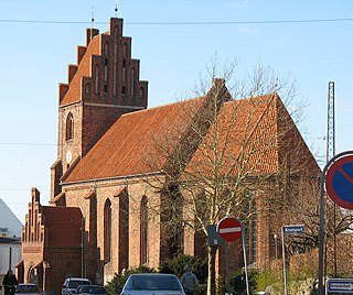
This list of churches in Næstved Municipality lists church buildings in Næstved Municipality, Denmark.

Church (building) building constructed for Christian worship

A church building or church house, often simply called a church, is a building used for Christian religious activities, particularly for Christian worship services. The term is often used by Christians to refer to the physical buildings where they worship, but it is sometimes used to refer to buildings of other religions. In traditional Christian architecture, the church is often arranged in the shape of a Christian cross. When viewed from plan view the longest part of a cross is represented by the aisle and the junction of the cross is located at the altar area.

Næstved Municipality Municipality in Region Zealand, Denmark

Næstved is a municipality in Region Sjælland on the island of Zealand (Sjælland) in the south of Denmark. The municipality includes the island of Gavnø. It covers an area of 681 km², and has a total population of 80,732 (2008). Its mayor is Carsten Rasmussen, a member of the Social Democrats (Socialdemokraterne) political party. The main town and the site of its municipal council is the town of Næstved.
Denmark constitutional monarchy in Europe

Denmark, officially the Kingdom of Denmark, is a Nordic country and the southernmost of the Scandinavian nations. Denmark lies southwest of Sweden and south of Norway, and is bordered to the south by Germany. The Kingdom of Denmark also comprises two autonomous constituent countries in the North Atlantic Ocean: the Faroe Islands and Greenland. Denmark proper consists of a peninsula, Jutland, and an archipelago of 443 named islands, with the largest being Zealand, Funen and the North Jutlandic Island. The islands are characterised by flat, arable land and sandy coasts, low elevation and a temperate climate. Denmark has a total area of 42,924 km2 (16,573 sq mi), land area of 42,394 km2 (16,368 sq mi), and the total area including Greenland and the Faroe Islands is 2,210,579 km2 (853,509 sq mi), and a population of 5.8 million.

Contents

List

Name Location Year Coordinates Image Refs
Aversi Church Annisse 55°20′42.36″N11°51′5.75″E / 55.3451000°N 11.8515972°E / 55.3451000; 11.8515972 AversiKirke.jpg
Bavelse Church Blistrup 04-10-27-a3-copie 2 Bavelse kirke (Naestved).jpg
Everdrup Church Everdrup 55°12′5.03″N11°57′24.83″E / 55.2013972°N 11.9568972°E / 55.2013972; 11.9568972 Nordenskirker Everdrup(01).jpg
Fensmark Church Fensmark FensmarkKirke.jpg
Fodby Church Græsted 55°14′57.12″N12°16′48″E / 55.2492000°N 12.28000°E / 55.2492000; 12.28000 Nordenskirker Fodby01.jpg [1]
Fuglebjerg Church Fuglebjerg 55°18′20″N11°32′54″E / 55.30556°N 11.54833°E / 55.30556; 11.54833 05-06-15-f4 copy filtered Fuglebjerg (Naestved).jpg
Fyrendal Church Mårum 55°14′55.68″N11°30′42.47″E / 55.2488000°N 11.5117972°E / 55.2488000; 11.5117972 Fyrendal kirke 20090411-03.jpg [2]
Førslev Church Førslev 55°16′33.95″N11°34′38.64″E / 55.2760972°N 11.5774000°E / 55.2760972; 11.5774000 Forslev kirke 20090411-4.jpg [3]
Gavnø Chapel Gavnø Nordenskirker Gaunoe(01).jpg [4]
Glumsø Church Glumsø 05-06-15-e1 copy filtered Glumso (Naestved).jpg
Gunderslev Church Gunderslev Nordenskirker Gunderslev01.jpg [5]
Haldagerlille Church Haldagerlille 56°03′51.4″N12°08′27″E / 56.064278°N 12.14083°E / 56.064278; 12.14083 06-01-15-e4 Haldagerlille (Naestved).JPG
Hammer Church Hammer 06-01-08-f1 filtered copie Hammer (Naestved).jpg
Herlufmagle Church Herlufmagle 55°18′45.75″N11°45′29.21″E / 55.3127083°N 11.7581139°E / 55.3127083; 11.7581139 Nordenskirker Herlufmagle(01).jpg [6]
Herlufsholm Chapel Blistrup Nordenskirker Herlufsholm(01).jpg
Holme-Olstrup Church Holme-Olstrup HolmeOlstrupKirke.jpg
Hyllinge Church Hyllinge Hyllinge kirke 20090411-03.jpg [7]
Hårslev Church Hårslev 05-06-15-m3 copy Harslev kirke (Naestved).jpg
Karrebæk Church Karrebæksminde KarrebaekKirkeSO.JPG
Krummerup Church Krummerup Krummerup kirke (Naestved).jpg
Førslev Church Førslev Forslev kirke 20090411-4.jpg
Kvislemark Church  (da ) Kvislemark  (da ) Kvislemark kirke (Naestved).jpg
Marvede Church Marvede Marvede kirke 20090411-07.jpg
Mogenstrup Church Mogenstrup Nordenskirker Mogenstrup(01).jpg
St Morten's Church Næstved 55°13′47″N11°45′39″E / 55.22972°N 11.76083°E / 55.22972; 11.76083 Vejby kirke 15-04-06 02.jpg
Mæsby Church Næsby Nordenskirker Naesby01.jpg [8]
Næstelsø Church Næstelsø Nordenskirker Naesteloe(01).jpg
St. Peter's Church Næstved 55°13′48″N11°45′25″E / 55.23000°N 11.75694°E / 55.23000; 11.75694 Skt. Peders Kirke - Naestved.jpg
Rislev Church Rislev Nordenskirker Rislev(01).jpg [9]
Rønnebæk Church Rønnebæk Ronnebaek kirke (Naestved).jpg
Sandby Church Sandby Sandby kirke (Naestved).JPG
Skelby Church Skelby Skelby kirke (Naestved).jpg
Snesere Church Næstved 55°09′55.3″N11°55′49.8″E / 55.165361°N 11.930500°E / 55.165361; 11.930500 Snesere kirke (Naestved).jpg
Ting Jellinge Church Ting Jellinge kirke (Naestved).JPG
Toksværd Church Toksværd Toksvaerd kirke (Naestved).JPG
Tybjerg Church Tybjerg 55°20′54″N11°48′44″E / 55.34833°N 11.81222°E / 55.34833; 11.81222 Nordenskirker Tybjerg(01).jpg
Tystrup Church Tystrup Tystrup kirke (Naestved).jpg
Tyvelse Church Tyvelse Nordenskirker Tyvelse(01).jpg [10]
Vallensved Church Vallensved 55°15′55.4″N11°39′9.1″E / 55.265389°N 11.652528°E / 55.265389; 11.652528 Vallensved kirke (Naestved).jpg
Vejlø Church Vejlø 55°10′35.42″N11°45′12.66″E / 55.1765056°N 11.7535167°E / 55.1765056; 11.7535167 Vejloe(01).JPG
Vester Egesborg Church Vester Egesborg 55°09′28.03″N11°49′7.84″E / 55.1577861°N 11.8188444°E / 55.1577861; 11.8188444 Nordenskirker Vestegborg(01).jpg
Vrangstrup Church Vrangstrup Vrangstrup kirke (Naestved).jpg

See also

This is a list of listed buildings in Næstved Municipality, Denmark.

Related Research Articles

St. Peters Church, Næstved church building in Naestved Municipality, Denmark

St. Peter's Church in Næstved on the Danish island of Sealand is first mentioned in a monasterial letter from 1135. Built of red brick, it is one of Denmark's largest and finest Gothic buildings, scarcely altered since 1375. The chancel, with its five tall windows, is particularly impressive. It is Næstved's largest church, measuring 55 m in length.

Vester Egesborg Church Church in Næstved, Denmark

Vester Egesborg Church is located in Næstved Municipality of Region Zealand, Denmark. It was built in 1250-1300, with the addition of the tower and vestry around 1500. The choir was rebuilt at the end of the 18th century. The pulpit and altarpiece were carved around the middle of the 17th century by Abel Schrøder in the auricular style. The wrought iron baptismal font from the 1670s bears the arms of Niels Trolle and Helle Rosenkrantz. A farmer, John Jensen, believed that a church should also have a ship, so with his wife, he bequeathed money for that purpose; Neptunus hangs from the ceiling of the church.

St Martins Church, Næstved Church in Næstved, Denmark

St Martin's Church is located in Næstved on the Danish island of Sealand. It is one of the city's medieval churches. Known from records since approximately 1280, it is believed to have been built and put into service around 1200. The building was constructed as the city's parish church. It is dedicated to St Martin of Tours considered its patron saint. It is one of the five Church of Denmark churches in Næstved; the other four are the St Peter's Church, St John’s Church, Herlufsholm Church and Holsted Church. St Martin's Church and St Peter's Church are located on perpendicular streets, the former situated on Riddergade, while the latter is on Kobmagergade.

Freerslev Church church building in Faxe Municipality, Denmark

Freerslev Church is located in the Danish Diocese of Roskilde, Faxe Municipality in Region Sjælland on the island of Zealand. Parts of the original Romanesque church subsist today although there have been substantial Gothic additions. Primitive 14th-century frescos have been uncovered in the arch of an old window on the north wall.

Næstved Museum

Næstved Museum is located in Helligåndshuset in Næstved, central Zealand, Denmark. Its collections trace the development of the area from the last ice age to the present. Highlights include an extensive collection of textiles and exhibitions of artefacts from the Kähler Ceramics Factory and from the Holmegaard Glass Factory.

St Ibs Church, Roskilde church building in Roskilde Municipality, Denmark

St Ib's Church is a Romanesque church in Roskilde on the Danish island of Zealand. It was first mentioned in 1291. The church was once richly decorated with frescos.

Gadstrup Town in Zealand (Sjælland), Denmark

Gadstrup is a town located on the Lille Syd railway between Roskilde and Køge, in Roskilde Municipality, some 20 km southwest of Copenhagen, Denmark.

References

  1. "Fodby Kirke" (in Danish). Retrieved 2014-11-25.
  2. "Fyrendal Kirke" (in Danish). Retrieved 2014-11-25.
  3. "Førslev Kirke" (in Danish). Retrieved 2014-11-25.
  4. "Gavnø Slotskapel" (in Danish). Retrieved 2014-11-25.
  5. "Gunderslev Kirke" (in Danish). Retrieved 2014-11-25.
  6. "Herlufsmagle Kirke" (in Danish). Retrieved 2014-11-25.
  7. "Hyllinge Kirke" (in Danish). Retrieved 2014-11-25.
  8. "Mæsby Kirke" (in Danish). Retrieved 2014-11-25.
  9. "RislevKirke" (in Danish). Retrieved 2014-11-25.
  10. "Tyvelse Kirke" (in Danish). Retrieved 2014-11-25.