WikiMili
List of islands of Namibia
Last updated
November 17, 2025
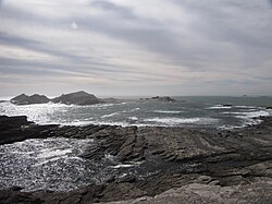
Halifax Island
Namibia
has many islands. Here are some of them:
Bird Island
Impalila
Penguin Islands
The
Penguin Islands
consist of:
From north to south:
Name
coordinates
Hollam's Bird Island
24°38′S
14°31′E
/
24.633°S 14.517°E
/
-24.633; 14.517
(
Hollam's Bird Island
)
Mercury Island
25°43′09″S
14°49′59″E
/
25.719161°S 14.832948°E
/
-25.719161; 14.832948
(
Mercury Island
)
Ichaboe Island
25°43′S
14°50′E
/
25.717°S 14.833°E
/
-25.717; 14.833
(
Ichaboe Island
)
Black Rock
26°05′S
14°58′E
/
26.083°S 14.967°E
/
-26.083; 14.967
(
Black Rock
)
Staple Rock
26°22′S
14°58′E
/
26.367°S 14.967°E
/
-26.367; 14.967
(
Staple Rock
)
Marshall Reef
26°22′S
14°58′E
/
26.367°S 14.967°E
/
-26.367; 14.967
(
Marshall Reef
)
Boat Bay Rocks
26°25′S
15°5′E
/
26.417°S 15.083°E
/
-26.417; 15.083
(
Boat Bay Rocks
)
Seal Island
26°36′S
15°9′E
/
26.600°S 15.150°E
/
-26.600; 15.150
(
Seal Island
)
Penguin Island
26°37′S
15°9′E
/
26.617°S 15.150°E
/
-26.617; 15.150
(
Penguin Island
)
Halifax Island
26°39′S
15°5′E
/
26.650°S 15.083°E
/
-26.650; 15.083
(
Halifax Island
)
Graget Island
26°00′S
15°11′E
/
26.000°S 15.183°E
/
-26.000; 15.183
(
Graget Island
)
Albatross Rock
27°07′S
15°13′E
/
27.117°S 15.217°E
/
-27.117; 15.217
(
Albatross Rock
)
Possession Island
27°01′S
15°13′E
/
27.017°S 15.217°E
/
-27.017; 15.217
(
Possession Island
)
Pomona Island
27°12′S
15°15′E
/
27.200°S 15.250°E
/
-27.200; 15.250
(
Pomona Island
)
North Long Island
26°49′S
15°8′E
/
26.817°S 15.133°E
/
-26.817; 15.133
(
North Long Island
)
South Long Island
26°50′S
15°8′E
/
26.833°S 15.133°E
/
-26.833; 15.133
(
South Long Island
)
Black Rock
24°56′S
14°48′E
/
24.933°S 14.800°E
/
-24.933; 14.800
(
Black Rock
)
Black Sophie Rock
27°38′S
15°31′E
/
27.633°S 15.517°E
/
-27.633; 15.517
(
Black Sophie Rock
)
Plumpudding Island
27°38′S
15°32′E
/
27.633°S 15.533°E
/
-27.633; 15.533
(
Plumpudding Island
)
Sinclair Island (Roast Beef Island)
27°40′S
15°32′E
/
27.667°S 15.533°E
/
-27.667; 15.533
(
Sinclair Island
)
Little Roastbeef Islets
27°42′S
15°32′E
/
27.700°S 15.533°E
/
-27.700; 15.533
(
Little Roastbeef Islets
)
Map all coordinates using
OpenStreetMap
Download coordinates as
KML
v
t
e
List of islands of Africa
Sovereign states
Algeria
Angola
Benin
Botswana
Burkina Faso
Burundi
Cameroon
Cape Verde
Central African Republic
Chad
Comoros
Democratic Republic of the Congo
Republic of the Congo
Djibouti
Egypt
Equatorial Guinea
Eritrea
Eswatini
Ethiopia
Gabon
The Gambia
Ghana
Guinea
Guinea-Bissau
Ivory Coast
Kenya
Lesotho
Liberia
Libya
Madagascar
Malawi
Mali
Mauritania
Mauritius
Morocco
Mozambique
Namibia
Niger
Nigeria
Rwanda
São Tomé and Príncipe
Senegal
Seychelles
Sierra Leone
Somalia
South Africa
South Sudan
Sudan
Tanzania
Togo
Tunisia
Uganda
Zambia
Zimbabwe
States with limited
recognition
Sahrawi Arab Democratic Republic
Somaliland
Dependencies and
other territories
Canary Islands
/
Ceuta
/
Melilla
(Spain)
Madeira
(Portugal)
Mayotte
/
Réunion
(France)
Saint Helena
/
Ascension Island
/
Tristan da Cunha
(United Kingdom)
Authority control databases
: National
United States
Israel
This page is based on this
Wikipedia article
Text is available under the
CC BY-SA 4.0
license; additional terms may apply.
Images, videos and audio are available under their respective licenses.