The following list consists of Dinaric karst fields or polje(s) in Bosnia and Herzegovina:
The following list consists of Dinaric karst fields or polje(s) in Bosnia and Herzegovina:
Western Bosnia:
Western Herzegovina:
Eastern Bosnia:
Eastern Herzegovina:
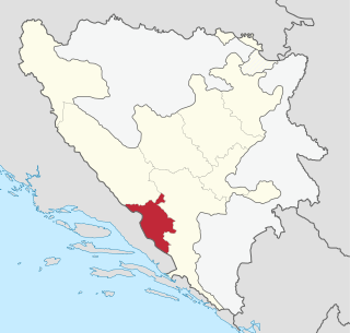
The West Herzegovina Canton is one of the cantons of the Federation of Bosnia and Herzegovina. The West Herzegovina Canton is in the Herzegovina region in the southwest of Bosnia and Herzegovina. Its seat of government is in Široki Brijeg, while other municipalities within the Canton are Grude, Ljubuški and Posušje. It has 94,898 inhabitants, of whom more than 98% are ethnic Croats.

A polje, also karst polje or karst field, is a large flat plain found in karstic geological regions of the world, with areas usually 5–400 km2 (2–154 sq mi). The name derives from the Slavic languages and literally means 'field', whereas in English polje specifically refers to a karst plain or karst field.
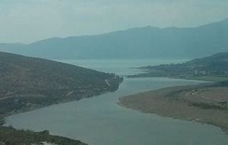
Buško Blato or Buško Jezero is an accumulation lake located on the south side of Livanjsko Polje and northwest of Duvanjsko Polje in Bosnia and Herzegovina. The name is also a reference to the area surrounding the lake which includes a number of villages, of which Prisoje is the largest.

Livanjsko polje, located in Bosnia and Herzegovina, is the largest polje in the world. A typical example of karst polje encircled by tall peaks and mountain ranges, the field is characterized by many unique natural phenomenons and karstic features.
The Trebišnjica is a river in Bosnia and Herzegovina. It used to be a sinking river, 96.5 km (60.0 mi) long above the ground. With a total length of 187 km (116 mi) above and under the ground, it is one of the longest sinking rivers in the world.

Popovo field is a polje in Bosnia and Herzegovina, located in a southernmost region of the country, near the Adriatic coast. Its size is 5.9 square kilometres (2.3 sq mi).

A flood-meadow is an area of grassland or pasture beside a river, subject to seasonal flooding. Flood-meadows are distinct from water-meadows in that the latter are artificially created and maintained, with flooding controlled on a seasonal and even daily basis.

Telestes is a genus of cyprinid fish. It was formerly usually included in Leuciscus.
Kosovo Polje may refer to:

The Trebižat is a river in the southern part of Bosnia and Herzegovina, and major right tributary of the Neretva River.
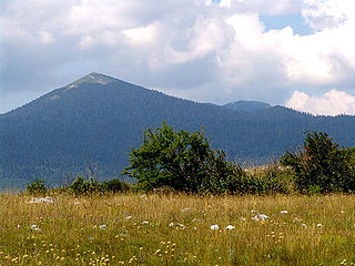
Šator is a mountain in the Dinaric Alps, in the western regions of Bosnia and Herzegovina. The name šator means "tent". The highest peak Veliki Šator is 1,872 m (6,142 ft) above sea level. Dimensions of the mountain are some 15 km in the west–east and 10 km in the north–south direction.
Petrovo Polje may refer to:
Polje is a karst feature.

Rama is a river in Bosnia and Herzegovina, and a major tributary of the Neretva. It joins it from the right by discharging into Neretva's artificial reservoir, Jablaničko lake, at place called Marina Pećina, near village of Gračac, between location of underground powerhouse of Rama Hydroelectric Power Station and Jablanica Dam, depending on water level in Jablaničko lake, some 15 kilometers upstream from Jablanica.

Tropolje or Završje or Western Regions is a historical region in Bosnia and Herzegovina covering a part of the Dinaric Alps. It encompasses territory around karst fields of Livno, Duvno and Glamoč. The wider zone of this region also comprises the fields of Kupres and Bosansko Grahovo. Historically, the region is located on the border of Bosnia, Dalmatia and Herzegovina. The region covers 5 out of 6 municipalities of Canton 10.

Žabljak is a river near Livno in Western Bosnia, Bosnia and Herzegovina. It flows for roughly 6.6 kilometers westward through Livanjsko Polje before its confluence with the Bistrica, just upstream from beginning of its section with artificially created riverbed, from where river begins to turn southward toward Buško Blato.
Gatačko Polje is a karst field within the Gacko municipality in Bosnia and Herzegovina, spanning 57–60 km2, being ca. 24 km long and ca. 3,6 km wide, in the northwest–southeast direction. It is situated between the mountains of Bjelašnica and Lebršnik on the altitude of 930 to 1000 m. The subterranean rivers of Gračanica and Mušnica cross the field. The only larger settlement is Gacko. Near the field are the mountains and straddle of Čemerno, the source of the Trebišnjica, Klinje Lake and the Sutjeska National Park. The field develops agriculture and animal husbandry.

The Zalomka is a karstic river in the southern part of Bosnia and Herzegovina and one of the largest sinking rivers in the country and the world. It collects its waters from Gatačko Polje.
Vilina Pećina is a cave and a karst resurgence wellspring in Dinaric Alps karst of Bosnia and Herzegovina, also previously known from research descriptions of older date as "Vilić Pećina", such as one from 1896, conducted by Austria-Hungary geologists.