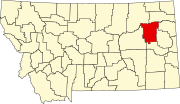
There are at least 28 named lakes and reservoirs in McCone County, Montana .

A lake is an area filled with water, localized in a basin, that is surrounded by land, apart from any river or other outlet that serves to feed or drain the lake. Lakes lie on land and are not part of the ocean, and therefore are distinct from lagoons, and are also larger and deeper than ponds, though there are no official or scientific definitions. Lakes can be contrasted with rivers or streams, which are usually flowing. Most lakes are fed and drained by rivers and streams.

A reservoir is, most commonly, an enlarged natural or artificial lake, pond or impoundment created using a dam or lock to store water.

McCone County is a county located in the U.S. state of Montana. As of the 2010 United States Census, the population was 1,734. Its county seat is Circle.


