Montagnard is an umbrella term for the various indigenous peoples of the Central Highlands of Vietnam. The French term Montagnard signifies a mountain dweller, and is a carryover from the French colonial period in Vietnam. In Vietnamese, they are known by the term người Thượng, although this term can also be applied to other minority ethnic groups in Vietnam. In modern Vietnam, both terms are archaic, and indigenous ethnic groups are referred to as Đồng bào or Người dân tộc thiểu số. Earlier they were referred to pejoratively as the mọi. Sometimes the term Degar is used for the group as well. Most of those living in America refer to themselves as Montagnards, while those living in Vietnam refer to themselves by their individual ethnic group.
On the first tier, Vietnam is divided into fifty-eight provinces and five municipalities under the command of the central government. Municipalities are the highest-ranked cities in Vietnam. Municipalities are centrally-controlled cities and have special status equal to the provinces.
Articles related to Vietnam and Vietnamese culture include:
Bình Định is a province of Vietnam. It is located in Vietnam's South Central Coast region.
Quảng Trị is a province in the North Central Coast region of Vietnam, north of the former imperial capital of Huế.
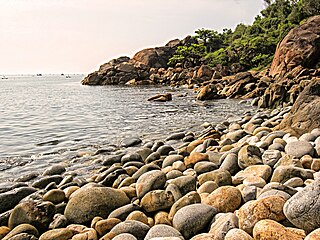
Quảng Ngãi is a province in the South Central Coast region of Vietnam, on the coast of East Sea. It is located 883 kilometres (549 mi) south of Hanoi and 838 kilometres (521 mi) north of Hồ Chí Minh City. The province has been historically populated with H're people and ethnic Kinh, and located on the coast.

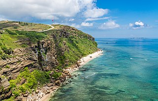
Quy Nhon is a coastal city in Bình Định Province in central Vietnam. It is composed of 16 wards and five communes with a total of 284 km2 (110 sq mi). Quy Nhơn is the capital of Bình Định Province. As of 2019 its population was 457,400. Historically, the commercial activities of the city focused on agriculture and fishing. In recent years, however, there has been a significant shift towards service industries and tourism. There is also a substantial manufacturing sector.

Quảng Bình, formerly Tiên Bình under the reign of Lê Trung Hưng of the Lê dynasty, is a province along Vietnam's north-central coast. The province has an area of 8,065.8 square kilometers and population of 857,818 inhabitants The province is bordered by the Laotian Khammouane province to the west, the North Pacific Ocean to the east, Hà Tĩnh province to the north and Quảng Trị province to the south. Historically, this region belonged to Văn Lang and later the kingdom of Champa. Later it was claimed by both the Đại Việt and Champa and officially annexed into Đại Việt by Lý Thường Kiệt, a Lý dynasty general.

South Central Coast or Nam Trung Bộ is one of the regions of Vietnam. It consists of the independent municipality of Đà Nẵng and seven other provinces. The two southern provinces Ninh Thuận and Bình Thuận are sometimes seen as part of the Southeast region. The Paracel Islands, and Spratly Islands, are also part of this region.

Đồng Hới is the capital city of Quảng Bình Province in the north central coast of Vietnam. The city's area is 155.71 km2 (60.12 sq mi). Population as per the 2017 census was 119,222. It is served by National Highway 1A, the Đồng Hới Railway Station, and airport. By road, Đồng Hới is 486 kilometres (302 mi) south of Hanoi, 195 kilometres (121 mi) south of Vinh, 160 kilometres (99 mi) north of Huế and 1,204 kilometres (748 mi) north of Hồ Chí Minh City. It borders Quảng Ninh District on the west and south, the South China Sea on the east, Bố Trạch District on the north.
The Battle of An Lão was a battle that took place in the An Lão District of Bình Định Province, just over 300 miles north-east of Saigon between December 7–9, 1964. The battle was part of a larger 5th Military Region operation known as Campaign An Lão to capture An Lão valley, and use it as a corridor between their military bases in Quảng Ngãi Province and Bình Định Province.

Lệ Thủy is a district of Quảng Bình province in the North Central Coast of Vietnam. The district borders Quảng Ninh district on the north, Vĩnh Linh district on the south, Laos on the west. Lệ Thủy central is 40 km south of the provincial capital Đồng Hới. The district government seat is Kiến Giang Township. The district area is 1420.52 km2, population: 140,804 (1998). Lệ Thủy district is home to Võ Nguyên Giáp and the family of Ngô Đình Diệm. Economy bases on agriculture, mainly rice culture. Mỹ Trạch massacre by French army happened here on 29 November 1947.

National Route 1A is the trans-Vietnam highway. The route begins at km 0 at Hữu Nghị Quan Border Gate near the China-Vietnam border, runs the length of the country connecting major cities including Hanoi, Da Nang and Ho Chi Minh City, and ends at km 2301.34 at Năm Căn township in Cà Mau Province.

Hoài Nhơn is a district-level town of Bình Định province in the South Central Coast region of Vietnam. The town seat lies at Bồng Sơn.

The 2nd Division was a division of the Army of the Republic of Vietnam (ARVN)—the army of the nation state of South Vietnam that existed from 1955 to 1975. It was part of I Corps that oversaw the northernmost region of South Vietnam.

Đồng Khởi was a movement led by remnants of the Việt Minh that remained in South Vietnam and urged people to revolt against the United States and the Republic Of Vietnam, first of all in large rural areas in southern Vietnam and on highlands of South Central Coastal Vietnam. This movement took place from the end of 1959, culminating in 1960, rapidly spreading across the South, dissolving the rural government structure of the Republic of Vietnam under President Ngô Đình Diệm, resulting in a significant part of rural South Vietnam being controlled by the communists, leading to the foundation of the National Liberation Front.
The War of the flags was a phase of fighting throughout South Vietnam lasting from 23 January to 3 February 1973 as the forces of North and South Vietnam each sought to maximize the territory under their control before the ceasefire in place agreed by the Paris Peace Accords came into effect on 27 January 1973. The fighting continued past the ceasefire date and into early February. South Vietnamese forces made greater territorial gains and inflicted significant losses on the North Vietnamese forces.
Firebases in the U.S.-involvement Vietnam War, were a type of military base, usually fire bases.
Murder, kidnapping, torture and intimidation were a routine part of Viet Cong (VC) and People's Army of Vietnam (PAVN) operations during the Vietnam War. They were intended to cow the populace, liquidate opponents, erode the morale of South Vietnamese government employees, and boost tax collection and propaganda efforts. Estimates of the total number of South Vietnamese civilians killed by the VC/PAVN between 1954 and 1975 range from 106,000 to 227,000.