Name Location Date Listed Grid Ref. [note 1] Geo-coordinates Notes LB Number [note 2] Image Kirkshaws Road, Kirkstyle Cottages 55°50′44″N 4°02′56″W / 55.845471°N 4.048882°W / 55.845471; -4.048882 (Kirkshaws Road, Kirkstyle Cottages ) Category B 23017 Upload another image
59-65 (Odd Nos) Main Street And 1 Church Street 55°51′46″N 4°01′37″W / 55.862686°N 4.02684°W / 55.862686; -4.02684 (59-65 (Odd Nos) Main Street And 1 Church Street ) Category B 23020 Graveyard 55°50′42″N 4°02′59″W / 55.845088°N 4.049724°W / 55.845088; -4.049724 (Graveyard ) Category B 22996 Drumpellier Farm 55°51′50″N 4°03′10″W / 55.863892°N 4.052745°W / 55.863892; -4.052745 (Drumpellier Farm ) Category B 23000 Central Station (Now Pullmans) K6 Telephone Kiosk 55°51′45″N 4°01′53″W / 55.862541°N 4.031275°W / 55.862541; -4.031275 (Central Station (Now Pullmans) K6 Telephone Kiosk ) Category B 23009 Hozier Street, St Mary (Rc Church) Including Presbytery, Hall, Boundary Walls And Gatepiers 55°51′10″N 4°01′19″W / 55.852729°N 4.021912°W / 55.852729; -4.021912 (Hozier Street, St Mary (Rc Church) Including Presbytery, Hall, Boundary Walls And Gatepiers ) Category B 49590 Bank Street And Blair Road, Langloan Primary School With Boundary Walls, Gatepiers And Railings 55°51′28″N 4°02′40″W / 55.85784°N 4.044372°W / 55.85784; -4.044372 (Bank Street And Blair Road, Langloan Primary School With Boundary Walls, Gatepiers And Railings ) Category C(S) 49862 Upload another image
163 Bank Street, (Former Union Bank) Including Boundary Walls And Gatepiers 55°51′35″N 4°02′12″W / 55.859602°N 4.036731°W / 55.859602; -4.036731 (163 Bank Street, (Former Union Bank) Including Boundary Walls And Gatepiers ) Category C(S) 49869 1 Ross Street And 1 - 13 (Odd Nos) Bank Street 55°51′42″N 4°01′52″W / 55.861608°N 4.031179°W / 55.861608; -4.031179 (1 Ross Street And 1 - 13 (Odd Nos) Bank Street ) Category C(S) 50160 St Patrick's Roman Catholic Church, Including Walls, Piers, Gates And Fencing, Main Street, Coatbridge 55°51′45″N 4°01′32″W / 55.86261°N 4.025462°W / 55.86261; -4.025462 (St Patrick's Roman Catholic Church, Including Walls, Piers, Gates And Fencing, Main Street, Coatbridge ) Category B 42895 Coltswood Road, Greenhill Primary School, Including Boundary Walls, Railings And Gates 55°52′09″N 4°01′29″W / 55.869131°N 4.024603°W / 55.869131; -4.024603 (Coltswood Road, Greenhill Primary School, Including Boundary Walls, Railings And Gates ) Category B 23015 453 Main Street, Monklands District Magistrates Court 55°51′35″N 4°00′34″W / 55.85981°N 4.009337°W / 55.85981; -4.009337 (453 Main Street, Monklands District Magistrates Court ) Category B 23021 School Street, Whifflet Primary School, Including Boundary Walls, Gatepiers, Railings And Gates 55°51′02″N 4°01′21″W / 55.850668°N 4.02262°W / 55.850668; -4.02262 (School Street, Whifflet Primary School, Including Boundary Walls, Gatepiers, Railings And Gates ) Category C(S) 23022 Weir Street, Dunbeth Church, Including Boundary Wall 55°51′55″N 4°01′25″W / 55.865182°N 4.02371°W / 55.865182; -4.02371 (Weir Street, Dunbeth Church, Including Boundary Wall ) Category B 23023 Muiryhall Street East, Former Coatdyke Parish Church, Including Hall, Boundary Walls And Gatepiers 55°51′42″N 4°00′29″W / 55.861747°N 4.007951°W / 55.861747; -4.007951 (Muiryhall Street East, Former Coatdyke Parish Church, Including Hall, Boundary Walls And Gatepiers ) Category C(S) 23024 Gartsherrie Parish Church 55°51′52″N 4°01′37″W / 55.864439°N 4.02682°W / 55.864439; -4.02682 (Gartsherrie Parish Church ) Category B 22997 St John Street St John The Evangelist Episcopal Church 55°51′48″N 4°01′29″W / 55.863438°N 4.02485°W / 55.863438; -4.02485 (St John Street St John The Evangelist Episcopal Church ) Category C(S) 23005 31 Muiryhall Street 55°51′49″N 4°01′16″W / 55.863626°N 4.02104°W / 55.863626; -4.02104 (31 Muiryhall Street ) Category C(S) 23008 Chisholm Street, K6 Telephone Kiosk 55°52′11″N 4°01′09″W / 55.869627°N 4.019035°W / 55.869627; -4.019035 (Chisholm Street, K6 Telephone Kiosk ) Category B 23010 Dundyvan Road, St Augustine (Rc Church) Including Sacristy, Presbytery, Hall, Boundary Walls And Gatepiers 55°51′31″N 4°02′10″W / 55.858704°N 4.036156°W / 55.858704; -4.036156 (Dundyvan Road, St Augustine (Rc Church) Including Sacristy, Presbytery, Hall, Boundary Walls And Gatepiers ) Category B 49591 Upload another image See more images
West Canal Street And Heritage Way, Former Caledonian Railway Station, With Gatepiers And Railings 55°51′45″N 4°01′53″W / 55.862576°N 4.031341°W / 55.862576; -4.031341 (West Canal Street And Heritage Way, Former Caledonian Railway Station, With Gatepiers And Railings ) Category C(S) 49871 West Lodge Drumpellier Park 55°51′26″N 4°03′30″W / 55.857113°N 4.058315°W / 55.857113; -4.058315 (West Lodge Drumpellier Park ) Category B 22998 Dundyvan Church Henderson Street Oxford Street And Kirk Street 55°51′28″N 4°01′59″W / 55.857714°N 4.032957°W / 55.857714; -4.032957 (Dundyvan Church Henderson Street Oxford Street And Kirk Street ) Category B 23001 Heritage Way, Summerlee Gatehouse Including Boundary Wall 55°51′47″N 4°01′52″W / 55.862956°N 4.031201°W / 55.862956; -4.031201 (Heritage Way, Summerlee Gatehouse Including Boundary Wall ) Category C(S) 49870 Railway And Foot Bridge Over Former Monkland Canal (West Bridge) Including Access Stair Building 55°51′43″N 4°01′54″W / 55.861934°N 4.031579°W / 55.861934; -4.031579 (Railway And Foot Bridge Over Former Monkland Canal (West Bridge) Including Access Stair Building ) Category B 49873 27, 29 Main Street, Coia's Building 55°51′46″N 4°01′43″W / 55.862785°N 4.028492°W / 55.862785; -4.028492 (27, 29 Main Street, Coia's Building ) Category C(S) 23019 Holy Trinity And All Saints Roman Catholic Church, Muiryhall Street East And Quarry Street 55°51′41″N 4°00′22″W / 55.861406°N 4.006239°W / 55.861406; -4.006239 (Holy Trinity And All Saints Roman Catholic Church, Muiryhall Street East And Quarry Street ) Category C(S) 23004 Upload another image
Lamberton's Engineering Works, Sunnyside Road And Russell Colt Street 55°52′04″N 4°01′43″W / 55.867672°N 4.028603°W / 55.867672; -4.028603 (Lamberton's Engineering Works, Sunnyside Road And Russell Colt Street ) Category B 23011 Academy Street, Carnegie Library, Including Boundary Wall And Gatepiers 55°51′48″N 4°01′43″W / 55.863323°N 4.028552°W / 55.863323; -4.028552 (Academy Street, Carnegie Library, Including Boundary Wall And Gatepiers ) Category B 23012 Upload another image
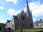
51 Blairhill Street, Kenilworth House 55°51′53″N 4°02′23″W / 55.864642°N 4.039584°W / 55.864642; -4.039584 (51 Blairhill Street, Kenilworth House ) Category B 46093 Old Monkland Church 55°50′45″N 4°02′59″W / 55.845807°N 4.049746°W / 55.845807; -4.049746 (Old Monkland Church ) Category B 22995 Upload another image See more images
Burial Place Of The Buchannans Of Drumpellier, West Lodge 55°51′29″N 4°03′32″W / 55.858066°N 4.058845°W / 55.858066; -4.058845 (Burial Place Of The Buchannans Of Drumpellier, West Lodge ) Category B 22999 Gartsherrie Road, Sunnyside Station 55°52′01″N 4°01′42″W / 55.866842°N 4.028272°W / 55.866842; -4.028272 (Gartsherrie Road, Sunnyside Station ) Category B 23003 Calder Street/26 Bute Street, Calder Parish Church, Including Manse, Gatepiers And Railings 55°51′06″N 4°01′04″W / 55.851788°N 4.017901°W / 55.851788; -4.017901 (Calder Street/26 Bute Street, Calder Parish Church, Including Manse, Gatepiers And Railings ) Category B 23007 Upload another image See more images
Railway Bridge Over Coatbridge Cross 55°51′44″N 4°01′48″W / 55.862196°N 4.029899°W / 55.862196; -4.029899 (Railway Bridge Over Coatbridge Cross ) Category B 49872 Main Street, Whitelaw Memorial Fountain 55°51′44″N 4°01′44″W / 55.86234°N 4.028756°W / 55.86234; -4.028756 (Main Street, Whitelaw Memorial Fountain ) Category C(S) 50508 Upload another image See more images
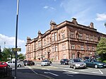
5 Carradale Road, Former Cattle Market, Including Lodge, Outbuilding, Gatepiers And Walls Facing West Canal Street, And Wall At Carradale Road 55°51′41″N 4°02′04″W / 55.861446°N 4.034462°W / 55.861446; -4.034462 (5 Carradale Road, Former Cattle Market, Including Lodge, Outbuilding, Gatepiers And Walls Facing West Canal Street, And Wall At Carradale Road ) Category B 23014 Albert Street, Coatbridge High School, Including Gatepiers,_Boundary Walls And Railings 55°51′56″N 4°01′26″W / 55.865612°N 4.023781°W / 55.865612; -4.023781 (Albert Street, Coatbridge High School, Including Gatepiers,_Boundary Walls And Railings ) Category C(S) 23013 Dunbeth Road, Municipal Buildings, Including Boundary Walls,_Railings, Gatepiers And Gates 55°51′50″N 4°01′19″W / 55.863838°N 4.021818°W / 55.863838; -4.021818 (Dunbeth Road, Municipal Buildings, Including Boundary Walls,_Railings, Gatepiers And Gates ) Category B 23016 Upload another image
Coats Church Jackson Street And Muiryhall Street 55°51′47″N 4°01′09″W / 55.862957°N 4.019104°W / 55.862957; -4.019104 (Coats Church Jackson Street And Muiryhall Street ) Category B 23002 Gartsherrie Road, Gartsherrie Primary School 55°52′09″N 4°02′29″W / 55.869167°N 4.041451°W / 55.869167; -4.041451 (Gartsherrie Road, Gartsherrie Primary School ) Category C(S) 49606 Main Street, Airdrie Savings Bank 55°51′45″N 4°01′45″W / 55.862513°N 4.029165°W / 55.862513; -4.029165 (Main Street, Airdrie Savings Bank ) Category B 23018 Academy Street, Gartsherrie Academy Primary School Including Playground Walls 55°51′50″N 4°01′40″W / 55.863873°N 4.027893°W / 55.863873; -4.027893 (Academy Street, Gartsherrie Academy Primary School Including Playground Walls ) Category B 23006 Bank Street, Coatbridge War Memorial 55°51′28″N 4°02′36″W / 55.857832°N 4.043221°W / 55.857832; -4.043221 (Bank Street, Coatbridge War Memorial ) Category C(S) 50509 Upload another image