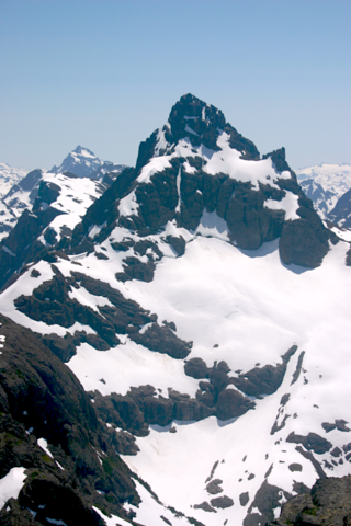
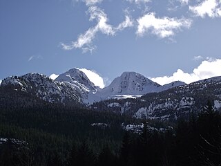
The list of mountains in Strathcona Provincial Park lists all mountains in Strathcona Provincial Park recognized by name. All of these mountains are part of the Vancouver Island Ranges.
The list of mountains in Strathcona Provincial Park lists all mountains in Strathcona Provincial Park recognized by name. All of these mountains are part of the Vancouver Island Ranges.

Mount Vancouver is the 15th highest mountain in North America. Its southern side lies in Glacier Bay National Park and Preserve at the top of the Alaska panhandle, while its northern side is in Kluane National Park and Reserve in the southwestern corner of Yukon, Canada. Mount Vancouver has three summits: north, middle, and south, with the middle summit being the lowest. The south summit, Good Neighbor Peak at 4,785 m (15,699 ft), straddles the international border while the north summit is slightly higher at 4,812 m (15,787 ft).

The North Shore Mountains are a mountain range overlooking Vancouver in British Columbia, Canada. Their southernmost peaks are visible from most areas in Vancouver and form a distinctive backdrop for the city.

The Golden Hinde is a mountain located in the Vancouver Island Ranges on Vancouver Island, British Columbia, Canada. At 2,195 metres (7,201 ft), it is the highest peak on the island. The peak is popular with experienced backcountry-climbers, having been first ascended in 1913. The mountain is made of basalt which is part of the Karmutsen Formation.

Strathcona Provincial Park is the oldest provincial park in British Columbia, Canada, and the largest on Vancouver Island. Founded in 1911, the park was named for Donald Alexander Smith, 1st Baron Strathcona and Mount Royal, a wealthy philanthropist and railway pioneer. It lies within the Strathcona Regional District. The Clayoquot Sound Biosphere Reserve, established in 2000, includes three watersheds in the western area of the park.

Mount Albert Edward is the sixth highest peak on Vancouver Island and one of the most easily accessible. Located in Strathcona Provincial Park, the mountain is a popular destination both in summer for hikers and in winter for skiers and snowshoers. The mountain is named for Albert Edward, the Prince of Wales, later Edward VII.

The Vancouver Island Ranges, formerly called the Vancouver Island Mountains, are a series of mountain ranges extending along the length of Vancouver Island which has an area of 31,788 km2 (12,273 sq mi). The Vancouver Island Ranges comprise the central and largest part of the island. The Geological Survey of Canada refers to Vancouver Island, Haida Gwaii, and the Alaska Panhandle as the Insular Belt including the sea floor out to 100 km (62 mi) west of Vancouver Island. The Vancouver Island Ranges are a sub-range of the Insular Mountains.

Elkhorn Mountain is a mountain located in the Elk River Mountains of the Vancouver Island Ranges of British Columbia, Canada. At 2,194 m (7,198 ft), it is the second highest peak on Vancouver Island, second only to the nearby Golden Hinde which lies 15 km (9 mi) to the south. The mountain is located in the 2,500 km² Strathcona Provincial Park, 24 km (15 mi) east of Gold River.

Mount Colonel Foster is a mountain located on Vancouver Island in Strathcona Regional District, British Columbia, Canada. At 2,135 metres (7,005 ft), it is the fourth highest peak on the island. It is one of the nine Island Qualifiers.
Rambler Peak is a mountain located on Vancouver Island, British Columbia. The mountain is 23 km (14 mi) east of Gold River and 4 km (2 mi) southeast of Mount Colonel Foster

Kings Peak is a mountain located on Vancouver Island in British Columbia, Canada. The mountain is located in Strathcona Provincial Park 25 km (16 mi) northeast of Gold River and 2 km (1 mi) north of Elkhorn Mountain.
Mount Celeste is the unofficial name for a mountain located on Vancouver Island, British Columbia. It shares the name Celeste with two peaks in the Cariboo region of the BC Interior. Within the boundaries of Strathcona Provincial Park, this peak lies at the north end of Rees Ridge. Iceberg Peak lies at the south end of this ridge.
Iceberg Peak is a mountain located on Vancouver Island, British Columbia, Canada. Within the boundaries of Strathcona Provincial Park, this peak lies at the south end of Rees Ridge. Mount Celeste lies at the north end of this ridge.
Mount George V is a mountain located in Strathcona Provincial Park on Vancouver Island in British Columbia. This peak is located 3.2 km (2 mi) south of Mount Albert Edward. Mount Frink and Castlecrag Mountain are within 2 km (1 mi) to the northeast. Its first ascent may have been by surveyors in the 1930s.

The Insular Mountains are a range of mountains in the Pacific Coast Ranges on the Coast of British Columbia, Canada, comprising the Vancouver Island Ranges and Queen Charlotte Mountains. The Insular Mountains are rugged, particularly on Vancouver Island where peaks in Strathcona Provincial Park rise to elevations of more than 2,000 m (6,562 ft). The highest of these mountains is Golden Hinde on Vancouver Island, which rises to 2,196.818 m (7,207 ft).

Argus Mountain is a mountain on Vancouver Island, British Columbia, Canada, located 32 km (20 mi) southwest of Courtenay and 1 km (1 mi) north of The Red Pillar.

Mount Septimus is the western summit of a jagged mountain on Vancouver Island, British Columbia, Canada, located 50 km (31 mi) southeast of Gold River and 10 km (6 mi) south of Buttle Lake. It contains a huge glacier on the north flank. The highest peak on the massif is Mount Rosseau, located 600 m (1,969 ft) to the west.

Nine Peaks is a mountain featuring numerous peaks on Vancouver Island, British Columbia, Canada, located 40 km (25 mi) northeast of Tofino and 4 km (2 mi) southeast of Big Interior Mountain.

Mount Tom Taylor is a mountain on Vancouver Island, British Columbia, Canada, located 41 km (25 mi) northeast of Tofino and 27 km (17 mi) southwest of Mount Albert Edward. This mountain is composed of granite, which is nearly unique in Strathcona Provincial Park. Several multi-pitch alpine climbing routes have been established on its steep SE flanks.
Marble Peak is a mountain in Strathcona Provincial Park on Vancouver Island, British Columbia, Canada. It is located 33 km (21 mi) east of Gold River and 4 km (2 mi) southeast of Mount McBride.

Clayoquot Sound Biosphere Reserve is a UNESCO Biosphere Reserve situated in Clayoquot Sound on the west coast of Vancouver Island in British Columbia, Canada. A diverse range of ecosystems exist within the biosphere reserve boundaries, including temperate coastal rainforest, ocean and rocky coastal shores.