Lauca is a Biosphere Reserve, located in northern Chile, in Arica y Parinacota Region. The reserve comprises three protected areas: Lauca National Park, Las Vicuñas National Reserve and Salar de Surire Natural Monument. This zone was declared a Biosphere Reserve by UNESCO in 1981.
The Lauca River is a binational river. It originates in the Chilean Altiplano of the Arica and Parinacota Region, crosses the Andes and empties into Coipasa Lake in Bolivia.

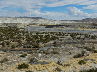
The Lluta River is a river located in the northern portion of the Arica y Parinacota Region of Chile. Its headwaters are on the western flanks of the Andes of the Parinacota Province, just a few kilometers south of the border with Peru, and empties into the Pacific Ocean about 4 km north of the city of Arica.
The Caldera Lauca is a caldera in the Arica y Parinacota Region of Chile. It is located in the Cordillera Occidental, in the valley of the Lauca River. The elliptic caldera has an east-west extension of 23 kilometres (14 mi) and 50 kilometres (31 mi) in north-south direction, buried beneath the late Miocene Vilañuñumani-Tejene volcanic complex in the north and ending at Chucal in the south. The 21 mya Oxaya Ignimbrite originates in the caldera. The eastern border of the caldera is buried beneath younger ignimbrites and deposits but is located east of the Guallatiri volcano. An Oligocene fault marks the western edge of the caldera.
Lauca is a 5,140 metres (16,860 ft) high andesitic stratovolcano in the Central Volcanic Zone of the Andes on the Altiplano in northern Chile. Administratively it is located in Putre, Arica y Parinacota Region. The volcano was active during the Late Miocene from 10.5 million years ago onwards. A major ignimbrite collapsed the volcano in the Late Pliocene.
Canal Mauri is a canal in Peru and Chile. It transfers water from the Mauri River watershed and transfers it into the Caplina River for irrigation purposes. An earlier canal Canal Uchusuma was constructed in the early 19th century and was replaced by the Canal Mauri. This canal collects water from several tributaries of the Mauri River and diverts it through Chilean territory into the Quebrada Vilavilani, a tributary of the Caplina River; from there it is later diverted for irrigation purposes in the Tacna region.


