Mount Kyllini or Mount Cyllene, is a mountain on the Peloponnese in Greece famous for its association with the god Hermes. It rises to 2,376 m (7,795 ft) above sea level, making it the second highest point on the peninsula. It is located near the border between the historic regions of Arcadia and Achaea—in the northeast of Arcadia, and entirely within modern Corinthia. It is located west of Corinth, northwest of Stymfalia, north of Tripoli, and south of Derveni.

Amaliada is a town and a former municipality in northwestern Elis, West Greece, Greece. Since the 2011 local government reform it is part of the municipality Ilida, of which it is the seat and a municipal unit. The municipal unit has an area of 251.945 km2. In 2011, the municipal unit had 28,520 inhabitants, of whom 16,763 lived in the town of Amaliada. It is near the archaeological site of Elis, the city-state whose territory was the site of the ancient Olympic Games. It is situated in the plains of Elis, 6 km from the Ionian Sea. It is 10 km southeast of Gastouni, 16 km northwest of Pyrgos and 60 km southwest of Patras.
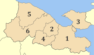
Xylokastro is a seaside town or village and a former municipality in Corinthia in the Peloponnese, Greece. Since the 2011 local government reform it is part of the municipality Xylokastro-Evrostina, of which it is a unit or component. The municipal unit has an area of 310.252 km2. In 2011 its population was 5,715 for the town and 13,277 for the municipal unit.
Rio is a town in the suburbs of Patras and a former municipality in Achaea, West Greece, Greece. Since the 2011 local government reform it is part of the municipality Patras, of which it is a municipal unit. The municipal unit has an area of 98.983 km2. The municipal unit had a population of 14,622 in 2011. The campus of the University of Patras and the Casino Rio is located in Rio.

The Gulf of Corinth or the Corinthian Gulf is a deep inlet of the Ionian Sea, separating the Peloponnese from western mainland Greece. It is bounded in the east by the Isthmus of Corinth which includes the shipping-designed Corinth Canal and in the west by the Strait of Rion which widens into the shorter Gulf of Patras and of which the narrowest point is crossed since 2004 by the Rio–Antirrio bridge. The gulf is bordered by the large administrative divisions : Aetolia-Acarnania and Phocis in the north, Boeotia in the northeast, Attica in the east, Corinthia in the southeast and south and Achaea in the southwest. The gulf is in tectonic movement comparable to movement in parts of Iceland and Turkey, growing by 10 mm (0.39 in) per year.
Agios Dimitrios is a village and a community in the municipal unit of Amaliada, northern Elis, Peloponnese, Greece. It is situated on the left bank of the river Pineios, 3 km west of the Pineios reservoir. It is 3 km west of Kentro, 3 km northeast of Archaia Ilida, 12 km east of Andravida and 12 km northeast of Amaliada. The community Agios Dimitrios includes the village Kolokythas.
Vilia is a village and a former municipality of West Attica, Greece. Since the 2011 local government reform it is part of the municipality Mandra-Eidyllia, of which it is a municipal unit. Its population was 1,753 at the 2011 census.
Kleitoria is a village and a municipal unit in Achaea, Peloponnese, Greece. It was also the new name of the former municipality Lefkasio, of which it was the seat, between 2008 and 2011. Since the 2011 local government reform it is part of the municipality Kalavryta, and became a municipal unit of this municipality. The municipal unit has an area of 253.221 km2. The site of the ancient city of Cleitor is nearby.
Dervenakia is a small village in Corinthia, in northeastern Peloponnese. It is situated on the old national highway from Nafplio to Corinth. Dervenakia is part of the community of Archaia Nemea. The name is derived from the Turkish word derven, meaning mountain pass.
Sikyona is a municipality in Corinthia, Greece. The seat of the municipality is in Kiato. Sikyona takes its name from the ancient city Sicyon, which was located in the same territory.
Archaia Nemea is a village about 27 km southwest of Corinth in Greece named after the nearby ruins of the ancient town of Nemea. The old name of this place was Koutsoumadhi and Iraklion. At the 2011 census, it had 559 inhabitants.

Lake Doxa is an artificial lake in western Corinthia, Greece. It is situated at an elevation of 900 m, in the municipal unit Feneos, near the village Archaia Feneos. Construction was completed in the late 1990s. It is fed and drained by the small river Doxa (Δόξα), which empties into the plain of Feneos. In the heart of the lake on a small peninsula features a small church of Agios Fanourios. The Saint George Monastery in Feneos was relocated to higher ground, north of the lake. The lake is surrounded by pine forests.
The Olvios is a river that flows in western Corinthia in the northern Peloponnese in Greece. The river empties into the Feneos plain, once an area of swamps, now containing farmlands. It is approximately 30 km long. The river begins on the Mavro Oros mountain, south of Evrostina. It flows to the southwest, between the Chelmos (Aroania) and Kyllini mountains. The river empties into the Feneos Fields northwest of the Oligyrtos mountains. One of its tributaries is the Doxa stream, that comes from the Chelmos mountains and flows through the artificial lake Doxa.
Archaies Kleones is a settlement in the municipality of Nemea, Corinthia, Greece with a population of 1092 residents according to 2011 census. It is situated on a hillside, 8 km east of Nemea and 14 km southwest of Corinth.