The name Hernan has been used for seven tropical cyclones in the Eastern Pacific Ocean.
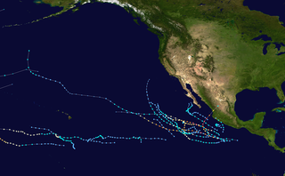
The 2002 Pacific hurricane season was an above-average season which produced fifteen named storms. Eight hurricanes formed, including three Category 5 hurricanes, which tied for the most in a season with 1994 and 2018. Moreover, the season was a near-average season in terms of accumulated cyclone energy (ACE), with a total index of 125 units. The season officially began on May 15 in the East Pacific Ocean, and on June 1 in the Central Pacific and they both ended on November 30. These dates conventionally delimit the period of each year when most tropical cyclones form in the Pacific basin. However, the formation of tropical cyclones is possible at any time of the year.
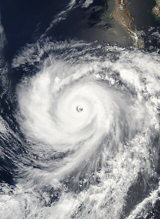
Hurricane Hernan was the second of three Category 5 hurricanes during the 2002 Pacific hurricane season. The twelfth tropical cyclone, tenth named storm and sixth hurricane of the season, Hernan originated from a tropical wave that formed in the Atlantic Ocean and crossed to the Pacific Ocean. The wave spawned a low-pressure area which organized into a tropical depression on August 30, a tropical storm on August 31 and a hurricane later that day. Hernan rapidly intensified and reached peak intensity as a Category 5 storm on the Saffir–Simpson hurricane scale. Proceeding northwest, it maintained this strength for eight hours, but on September 2 it entered cooler waters and began to weaken. By September 6 it had degenerated into a remnant area of low pressure.
Hurricane Hernan was fourth and final tropical cyclone to strike Mexico at hurricane intensity during the 1996 Pacific hurricane season. The thirteenth tropical cyclone, eighth named storm, and fifth hurricane of the season, Hernan developed as a tropical depression from a tropical wave to the south of Mexico on September 30. The depression quickly strengthened, and became Tropical Storm Hernan later that day. Hernan curved north-northwestward the following day, before eventually turning north-northeastward. Still offshore of the Mexican coast on October 2, Hernan intensified into a hurricane. Six hours later, Hernan attained its peak as an 85 mph (140 km/h) Category 1 hurricane on the Saffir-Simpson Hurricane Wind Scale (SSHWS). After weakening somewhat, on 1000 UTC October 3, Hurricane Hernan made landfall near Barra de Navidad, Jalisco, with winds of 75 mph (120 km/h). Only two hours after landfall, Hernan weakened to a tropical storm. By October 4, Tropical Storm Hernan had weakened into a tropical depression, and dissipated over Nayarit on the following day.