This topic is split into two separate articles:
- List of crossings of the Upper Mississippi River – crossings north of the Ohio River
- List of crossings of the Lower Mississippi River – crossings south of the Ohio River
This topic is split into two separate articles:

The Mississippi River is the second-longest river and chief river of the second-largest drainage system on the North American continent, second only to the Hudson Bay drainage system. From its traditional source of Lake Itasca in northern Minnesota, it flows generally south for 2,340 miles (3,770 km) to the Mississippi River Delta in the Gulf of Mexico. With its many tributaries, the Mississippi's watershed drains all or parts of 32 U.S. states and two Canadian provinces between the Rocky and Appalachian mountains. The main stem is entirely within the United States; the total drainage basin is 1,151,000 sq mi (2,980,000 km2), of which only about one percent is in Canada. The Mississippi ranks as the thirteenth-largest river by discharge in the world. The river either borders or passes through the states of Minnesota, Wisconsin, Iowa, Illinois, Missouri, Kentucky, Tennessee, Arkansas, Mississippi, and Louisiana.

The Ohio River is a 981-mile (1,579 km) long river in the United States. It is located at the boundary of the Midwestern and Southern United States, flowing southwesterly from far-western Pennsylvania south of Lake Erie to its mouth on the Mississippi River at the southern tip of Illinois. It is the third largest river by discharge volume in the United States and the largest tributary by volume of the north-south flowing Mississippi River that divides the eastern from western United States. It is also the 6th oldest river on the North American continent. The river flows through or along the border of six states, and its drainage basin includes parts of 14 states. Through its largest tributary, the Tennessee River, the basin includes several states of the southeastern U.S. It is the source of drinking water for three million people.

The Tennessee River is the largest tributary of the Ohio River. It is approximately 652 miles (1,049 km) long and is located in the southeastern United States in the Tennessee Valley. The river was once popularly known as the Cherokee River, among other names, as the Cherokee people had their homelands along its banks, especially in what are now East Tennessee and northern Alabama. In addition, its tributary the Little Tennessee River, flows into it from Western North Carolina and northeastern Georgia, where it also was bordered by numerous Cherokee towns. Its current name is derived from the Cherokee town, Tanasi, which was located on the Tennessee side of the Appalachian Mountains.

A swing bridge is a movable bridge that has as its primary structural support a vertical locating pin and support ring, usually at or near to its center of gravity, about which the turning span can then pivot horizontally as shown in the animated illustration to the right. Small swing bridges as found over canals may be pivoted only at one end, opening as would a gate, but require substantial underground structure to support the pivot.

The Youghiogheny River, or the Yough for short, is a 134-mile-long (216 km) tributary of the Monongahela River in the U.S. states of West Virginia, Maryland, and Pennsylvania. It drains an area on the west side of the Allegheny Mountains northward into Pennsylvania, providing a small watershed in extreme western Maryland into the tributaries of the Mississippi River. Youghiogheny is a Lenape word meaning "a stream flowing in a contrary direction".

In the United States, A National Heritage Area (NHA) is a site designated by Act of Congress, intended to encourage historic preservation of the area and an appreciation of the history and heritage of the site. There are currently 55 NHAs, some of which use variations of the title, such as National Heritage Corridor.

The National Register of Historic Places in the United States is a register including buildings, sites, structures, districts, and objects. The Register automatically includes all National Historic Landmarks as well as all historic areas administered by the U.S. National Park Service. Since its introduction in 1966, more than 90,000 separate listings have been added to the register.

The Cairo Mississippi River Bridge is a type of cantilever bridge known as a Steel Truss Through Deck carrying U.S. Route 60 and U.S. Route 62 across the Mississippi River. Located in the tri-state area of Illinois, Kentucky, and Missouri, it connects Cairo, Illinois at its northern terminus to Bird's Point, Missouri at its southern terminus. The bridge was most recently closed for renovation from March 16, 2015 to October 13, 2015.

The Cairo Ohio River Bridge is a cantilever bridge carrying U.S. Route 51, U.S. Route 60, and U.S. Route 62 across the Ohio River between Wickliffe, Kentucky and Cairo, Illinois. Of all the Ohio River crossings, it is the furthest downstream; the Mississippi River can be seen while crossing the bridge and looking westward.

The Lower Mississippi River is the portion of the Mississippi River downstream of Cairo, Illinois. From the confluence of the Ohio River and Upper Mississippi River at Cairo, the Lower flows just under 1000 miles (1600 km) to the Gulf of Mexico. It is the most heavily travelled component of the Mississippi River System.

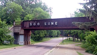
Canadian Pacific Camden Place Rail Bridge is a truss bridge that spans the Mississippi River in Minneapolis, Minnesota. This bridge is the official end of the navigable channel for river traffic. It was built in 1905 by the Minneapolis, St. Paul and Sault Ste. Marie Railway. In 1977, the bridge was modified to allow higher clearance under the center span. This was done by replacing the deck truss span with a shallower girder span. It is the main line crossing of the Mississippi River for the Canadian Pacific Railway transcontinental line.

USS Rattler (1862) was a steamer acquired by the Union Navy during the American Civil War.
The Portsmouth Earthworks are a large prehistoric mound complex constructed by the Ohio Hopewell culture mound builder indigenous peoples of eastern North America. The site was one of the largest earthwork ceremonial centers constructed by the Hopewell and is located at the confluence of the Scioto and Ohio Rivers, in present-day Ohio.

The Dorena–Hickman Ferry is a ferry across the Mississippi River between Dorena, Missouri and Hickman, Kentucky. A single boat takes vehicular traffic across the river seven days a week during daylight hours. Missouri Route 77 connects to the Missouri side while Kentucky Route 1354 connects to the Kentucky side.