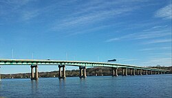
Crossing Carries Location Miles above Coordinates Highway 24 Bridge Demolished, formerly MN 24 Clearwater 45°25′04″N 94°02′37″W / 45.41778°N 94.04361°W / 45.41778; -94.04361 New I-94 and Highway 10 Interregional Connection Bridge East of Clearwater Highway 25 Bridge MN 25 Monticello 45°18′31″N 93°47′29″W / 45.30861°N 93.79139°W / 45.30861; -93.79139 Parrish Avenue Bridge CSAH 42 (Parrish Avenue) Otsego –Elk River 45°18′06″N 93°33′56″W / 45.30167°N 93.56556°W / 45.30167; -93.56556 Betty Adkins Bridge MN 101 45°17′19″N 93°33′29″W / 45.28861°N 93.55806°W / 45.28861; -93.55806 Anoka–Champlin Mississippi River Bridge US 169 Anoka –Champlin 45°11′30″N 93°23′43″W / 45.19167°N 93.39528°W / 45.19167; -93.39528 Coon Rapids Dam pedestrian and bicycle bridge pedestrian and bicycle trail Brooklyn Park –Coon Rapids 45°08′37.64″N 93°18′41.77″W / 45.1437889°N 93.3116028°W / 45.1437889; -93.3116028 Richard P. Braun Bridge MN 610 ~865 45°07′45″N 93°17′57″W / 45.12917°N 93.29917°W / 45.12917; -93.29917 I-694 Bridge I-694 Brooklyn Center –Fridley ~860.4 45°04′09″N 93°16′54″W / 45.06917°N 93.28167°W / 45.06917; -93.28167 Camden Bridge 42nd Avenue North to 37th Avenue Northeast Minneapolis ~857.8 45°01′56″N 93°17′00″W / 45.03222°N 93.28333°W / 45.03222; -93.28333 Canadian Pacific Camden Place Rail Bridge Canadian Pacific Railway ~857.6 45°01′56″N 93°17′00″W / 45.03222°N 93.28333°W / 45.03222; -93.28333 Lowry Avenue Bridge CSAH 153 /Lowry Avenue~856.4 45°00′47″N 93°16′28″W / 45.01306°N 93.27444°W / 45.01306; -93.27444 Northern Pacific-BNSF Minneapolis Rail Bridge BNSF Railway ~855.8 45°00′16″N 93°16′28″W / 45.00444°N 93.27444°W / 45.00444; -93.27444 Broadway Avenue Bridge CSAH 66 /Broadway Avenue~855.4 44°59′56″N 93°16′31″W / 44.99889°N 93.27528°W / 44.99889; -93.27528 Plymouth Avenue Bridge Plymouth Avenue ~855 44°59′35″N 93°16′23″W / 44.99306°N 93.27306°W / 44.99306; -93.27306 Wisconsin Central Boom Island Rail Bridge Pedestrian and Bicycle traffic – North end of Nicollet Island to Boom Island Park [ 2] ~854.7 44°59′27″N 93°15′56″W / 44.99083°N 93.26556°W / 44.99083; -93.26556 Curved Wisconsin Central Rail Bridge Abandoned Wisconsin Central Railway over East channel connecting via [ 3] ~854.5 44°59′20.5″N 93°15′42″W / 44.989028°N 93.26167°W / 44.989028; -93.26167 BNSF East Channel Rail Bridge BNSF Railway over Nicollet Island East channel [ 3] ~854.5 44°59′20″N 93°15′41″W / 44.98889°N 93.26139°W / 44.98889; -93.26139 Minneapolis BNSF Rail Bridge BNSF Railway over the main river channel West of Nicollet Island ~854.5 44°59′16″N 93°15′57″W / 44.98778°N 93.26583°W / 44.98778; -93.26583 First Avenue Bridge First Avenue over river channel East of Nicollet Island ~854.4 44°59′14″N 93°15′38″W / 44.98722°N 93.26056°W / 44.98722; -93.26056 East Hennepin Avenue Bridge CSAH 52 /East Hennepin Avenue over river channel East of Nicollet Island~854.3 44°59′12″N 93°15′36″W / 44.98667°N 93.26000°W / 44.98667; -93.26000 Hennepin Avenue Bridge CSAH 52 /Hennepin Avenue over main river channel West of Nicollet Island~854.3 44°59′07″N 93°15′50″W / 44.98528°N 93.26389°W / 44.98528; -93.26389 Merriam Street Bridge Merriam Street over East channel of Nicollet Island ~854.2 44°59′09″N 93°15′34″W / 44.98583°N 93.25944°W / 44.98583; -93.25944 Third Avenue Bridge MN 65 /Central Avenue SE/Third Avenue S~854.1 44°58′58″N 93°15′40″W / 44.98278°N 93.26111°W / 44.98278; -93.26111 Stone Arch Bridge pedestrian and bicycle traffic ~853.6 44°58′51″N 93°15′13″W / 44.98083°N 93.25361°W / 44.98083; -93.25361 Tenth Avenue (Wagon) Bridge 10th Avenue South to 6th Avenue Southeast (demolished) ~853.5 Lower Saint Anthony Falls Lock and dam restricted catwalk ~853.3 44°58′44″N 93°14′52″W / 44.97889°N 93.24778°W / 44.97889; -93.24778 I-35W Mississippi River bridge Collapsed August 1, 2007 I-35W ~853.2 44°58′44″N 93°14′42″W / 44.97889°N 93.24500°W / 44.97889; -93.24500 I-35W Saint Anthony Falls Bridge I-35W ~853.2 44°58′44″N 93°14′42″W / 44.97889°N 93.24500°W / 44.97889; -93.24500 10th Avenue Bridge 10th Avenue SE to 19th Avenue South ~853.1 44°58′44″N 93°14′38″W / 44.97889°N 93.24389°W / 44.97889; -93.24389 Northern Pacific Bridge Number 9 pedestrian and bicycle trail ~853 44°58′40″N 93°14′28″W / 44.97778°N 93.24111°W / 44.97778; -93.24111 Washington Avenue Bridge (Minneapolis) Lower Deck: CSAH 122 /Washington Avenue and METRO Green Line light rail ~852.6 44°58′24″N 93°14′21″W / 44.97333°N 93.23917°W / 44.97333; -93.23917 Dartmouth Bridge I-94 ~851.7 44°57′58″N 93°13′33″W / 44.96611°N 93.22583°W / 44.96611; -93.22583 Franklin Avenue Bridge CSAH 5 /E Franklin Avenue~851.5 44°57′50″N 93°13′22″W / 44.96389°N 93.22278°W / 44.96389; -93.22278 Short Line Bridge Canadian Pacific Railway ~850.7 44°57′22″N 93°12′45″W / 44.95611°N 93.21250°W / 44.95611; -93.21250 Lake Street-Marshall Bridge Lake Street and Marshall Avenue Minneapolis –St. Paul ~849.9 44°56′54″N 93°15′06″W / 44.94833°N 93.25167°W / 44.94833; -93.25167 Intercity Bridge / Ford Bridge 46th Street and Ford Parkway ~847.6 44°55′04″N 93°12′05″W / 44.91778°N 93.20139°W / 44.91778; -93.20139 Fort Road Bridge MN 5 Saint Paul –Fort Snelling ~845.6 44°53′40″N 93°10′54″W / 44.89444°N 93.18167°W / 44.89444; -93.18167 Lexington Bridge I-35E Saint Paul –Lilydale , ~843.3 44°54′16″N 93°08′20″W / 44.90444°N 93.13889°W / 44.90444; -93.13889 Omaha Road Bridge Number 15 Union Pacific Railroad Saint Paul ~841.4 44°55′24″N 93°07′02″W / 44.92333°N 93.11722°W / 44.92333; -93.11722 High Bridge (St. Paul) MN 149 /Smith Ave~840.5 44°56′00″N 93°06′16″W / 44.93333°N 93.10444°W / 44.93333; -93.10444 Raspberry Island Bridge Vehicles, bicycles, and pedestrians over south channel of Raspberry Island ~839.5 44°56′34″N 93°05′31″W / 44.94278°N 93.09194°W / 44.94278; -93.09194 Wabasha Street Bridge Wabasha Street ~839.5 44°56′34″N 93°05′31″W / 44.94278°N 93.09194°W / 44.94278; -93.09194 St. Paul Union Pacific Vertical-lift Rail Bridge Union Pacific Railroad ~839.3 44°56′39″N 93°05′18″W / 44.94417°N 93.08833°W / 44.94417; -93.08833 Robert Street Bridge Robert Street ~839.2 44°56′38.13″N 93°05′14.65″W / 44.9439250°N 93.0874028°W / 44.9439250; -93.0874028 Lafayette Bridge US 52 ~838.8 44°56′48″N 93°04′45″W / 44.94667°N 93.07917°W / 44.94667; -93.07917 St. Paul Union Pacific Rail Bridge Union Pacific Railroad Saint Paul –West Saint Paul ~835.6 44°55′07″N 93°02′03″W / 44.91861°N 93.03417°W / 44.91861; -93.03417 Wakota Bridge I-494 South St. Paul –Newport ~832.4 44°52′59″N 93°00′54″W / 44.88306°N 93.01500°W / 44.88306; -93.01500 Rock Island Swing Bridge Former Rock Island Railroad and 66th Street East to 3rd Avenue East Inver Grove Heights –Saint Paul Park ~830.3 44°51′12″N 93°00′32″W / 44.85333°N 93.00889°W / 44.85333; -93.00889 Hastings High Bridge Demolished Hastings ~814 44°44′47″N 92°51′10″W / 44.74639°N 92.85278°W / 44.74639; -92.85278 Hastings Bridge US 61 ~814 44°44′48.48″N 92°51′10.7994″W / 44.7468000°N 92.852999833°W / 44.7468000; -92.852999833 Hastings Rail Bridge Canadian Pacific Railway (Former Milwaukee Road) ~813.7 44°44′48″N 92°50′52″W / 44.74667°N 92.84778°W / 44.74667; -92.84778 


