
Interstate 94 (I-94) is an east–west Interstate Highway connecting the Great Lakes and northern Great Plains regions of the United States. Its western terminus is just east of Billings, Montana, at a junction with I-90; its eastern terminus is in Port Huron, Michigan, where it meets with I-69 and crosses the Blue Water Bridge into Sarnia, Ontario, Canada, where the route becomes Ontario Highway 402. It thus lies along the primary overland route from Seattle to Toronto and is the only east–west Interstate Highway to have a direct connection to Canada.

The Belt Parkway is the name given to a series of controlled-access parkways that form a belt-like circle around the New York City boroughs of Brooklyn and Queens. The Belt Parkway comprises three of the four parkways in what is known as the Belt System: the Shore Parkway, the Southern Parkway, and the Laurelton Parkway. The three parkways in the Belt Parkway are a combined 25.29 miles (40.70 km) in length. The Cross Island Parkway makes up the fourth parkway in the system, but is signed separately.
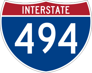
Interstate 494 (I-494) is an auxiliary Interstate Highway making up part of a beltway of I-94, circling through the southern and western portions of the Minneapolis–Saint Paul metropolitan area in Minnesota. The 42.94-mile (69.11 km) road is coupled with I-694 at each end and composes more than half of the major beltway of the region. I-694/I-494 also act as loop routes for I-35E and I-35W.

Interstate 694 (I-694) is an east–west auxiliary Interstate Highway located in the Minneapolis–Saint Paul metropolitan area in the US state of Minnesota. The western terminus of the route is at its junction with I-94, I-494, and US Highway 52 (US 52) in Maple Grove. The eastern terminus of I-694 is at its junction with I-94 and I-494 at the Woodbury–Oakdale city line. I-694 comprises the northern and northeastern portions of a beltway around the Twin Cities, with I-494 forming the remainder of the beltway. The speed limit is 60 mph (97 km/h). Interstate Highways outside of the loop in Minnesota may be signed as high as 70 mph (110 km/h) but can only reach 60 mph (97 km/h) inside the loop.

Minnesota State Highway 100 is a state highway in the Twin Cities region of Minnesota, which runs from its interchange with Interstate 494 (I-494) in Bloomington and continues north to its northern terminus at its interchange with I-694 in Brooklyn Center. The southern end of MN 100 continues in Bloomington as Normandale Boulevard. At the north end, the main line of MN 100 merges with I-694 in Brooklyn Center. The route is 16 miles (26 km) in length.

The Washington Avenue Bridge carries County Road 122 and the METRO Green Line light rail across the Mississippi River in Minneapolis and connects the East Bank and West Bank portions of the University of Minnesota campus. The bridge has two decks, with the lower deck designated for motor vehicle traffic and light rail trains and the upper deck used for pedestrians and bicycles. It is a utilitarian structure with simple architecture, but it has cultural significance because thousands of students, faculty, staff, and visitors walk across it every day.

New York State Route 27 (NY 27) is a 120.58-mile (194.05 km) long state highway that runs east–west from Interstate 278 (I-278) in the New York City borough of Brooklyn to Montauk Point State Park on Long Island, New York. Its two most prominent components are Sunrise Highway and Montauk Highway, the latter of which includes the Montauk Point State Parkway. NY 27 acts as the primary east–west highway on southern Long Island east of the interchange with the Heckscher State Parkway in Islip Terrace. The entire route in Suffolk, Nassau, and Queens counties were designated by the New York State Senate as the POW/MIA Memorial Highway. The highway gives access to every town on the South Shore. NY 27 is the easternmost state route in the state of New York, as well as the longest highway on Long Island.

Minnesota State Highway 610 (MN 610) is an east–west freeway in the Twin Cities region of Minnesota. The freeway connects Interstate 94 (I-94), County Road 81, and CR 130 in northern Hennepin County to U.S. Highway 10 (US 10) in southern Anoka County. MN 610 crosses the Mississippi River on the Richard P. Braun Bridge between suburban Brooklyn Park and Coon Rapids. The highway is 12.3 miles (19.8 km) long.

The Wakota Bridge is a ten-lane bridge carrying Interstate 494 over the Mississippi River between South St. Paul and Newport, Minnesota, United States. It was completed in 2010, replacing a four-lane span built in 1959. The name was given to the previous span in the early 1960s, and is derived from the two counties it connects, Washington and Dakota. Lunda Construction Company won the bid to build a new five-lane west-bound span, remove the existing bridge, and build a new five-lane east-bound span, which was completed in 2010. It is the widest bridge in Minnesota in number of lanes, along with the I-35W Saint Anthony Falls Bridge in Minneapolis.
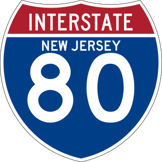
Interstate 80 (I-80) is a major interstate highway in the United States, running from San Francisco, California, eastward to the New York metropolitan area. In New Jersey, I-80 runs for 68.3 miles (109.9 km) from the Delaware Water Gap Toll Bridge at the Pennsylvania state line to its eastern terminus at the interchange with the New Jersey Turnpike (I-95) in Teaneck, Bergen County. I-95 continues from the end of I-80 to the George Washington Bridge for access to New York City. The highway runs parallel to US 46 through rural areas of Warren and Sussex counties before heading into more suburban surroundings in Morris County. As the road continues into Passaic and Bergen counties, it heads into more urban areas. The New Jersey Department of Transportation identifies I-80 within the state as the Christopher Columbus Highway.

Interstate 35E (I-35E) is an Interstate Highway in the US state of Minnesota, passing through downtown Saint Paul. It is one of two through routes for I-35 through the Twin Cities of Minneapolis and Saint Paul, the other being I-35W through Minneapolis. Thus, both ends of I-35E are shared with I-35W and I-35.

Interstate 35W (I-35W) is an Interstate Highway in the US state of Minnesota, passing through downtown Minneapolis. It is one of two through routes for I-35 through the Twin Cities of Minneapolis and Saint Paul, the other being I-35E through downtown Saint Paul.

The I-90 Mississippi River Bridge, or the Dresbach Bridge, consists of a pair of parallel bridges that traverse the Mississippi River, connecting the La Crosse, Wisconsin area to Dresbach in rural Winona County, Minnesota. The current bridge was fully opened to traffic in October 2016, replacing a previous 1967 plate girder bridge. It is part of the Interstate 90 route. There is another automobile crossing a few miles south of this bridge; the Mississippi River Bridge, a combination of two bridges, and the La Crosse West Channel Bridge, connecting La Crescent, Minnesota and La Crosse, Wisconsin.

Minnesota State Highway 252 (MN 252) is a 4.4-mile-long (7.1 km) state highway in Minnesota, which runs from its interchange with Interstate 94 (I-94), I-694 and US Highway 52 (US 52) in Brooklyn Center and continues north to its northern terminus at its interchange with MN 610 in Brooklyn Park. MN 252 generally follows not far from the west bank of the Mississippi River throughout its route.

U.S. Highway 90 Business is a business route of U.S. Highway 90 located in and near New Orleans, Louisiana. It runs 14.25 miles (22.93 km) in a general east–west direction from US 90 in Avondale to a junction with Interstate 10 (I-10) and US 90 in the New Orleans Central Business District.

U.S. Highway 52 (US 52) enters the state of Minnesota at the unincorporated community of Prosper, north of the town of Burr Oak, Iowa. The route is marked north–south in Minnesota along its independent segment from the Iowa state line to downtown St. Paul. US 52 is not signed along the length of its concurrency with Interstate 94 (I-94) from downtown St. Paul to the North Dakota state line at Moorhead and Fargo.

Interstate 10 (I-10), a major east–west Interstate Highway in the southern areas of the United States, has a section of about 77 miles (124 km) in Mississippi.

U.S. Highway 169 (U.S. 169) is a major north–south highway in the U.S. state of Minnesota, connecting the Minnesota River valley with the Twin Cities and the Iron Range. Much of the route is built to expressway or freeway standards.

Interstate 74 (I-74) is the central freeway through the Iowa Quad Cities. It roughly divides Davenport to the west and Bettendorf to the east. The Interstate Highway begins at an interchange with I-80 at the northeastern edge of Davenport and continues into Illinois at the Mississippi River by crossing the I-74 Bridge. The freeway was built in stages during the late 1960s and early 1970s.

Camp Ripley Bridge, also known as Bridge 4969, is the only remaining unified road–rail bridge over the Mississippi River. It carries both a railroad spur line and Minnesota State Highway 115 at Camp Ripley in Morrison County.
