Hamilton, Illinois

Last updated

Hamilton, Illinois
Broadway Street in Hamilton, Illinois.jpg
Broadway Street in Hamilton
Hancock County Illinois Incorporated and Unincorporated areas Hamilton Highlighted.svg
Location of Hamilton in Hancock County, Illinois.
USA Illinois location map.svg
Red pog.svg
Hamilton
Usa edcp location map.svg
Red pog.svg
Hamilton
Coordinates: 40°23′47.42″N91°20′15.32″W / 40.3965056°N 91.3375889°W / 40.3965056; -91.3375889
CountryUnited States
StateIllinois
CountyHancock
Government
  MayorBocephus Casey
  City clerkMichelle Dorthey
  Police chiefMike Boley
  Fire chiefSteve Helenthal
Area
[1]
  Total5.36 sq mi (13.87 km2)
  Land3.56 sq mi (9.22 km2)
  Water1.79 sq mi (4.65 km2)  33.46%
Elevation
[2]
495 ft (151 m)
Population
 (2020)
  Total2,753
  Density773.10/sq mi (298.48/km2)
Time zone Central Standard
ZIP code
62341
Area code 217
FIPS code 17-32434
GNIS feature ID2394275 [2]
Website www.hamiltonillinois.org

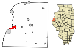
Hamilton is a city in Hancock County, Illinois, United States. The population was 2,951 at the 2010 census, [3] a decline from 3,029 in 2000. The city is located directly across the Mississippi River from Keokuk, Iowa. Hamilton is the largest city in Hancock County.

Contents

History

Hamilton was laid out in 1852 by several men in the area, including Samuel Gordon and Bryant Bartlett. Hamilton was officially incorporated as a town in 1854, and then re-incorporated as a city in 1859. Artois Hamilton, for whom the town was named, [4] was also active in the early history of the town.

Geography

According to the 2010 census, Hamilton has a total area of 5.354 square miles (13.87 km2), of which 3.56 square miles (9.22 km2) (or 66.49%) is land and 1.794 square miles (4.65 km2) (or 33.51%) is water. [5] Hamilton and Keokuk share Lock & Dam 19 on the Mississippi River. The dam has the largest fall of any on the Mississippi and the power house supplies a majority of the electricity for St. Louis, MO. Lake Cooper, formed above the dam, represents the widest span of the Mississippi between Montrose, IA and Nauvoo, IL.

Demographics

Historical population
CensusPop.Note
1880 1,025
1890 1,30126.9%
1900 1,3443.3%
1910 1,62721.1%
1920 1,6984.4%
1930 1,687−0.6%
1940 1,642−2.7%
1950 1,7768.2%
1960 2,22825.5%
1970 2,76424.1%
1980 3,50927.0%
1990 3,281−6.5%
2000 3,029−7.7%
2010 2,951−2.6%
2020 2,753−6.7%
U.S. Decennial Census [6]

As of the census [7] of 2000, there were 3,029 people, 1,223 households, and 805 families residing in the city. The population density was 808.3 inhabitants per square mile (312.1/km2). There were 1,325 housing units at an average density of 353.6 per square mile (136.5/km2). The racial makeup of the city was 98.18% White, 0.56% African American, 0.17% Native American, 0.43% Asian, and 0.43% from two or more races. Hispanic or Latino of any race were 0.79% of the population.

There were 1,223 households, out of which 28.6% had children under the age of 18 living with them, 55.4% were married couples living together, 8.0% had a female householder with no husband present, and 34.1% were non-families. 29.2% of all households were made up of individuals, and 13.9% had someone living alone who was 65 years of age or older. The average household size was 2.39 and the average family size was 2.94.

In the city, the population was spread out, with 22.9% under the age of 18, 8.1% from 18 to 24, 26.3% from 25 to 44, 24.9% from 45 to 64, and 17.9% who were 65 years of age or older. The median age was 40 years. For every 100 females, there were 91.0 males. For every 100 females age 18 and over, there were 85.9 males.

The median income for a household in the city was $40,179, and the median income for a family was $48,935. Males had a median income of $32,149 versus $21,587 for females. The per capita income for the city was $18,775. About 4.6% of families and 7.1% of the population were below the poverty line, including 4.5% of those under age 18 and 11.8% of those age 65 or over.

Education

Hamilton Community Unit School District #328 consists of Hamilton Elementary, Hamilton Junior High School, and Hamilton High School. The school's nickname is the Cardinals, but is switching over to Titans with the sports co-op with Warsaw and Nauvoo schools. The only sports that will still be "Cardinals" are Scholastic Bowl and Junior High and Elementary sports. In 2008, the newly co-oped West Hancock (Hamilton, Warsaw, Nauvoo-Colusa) Girls basketball team took first place in the IHSA Class 2A Championship. It is the first year of the co-op basketball team, and their first championship.[ citation needed ]

Notable people

Related Research Articles

<span class="mw-page-title-main">Hancock County, Illinois</span> County in Illinois, United States

Hancock County is a county in the U.S. state of Illinois. According to the 2020 census, it has a population of 17,620. Its county seat is Carthage, and its largest city is Hamilton. The county is composed of rural towns with many farmers.

<span class="mw-page-title-main">Bentley, Illinois</span> Town in Illinois, United States

Bentley is an incorporated town in southeast Hancock County, Illinois, United States. The population was 35 at the 2010 census.

<span class="mw-page-title-main">Dallas City, Illinois</span> City in Illinois, United States

Dallas City is a city in Hancock and Henderson counties in the U.S. state of Illinois. The population in 2020 stands at an estimate of 805, a decline from the 2010 census of 945, which was a decline from 1,055 in 2000.

<span class="mw-page-title-main">Elvaston, Illinois</span> Village in Illinois, United States

Elvaston is a village in Hancock County, Illinois, United States. The population was 165 at the 2010 census, an increase from 152 in 2000.

<span class="mw-page-title-main">Ferris, Illinois</span> Village in Illinois, United States

Ferris is a village in Hancock County, Illinois, United States. The population was 156 at the 2010 census.

<span class="mw-page-title-main">Pontoosuc, Illinois</span> Village in Illinois, United States

Pontoosuc is a village in Hancock County, Illinois, United States. The population was 146 at the 2010 census, down from 171 at the 2000 census.

<span class="mw-page-title-main">Warsaw, Illinois</span> City in Illinois, United States

Warsaw is a city in Hancock County, Illinois, United States. The population was 1,607 at the 2010 census, a decline from 1,793 in 2000. The city is notable for its historic downtown.

<span class="mw-page-title-main">West Point, Illinois</span> Village in Illinois, United States

West Point is a village in Hancock County, Illinois, United States. The population was 178 at the 2010 census.

<span class="mw-page-title-main">Fulton, Illinois</span> Place in Illinois, United States

Fulton is a city in Whiteside County, Illinois, United States. The population was 3,481 at the 2010 census, down from 3,881 in 2000. Fulton is located across the Mississippi River from Clinton, Iowa.

<span class="mw-page-title-main">Wilkinson, Indiana</span> Town in Indiana, United States

Wilkinson is a town in Brown Township, Hancock County, Indiana, United States. The population was 449 at the 2010 census.

<span class="mw-page-title-main">Keokuk, Iowa</span> City in Iowa, United States

Keokuk is a city in and a county seat of Lee County, Iowa, United States. It is Iowa's southernmost city. The population was 9,900 at the time of the 2020 census. The city is named after the Sauk chief Keokuk, who is recognized with a statue in Rand Park. It is in the extreme southeast corner of Iowa, where the Des Moines River meets the Mississippi. It is at the junction of U.S. Routes 61, 136 and 218. Just across the rivers are the towns of Hamilton and Warsaw, Illinois, and Alexandria, Missouri. Keokuk, along with the city of Fort Madison, is a principal city of the Fort Madison-Keokuk micropolitan area, which includes all of Lee County, Iowa, Hancock County, Illinois and Clark County, Missouri.

<span class="mw-page-title-main">Montrose, Iowa</span> City in Iowa, United States

Montrose is a city in Lee County, Iowa. The population was 738 at the time of the 2020 census. The town is located on the Mississippi River. It is part of the Fort Madison-Keokuk Micropolitan Statistical Area.

<span class="mw-page-title-main">Kellogg, Minnesota</span> City in Minnesota, United States

Kellogg is a city in Wabasha County, Minnesota, along the Zumbro River. The population was 456 at the 2010 census.

<span class="mw-page-title-main">Alexandria, Missouri</span> City in Missouri, United States

Alexandria is a city in eastern Clark County, Missouri, United States. As of the 2020 census, its population was 105.

<span class="mw-page-title-main">North Zanesville, Ohio</span> CDP in Ohio, United States

North Zanesville is a census-designated place (CDP) in Muskingum County, Ohio, United States, just north of the city of Zanesville, along the Muskingum River. The population was 3,116 at the 2020 census.

<span class="mw-page-title-main">West Kittanning, Pennsylvania</span> Borough in Pennsylvania, United States

West Kittanning is a borough in Armstrong County, Pennsylvania, United States. The population was 1,192 at the 2020 census.

<span class="mw-page-title-main">Lower Yoder Township, Pennsylvania</span> Township in Pennsylvania, United States

Lower Yoder Township is a township in Cambria County, Pennsylvania, United States. The population was 2,699 at the 2010 census, down from 3,029 at the 2000 census. It is part of the Johnstown, Pennsylvania Metropolitan Statistical Area.

<span class="mw-page-title-main">St. Andrews, South Carolina</span> Census-designated place in South Carolina, United States

St. Andrews is a census-designated place (CDP) in Richland County, South Carolina, United States. The population was 20,493 at the 2010 census. It is part of the Columbia, South Carolina Metropolitan Statistical Area.

<span class="mw-page-title-main">Wolf River, Winnebago County, Wisconsin</span> Town in Wisconsin, United States

Wolf River is a town in Winnebago County, Wisconsin, United States. The population was 1,189 at the 2010 census. The unincorporated communities of Orihula and Zittau are located in the town. The unincorporated community of Metz is also located partially in the town.

<span class="mw-page-title-main">Patterson Township, Pennsylvania</span> Township in Pennsylvania, United States

Patterson Township is a township that is located in Beaver County, Pennsylvania, United States. The population was 3,132 at the time of the 2020 census.

References

  1. "2020 U.S. Gazetteer Files". United States Census Bureau. Retrieved March 15, 2022.
  2. 1 2 U.S. Geological Survey Geographic Names Information System: Hamilton, Illinois
  3. "Geographic Identifiers: 2010 Demographic Profile Data (G001): Hamilton city, Illinois". American Factfinder. U.S. Census Bureau. Retrieved June 12, 2017.[ dead link ]
  4. Gannett, Henry (1905). The Origin of Certain Place Names in the United States. Govt. Print. Off. pp.  148.
  5. "G001 - Geographic Identifiers - 2010 Census Summary File 1". United States Census Bureau. Archived from the original on February 13, 2020. Retrieved December 27, 2015.
  6. "Census of Population and Housing". Census.gov. Retrieved June 4, 2015.
  7. "U.S. Census website". United States Census Bureau . Retrieved January 31, 2008.