Denver | |
|---|---|
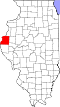
 Denver Location of Denver within Illinois  Denver Denver (the United States) | |
| Coordinates: 40°17′26″N91°06′25″W / 40.29056°N 91.10694°W | |
| Country | United States |
| State | Illinois |
| County | Hancock |
| Township | Harmony |
| Elevation | 205 m (672 ft) |
| Time zone | UTC-6 (CST) |
| • Summer (DST) | UTC-5 (CDT) |
| Postal code | 62321 |
Denver is a small unincorporated community located in rural Harmony Township in Hancock County in the U.S. state of Illinois, about eight miles south of Carthage and about 30 miles northeast of Quincy.