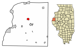
Ferris, Illinois | |
---|---|
Coordinates: 40°28′8″N91°10′10″W / 40.46889°N 91.16944°W | |
Country | United States |
State | Illinois |
County | Hancock |
Area | |
• Total | 1.97 sq mi (5.09 km2) |
• Land | 1.97 sq mi (5.09 km2) |
• Water | 0.00 sq mi (0.00 km2) |
Elevation | 682 ft (208 m) |
Population (2020) | |
• Total | 127 |
• Density | 64.57/sq mi (24.93/km2) |
Time zone | UTC-6 (CST) |
• Summer (DST) | UTC-5 (CDT) |
ZIP Code(s) | 62336 |
Area code | 217 |
FIPS code | 17-25895 |
GNIS feature ID | 2398872 [2] |
Wikimedia Commons | Ferris, Illinois |
Ferris is a village in Hancock County, Illinois, United States. The population was 127 at the 2020 census. [3]
Ferris is located in north-central Hancock County at 40°28′8″N91°10′10″W / 40.46889°N 91.16944°W (40.468753, -91.169448). [4] It is 5 miles (8 km) north of Carthage, the county seat.
According to the 2021 census gazetteer files, Ferris has a total area of 1.97 square miles (5.10 km2), all land. [5]
Census | Pop. | Note | %± |
---|---|---|---|
1880 | 182 | — | |
1890 | 305 | 67.6% | |
1900 | 269 | −11.8% | |
1910 | 299 | 11.2% | |
1920 | 297 | −0.7% | |
1930 | 250 | −15.8% | |
1940 | 272 | 8.8% | |
1950 | 226 | −16.9% | |
1960 | 208 | −8.0% | |
1970 | 200 | −3.8% | |
1980 | 202 | 1.0% | |
1990 | 177 | −12.4% | |
2000 | 168 | −5.1% | |
2010 | 156 | −7.1% | |
2020 | 127 | −18.6% | |
U.S. Decennial Census [6] |
As of the 2020 census [3] there were 127 people, 57 households, and 50 families residing in the village. The population density was 64.57 inhabitants per square mile (24.93/km2). There were 67 housing units at an average density of 34.06 per square mile (13.15/km2). The racial makeup of the village was 88.19% White, 0.79% African American, 1.57% Native American, 0.00% Asian, 0.00% Pacific Islander, 0.00% from other races, and 9.45% from two or more races. Hispanic or Latino of any race were 0.79% of the population.
There were 57 households, out of which 21.1% had children under the age of 18 living with them, 73.68% were married couples living together, 1.75% had a female householder with no husband present, and 12.28% were non-families. 12.28% of all households were made up of individuals, and 10.53% had someone living alone who was 65 years of age or older. The average household size was 3.08 and the average family size was 2.88.
The village's age distribution consisted of 18.3% under the age of 18, 1.2% from 18 to 24, 20.7% from 25 to 44, 26.2% from 45 to 64, and 33.5% who were 65 years of age or older. The median age was 56.5 years. For every 100 females, there were 144.8 males. For every 100 females age 18 and over, there were 127.1 males.
The median income for a household in the village was $43,750, and the median income for a family was $45,833. Males had a median income of $40,625 versus $27,000 for females. The per capita income for the village was $23,674. About 12.0% of families and 17.7% of the population were below the poverty line, including 46.7% of those under age 18 and 18.2% of those age 65 or over.
Coaling is a town in Tuscaloosa County, Alabama, United States. It incorporated in September 1997. At the 2020 census, the population was 2,035. It is part of the Tuscaloosa, Alabama Metropolitan Statistical Area.
Loraine is a village in Adams County, Illinois, United States. The population was 300 at the 2020 census.
Rockbridge is a village in Greene County, Illinois, United States. The population was 175 at the 2020 census.
Augusta is a village in southeast Hancock County, Illinois, United States. The population was 553 at the 2020 census. It is located near Weinberg-King State Park.
Basco is a village in Bear Creek Township, Hancock County, Illinois, United States. The population was 80 at the 2020 census.
Bentley is an incorporated town in southeast Hancock County, Illinois, United States. The population was 30 at the 2020 census.
Bowen is a village in southeast Hancock County, Illinois, United States. The population was 464 at the 2020 census.
Elvaston is a village in Hancock County, Illinois, United States. The population was 147 at the 2020 census.
Plymouth is a village in Hancock and McDonough counties, Illinois, United States. The population was 436 at the 2020 census, down from 505 in 2010.
Pontoosuc is a village in Hancock County, Illinois, United States. The population was 99 at the 2020 census.
West Point is a village in Hancock County, Illinois, United States. The population was 140 at the 2020 census.
Dana is a village in LaSalle County, Illinois, United States. As of the 2010 census, the village had a total population of 159, down from 171 in 2000. It is part of the Ottawa Micropolitan Statistical Area, as well as a part of the geographic region known as Streatorland.
Sawyerville is a village in Macoupin County, Illinois, United States. As of the 2020 census the population was 268.
Newark is a village in southeast Knox County, Missouri, United States, along the South Fabius River. As of the 2020 census, its population was 54.
Dungannon is a town in Scott County, Virginia. The population was 257 at the 2020 census. It was named after the town of Dungannon in County Tyrone, Northern Ireland.
Ettrick is a village in Trempealeau County, Wisconsin, United States. The population was 525 at the 2020 census. The village is surrounded by the Town of Ettrick.
Dallas City Township is one of twenty-five townships in Hancock County, Illinois, USA. As of the 2020 census, its population was 864 and it contained 488 housing units. It was formed from Pontoosuc Township in 1860.
Prairie Township is one of twenty-four townships in Hancock County, Illinois, USA. As of the 2020 census, its population was 382 and it contained 186 housing units. It was formed from Montebello and Carthage townships on September 12, 1854.
Rock Creek Township is one of twenty-five townships in Hancock County, Illinois, United States. As of the 2020 census, its population was 322 and it contained 155 housing units. It was formed from Sonora and Pilot Grove townships on April 27, 1855.
Niota is an unincorporated community in Appanoose Township, Hancock County, in the U.S. state of Illinois. The community is located on the bank of the Mississippi River and is at the eastern end of the Fort Madison Toll Bridge, which connects Niota to Fort Madison, Iowa. Niota is the western terminus of Illinois Route 9 and is also served by Illinois Route 96, which is part of the Great River Road.
{{cite web}}
: |last=
has generic name (help)