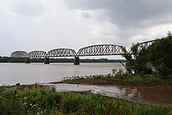
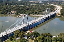
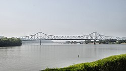
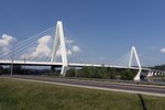
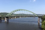
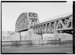
List of crossings of the Ohio River

Last updated

This is a complete list of current bridges and other crossings of the Ohio River from the mouth at the Mississippi River at Cairo, Illinois to the confluence of the Allegheny and Monongahela Rivers at Pittsburgh, Pennsylvania.

Contents

Illinois–Kentucky

ImageCrossingCarriesLocationOpenedCoordinates
CairoOhioRiverBridge.jpg Cairo Ohio River Bridge US 51.svgUS 60.svgUS 62.svg US 51  / US 60  / US 62 Cairo and Wickliffe 1937 36°59′39″N89°08′45″W / 36.99417°N 89.14583°W / 36.99417; -89.14583
Cairo Ohio River Bridge P6190072 crop.jpg Cairo Rail Bridge Canadian National Railway 1889,1952 37°01′23″N89°10′32″W / 37.02306°N 89.17556°W / 37.02306; -89.17556
Olmsted Locks and Dam Pulaski County, Illinois and Ballard County, Kentucky 2018 37°11′01″N89°03′50″W / 37.18361°N 89.06389°W / 37.18361; -89.06389
Lock and Dam Number 53 Chestnut Hills Nature Preserve and Monkey's Eyebrow 1929
demolished 2020
Metropolis Bridge 2022b.jpg Metropolis Bridge Canadian National Railway (Illinois Central Railroad) Metropolis and West Paducah 1917 37°08′42″N88°44′31″W / 37.14500°N 88.74194°W / 37.14500; -88.74194
I24 bridge(2).jpg Interstate 24 Bridge I-24.svg I-24 Metropolis and Paducah 1973 37°08′00″N88°41′13″W / 37.13333°N 88.68694°W / 37.13333; -88.68694
Lock and Dam Number 52 Brookport and Paducah1929
demolished 2020
Brookport Bridge 2022a.jpg Brookport Bridge US 45.svg US 45 1929 37°06′50″N88°37′45″W / 37.11389°N 88.62917°W / 37.11389; -88.62917
Smithland Locks and Dam Hamletsburg and Smithland 37°10′03″N88°25′32″W / 37.167394°N 88.425519°W / 37.167394; -88.425519 (Smithland Locks and Dam)
Lock and Dam No. 51 Golconda and Joy
Elizabethtown Ferry KY 297 Elizabethtown and Tolu
Cave-in-Rock Ferry Illinois 1.svgElongated circle 91.svg IL 1  / KY 91 Cave-in-Rock and Ferry Shore
Lock and Dam No. 50
Old Old Shawneetown, IL Bridge.jpg Shawneetown Bridge Illinois 13.svgElongated circle 56.svg IL 13  / KY 56 Old Shawneetown and Spring Grove 1955 37°41′28″N88°07′53″W / 37.69111°N 88.13139°W / 37.69111; -88.13139 (Shawneetown Bridge)

Indiana–Kentucky

ImageCrossingCarriesLocationOpenedCoordinates
John T. Myers Locks and Dam (2016).jpg John T. Myers Locks and Dam Point Township and Uniontown 1977 37°47′34″N87°59′30″W / 37.79276°N 87.99158°W / 37.79276; -87.99158 (Uniontown Locks and Dam)
Uniontown Ferry
L&N bridge at Henderson.jpg Henderson Bridge (Ohio River) CSX Transportation Union Township and Henderson 1932 37°50′45″N87°35′47″W / 37.84583°N 87.59639°W / 37.84583; -87.59639
P6260193 Ohio River Bridges @ Evansville, IN.JPG Bi-State Vietnam Gold Star Bridges US 41.svg US 41 Evansville and Henderson

(crosses the river entirely within the state of Kentucky at this point)

1932, 1965 37°54′19″N87°33′02″W / 37.90528°N 87.55056°W / 37.90528; -87.55056
Proposed Interstate 69 Bridge I-69.svg I-69 Evansville and HendersonN/A 37°54′19″N87°30′00″W / 37.90528°N 87.50000°W / 37.90528; -87.50000
Newburgh Lock and Dam.jpeg Newburgh Lock and Dam Newburgh and Green River State Wildlife Area 1975 37°55′46″N87°22′24″W / 37.9294°N 87.3734°W / 37.9294; -87.3734 (Newburgh Lock and Dam)
Clover Cary Bridge P6230249.JPG Owensboro Bridge Indiana 161.svgElongated circle 2262.svg SR 161  / KY 2262 Ohio Township and Owensboro 1940 37°46′45″N87°06′33″W / 37.77917°N 87.10917°W / 37.77917; -87.10917
US 231 Natcher Bridge - Up River.jpg William H. Natcher Bridge US 231.svg US 231 Ohio Township and Maceo 2002 37°54′03″N87°02′01″W / 37.90083°N 87.03361°W / 37.90083; -87.03361
Bob Cummings Lincoln Trail Bridge.JPG Lincoln Trail Bridge Indiana 237.svgElongated circle 69.svg SR 237  / KY 69 Cannelton and Hawesville 1966 37°54′12″N86°44′39″W / 37.90333°N 86.74417°W / 37.90333; -86.74417
Cannelton Locks Dam.jpg Cannelton Locks and Dam Ohio River Troy Township and Skillman 1966
SR 135 (Mauckport) P5250374.jpg Matthew E. Welsh Bridge Indiana 135.svgElongated circle 313.svg SR 135  / KY 313 Mauckport and Brandenburg 1966 38°01′02″N86°11′49″W / 38.01722°N 86.19694°W / 38.01722; -86.19694
Sherman Minton Bridge 2025c.jpg Sherman Minton Bridge I-64.svgUS 150.svg I-64  / US 150 New Albany and Louisville 1962 38°16′44″N85°49′21″W / 38.27889°N 85.82250°W / 38.27889; -85.82250
Kentucky and Indiana Bridge seen from New Albany Indiana in February 2006 a6b001.jpg Kentucky & Indiana Terminal Bridge Norfolk Southern Railway 1912 38°16′57″N85°48′05″W / 38.28250°N 85.80139°W / 38.28250; -85.80139
McAlpine Locks and Dam.jpg McAlpine Locks and Dam (includes bridge to Shippingport Island, not all the way across river)1830 38°16′41″N85°47′25″W / 38.278087°N 85.790408°W / 38.278087; -85.790408 (McAlpine Locks and Dam)
Ohio Falls Bridge 2007.jpg Fourteenth Street Bridge Louisville and Indiana Railroad Clarksville and Louisville1868, 1919 38°16′05″N85°45′59″W / 38.26806°N 85.76639°W / 38.26806; -85.76639
Clarkmemorial.jpg George Rogers Clark Memorial Bridge US 31.svg US 31 (Pedestrian and automobile traffic) Jeffersonville and Louisville1929 38°15′49″N85°45′06″W / 38.26361°N 85.75167°W / 38.26361; -85.75167
Spirit of Jefferson Ferry Temporary ferry service due to closure of Sherman Minton Bridge; no longer used after the bridge reopened in February 2012.
John F. Kennedy Bridge Louisville 2025c.jpg John F. Kennedy Memorial Bridge I-65.svg I-65 (southbound traffic)1963 38°15′52″N85°44′37″W / 38.26444°N 85.74361°W / 38.26444; -85.74361
Abraham Lincoln Bridge Louisville 2025a.jpg Abraham Lincoln Bridge I-65.svg I-65 (northbound traffic)2015 38°15′52″N85°44′36″W / 38.26444°N 85.74333°W / 38.26444; -85.74333
Ohio River P5230072.JPG Big Four Bridge Pedestrian (Former Cleveland, Cincinnati, Chicago and St. Louis Railway line)1895, 1929 38°15′58″N85°44′22″W / 38.26611°N 85.73944°W / 38.26611; -85.73944
Lewis & Clark Bridge in Louisville, Kentucky.jpg Lewis and Clark Bridge I-265.svgElongated circle 841.svg I-265  / KY 841 Utica Township and Louisville2016 38°20′36″N85°38′34″W / 38.34333°N 85.64278°W / 38.34333; -85.64278
Milton-Madison Bridge 2024b.jpg Milton–Madison Bridge US 421.svg US 421 Madison and Milton 1929, 2014 38°43′47″N85°22′12″W / 38.72972°N 85.37000°W / 38.72972; -85.37000
Markland Dam 2024b.jpg Markland Dam Bridge Indiana 101.svgElongated circle 1039.svg SR 101  / KY 1039 York Township and Warsaw 1964 38°46′36″N84°57′52″W / 38.77667°N 84.96444°W / 38.77667; -84.96444
Rising Sun Ferry Rising Sun and Rabbit Hash 2018 38°57′29″N84°50′14″W / 38.95806°N 84.83722°W / 38.95806; -84.83722
Aurora–Petersburg Ferry - closed in 1978 Aurora and Petersburg
Carroll Lee Cropper Bridge 2021a.jpg Carroll Lee Cropper Bridge I-275.svg I-275 Lawrenceburg Township and West Petersburg 1977 39°06′12″N84°49′31″W / 39.10333°N 84.82528°W / 39.10333; -84.82528

Ohio–Kentucky

ImageCrossingCarriesLocationOpenedCoordinates
AndersonFerry-2007.jpg Anderson Ferry Delhi Township and Constance 39°04′26″N84°37′30″W / 39.07389°N 84.62500°W / 39.07389; -84.62500
Cincinnati Southern Bridge from southeast.jpg Cincinnati Southern Bridge Norfolk Southern Railway Cincinnati and Ludlow 1877, 1922 39°05′54″N84°32′31″W / 39.09833°N 84.54194°W / 39.09833; -84.54194
Brent Spence Bridge 2018.jpg Brent Spence Bridge I-71.svgI-75.svg I-71  / I-75 Cincinnati and Covington 1963 39°05′29″N84°31′21″W / 39.09139°N 84.52250°W / 39.09139; -84.52250
Bridges and Trucks (11213819516).jpg C&O Railroad Bridge CSX Transportation Cincinnati Terminal 1929 39°05′29″N84°31′10″W / 39.09139°N 84.51944°W / 39.09139; -84.51944
Clay Wade Bailey Bridge 2018b.jpg Clay Wade Bailey Bridge US 25.svgUS 42.svgUS 127.svg US 25  / US 42  / US 127 1899, 1974 39°05′28″N84°31′09″W / 39.09111°N 84.51917°W / 39.09111; -84.51917
CovingtonKY JARoeblingBridge.jpg John A. Roebling Suspension Bridge Elongated circle 17.svg KY 17 1867 39°05′34″N84°30′36″W / 39.09278°N 84.51000°W / 39.09278; -84.51000
Taylor-Southgate Bridge 2017.jpg Taylor–Southgate Bridge US 27.svg US 27 Cincinnati and Newport 1995 39°05′46″N84°30′05″W / 39.09611°N 84.50139°W / 39.09611; -84.50139
Newport Southbank Bridge 2017.jpg Newport Southbank Bridge (Purple People Bridge)Pedestrian1872, 1897 39°05′53″N84°29′52″W / 39.09806°N 84.49778°W / 39.09806; -84.49778
"Big Mac" Bridge.jpg Daniel Carter Beard Bridge I-471.svg I-471 1976 39°06′01″N84°29′41″W / 39.10028°N 84.49472°W / 39.10028; -84.49472
Combs-Hehl Bridge aerial 2017b.jpg Combs–Hehl Bridge I-275.svg I-275 Cincinnati and Highland Heights 1979 39°03′24″N84°25′53″W / 39.05667°N 84.43139°W / 39.05667; -84.43139
Captain Anthony Meldahl Locks and Dam photo.png Captain Anthony Meldahl Locks and Dam Washington Township and Willow Grove 1964 38°47′35″N84°10′18″W / 38.79306°N 84.17167°W / 38.79306; -84.17167
Augusta Ferry approaching Kentucky.jpg Augusta Ferry Lewis Township and Augusta 38°46′50″N84°0′39″W / 38.78056°N 84.01083°W / 38.78056; -84.01083
William Harsha Bridge 2023a.jpg William H. Harsha Bridge US 62.svgUS 68.svg US 62  / US 68 Aberdeen and Maysville 2000 38°41′04″N83°46′56″W / 38.68444°N 83.78222°W / 38.68444; -83.78222
Simon Kenton Memorial Bridge 2023a.jpg Simon Kenton Memorial Bridge Business plate.svg
US 62.svg
Business plate.svg
US 68.svg
US 62 Bus.  / US 68 Bus.
1931 38°39′00″N83°45′35″W / 38.65000°N 83.75972°W / 38.65000; -83.75972
Ohioriver bridge8475.JPG Carl Perkins Bridge Truck plate.svg
US 23.svg
Elongated circle 8S.svgOH-852.svg US 23 Truck  / KY 8S  / SR 852
Portsmouth and South Portsmouth 1988 38°43′38″N83°01′03″W / 38.72722°N 83.01750°W / 38.72722; -83.01750
U.S. Grant Bridge 052409 479.jpg U.S. Grant Bridge US 23.svg US 23 Portsmouth and South Shore 2006 38°43′39″N82°59′49″W / 38.72750°N 82.99694°W / 38.72750; -82.99694
CSX train carrying rails (8755994906).jpg Sciotoville Bridge CSX Transportation Sciotoville and Siloam (junction in) South Shore1916 38°45′09″N82°53′07″W / 38.75250°N 82.88528°W / 38.75250; -82.88528
Greenup Lock and Dam.jpeg Jesse Stuart Memorial Bridge over the Greenup Lock and Dam OH-253.svg SR 253 Green Township and Lloyd 1984 38°38′48″N82°51′30″W / 38.64667°N 82.85833°W / 38.64667; -82.85833
New Ironton-Russell Bridge 2023b.jpg Oakley C. Collins Memorial Bridge (New Ironton-Russell Bridge) Ironton and Russell 2016 38°31′32″N82°41′07″W / 38.52556°N 82.68528°W / 38.52556; -82.68528
Williamson and Willis Bridges 2023f.jpg Ben Williamson Memorial Bridge OH-652.svg SR 652 South Coal Grove and Ashland 1932 38°29′05″N82°38′26″W / 38.48472°N 82.64056°W / 38.48472; -82.64056
Simeon Willis Memorial Bridge OH-652.svg SR 652 North1985 38°29′02″N82°38′25″W / 38.48389°N 82.64028°W / 38.48389; -82.64028

Ohio–West Virginia

ImageCrossingCarriesLocationOpenedCoordinates
KenovaRRBridge.jpg Norfolk Southern Bridge Norfolk Southern Railway South Point and Kenova 1913 38°24′19″N82°34′24″W / 38.40528°N 82.57333°W / 38.40528; -82.57333
West Huntington Bridge 2023b.jpg West Huntington Bridge US 52.svg US 52 Union Township and Huntington 1970 38°24′47″N82°29′11″W / 38.41306°N 82.48639°W / 38.41306; -82.48639
Robert C. Byrd Bridge 2023a.jpg Robert C. Byrd Bridge OH-527.svgWV-527.svg SR 527  / WV 527 Chesapeake and Huntington1994 38°25′28″N82°27′05″W / 38.42444°N 82.45139°W / 38.42444; -82.45139
Frank Gatski Bridge 2023.jpg Frank Gatski Memorial Bridge OH-775.svgWV-106.svg SR 775  / WV 106 Proctorville and Huntington1985 38°26′01″N82°23′23″W / 38.43361°N 82.38972°W / 38.43361; -82.38972
Robert C Byrd Lock and Dam.jpeg Robert C. Byrd Lock and Dam Clay Township and Gallipolis Ferry 1937 38°40′54″N82°11′04″W / 38.68167°N 82.18444°W / 38.68167; -82.18444
Day 10- The Silver Memorial Bridge.jpg Silver Memorial Bridge US 35.svg US 35 Addison Township and Henderson 1969 38°50′04″N82°08′51″W / 38.83444°N 82.14750°W / 38.83444; -82.14750
Point Pleasant Ohio River Rail Bridge 2022b.jpg Point Pleasant Rail Bridge Norfolk Southern Railway Addison Township and Point Pleasant 1885, 1919 38°50′46″N82°08′29″W / 38.84611°N 82.14139°W / 38.84611; -82.14139
The Bridge of Honor, commonly known as the Pomeroy-Mason Bridge is a cable-stayed bridge over the Ohio River between Pomeroy, Ohio and Mason, West Virginia LCCN2015631953.tif Pomeroy–Mason Bridge Spur plate.svg
WV-62.svg
OH-833.svg WV 62 Spur  / SR 833
Pomeroy and Mason 2008 39°00′48″N82°02′29″W / 39.01333°N 82.04139°W / 39.01333; -82.04139 (Pomeroy-Mason Bridge)
Racine Lock and Dam.jpeg Racine Lock and Dam Letart Township and Letart 1971
Ravenswood Bridge-edit.jpg Ravenswood Bridge US 33.svg US 33 Lebanon Township and Ravenswood 1981
Belleville Lock and Dam.jpeg Belleville Lock and Dam Olive Township and Belleville 1968
Blennerhassett Bridge 038.jpg Blennerhassett Island Bridge US 50.svg US 50 Belpre and Lubeck 2008 39°16′36″N81°38′49″W / 39.27667°N 81.64694°W / 39.27667; -81.64694
Belpre Parkersburg Bridge.jpg Parkersburg–Belpre Bridge OH-32.svgWV-618.svg SR 32  / WV 618 Belpre and Parkersburg 1980
Sixth Street Railroad Bridge Belpre Ohio.jpg Parkersburg CSX Bridge CSX Transportation Marietta Subdivision 1871, 1905
Memorial Bridge 1954 39°17′00″N81°33′47″W / 39.28333°N 81.56306°W / 39.28333; -81.56306
Williamstown Bridge WV.jpg Williamstown Bridge OH-60.svgWV-31.svg SR 60  / WV 31 Marietta and Williamstown 1992 39°24′30″N81°26′52″W / 39.40833°N 81.44778°W / 39.40833; -81.44778
Marietta–Williamstown Interstate Bridge I-77.svg I-77 1967 39°24′11″N81°25′52″W / 39.40306°N 81.43111°W / 39.40306; -81.43111
Willow Island Lock and Dam.jpeg Willow Island Lock and Dam Newport Township and Eureka Island 1976
WV Pleasants St. Marys 08 109-edit.jpg Hi Carpenter Memorial Bridge OH-807.svgWV-807.svg SR 807  / WV 807 Newport Township and St. Marys 1973 39°23′16″N81°12′51″W / 39.38778°N 81.21417°W / 39.38778; -81.21417
Sisterville WV 2 Fly OH Ferry.jpg Sistersville Ferry Jackson Township and Sistersville
NewMartinsvilleBridge.jpg New Martinsville Bridge OH-536.svgWV-7.svg SR 536  / WV 7 Ohio Township and New Martinsville 1961 39°39′33″N80°51′48″W / 39.65917°N 80.86333°W / 39.65917; -80.86333
Hannibal lock & dam.jpeg Hannibal Locks and Dam 1975
Moundsville Bridge.jpg Moundsville Bridge Spur plate.svg
WV-2.svg
OH-872.svg WV 2 Spur / SR 872 [1]
Mead Township and Moundsville 1986 39°54′48″N80°45′15″W / 39.91333°N 80.75417°W / 39.91333; -80.75417
B&O Railroad Viaduct from Benwood.jpg B & O Railroad Viaduct CSX Baltimore and Ohio Railroad line Bellaire and Benwood 1870
Bellaire Ohio River Picture.jpg Bellaire Bridge (Closed, Demolition planned)1926
(closed 1991)
Vietnam Vet Bridge-Wheeling P2100034.JPG Vietnam Veterans Memorial Bridge I-470.svg I-470 Brookside and Wheeling 1985
Wheeling Suspension Bridge west approach Wheeling Island West Virginia.jpg Wheeling Suspension Bridge (crosses main channel only)WV-251.svg WV 251 Wheeling Island (WV) and Wheeling (crosses the main channel entirely within the state of West Virginia)1849 40°04′13″N80°43′38″W / 40.07028°N 80.72722°W / 40.07028; -80.72722 ("Wheeling Suspension Bridge)
Fort Henry Bridge) Wheeling, West Virginia LCCN2015632042.tif Fort Henry Bridge I-70.svgUS 40.svgUS 250.svg I-70  / US 40  / US 250 Bridgeport, Wheeling Island and Wheeling1955 40°04′19″N80°43′39″W / 40.07194°N 80.72750°W / 40.07194; -80.72750 (Fort Henry Bridge)
Military Order of the Purple Heart Bridge (crosses back channel only)US 40.svgUS 250.svg US 40  / US 250 Bridgeport and Wheeling Island1998
The now (as of 2015) closed and private Aetnaville Bridge, constructed in 1891, which connected Wheeling Island (part of Wheeling, West Virginia) to what is now Bridgeport, Ohio, across a back channel LCCN2015632097.tif Aetnaville Bridge (crosses back channel only)Pedestrian Martin's Ferry and Wheeling Island1891
(closed 1988)
Pike Island Locks and Dam.jpeg Pike Island Locks and Dam Yorkville and Clearview 1963
Wellsburg Bridge from 3rd Street, Brilliant, OH, Aug. 2024.jpg Wellsburg Bridge Wellsburg and Brilliant 2023 40°15′22″N80°38′12″W / 40.25611°N 80.63667°W / 40.25611; -80.63667
Ohio River RR bridge.jpg Wabash Bridge CSX Pittsburgh and West Virginia Railway line Mingo Junction and Follansbee 1904
Wheeling–Pittsburgh Steel Railroad Bridge Wheeling and Lake Erie Railway Steubenville and Coketown 1917
MSB at night.JPG Market Street Bridge Spur plate.svg
WV-2.svg
WV 2 Spur
Steubenville and East Steubenville 1905
Steubenville Railroad Bridge Norfolk Southern Railway Steubenville and Weirton
Steubenville Bridge from University.jpg Veterans Memorial Bridge US 22.svg US 22 1990
Steubenville, Ohio, Fort Steuben Bridge.jpg Fort Steuben Bridge OH-822.svg SR 822 1928
(demolished 2012)
40°22′47″N80°36′48″W / 40.379824°N 80.613289°W / 40.379824; -80.613289 (Fort Steuben Bridge)
New Cumberland Lock and Dam.jpeg New Cumberland Locks and Dam Knox Township and New Cumberland 1961
Newell Toll Bridge interior.jpg Wayne Six Toll Bridge East Liverpool and Newell 1905
Chester BridgeEast Liverpool and Chester 1897
(demolished 1970)
East Liverpool Railroad Bridge (abandoned)Former Pittsburgh, Cincinnati, Chicago and St. Louis Railroad line1897
(demolished 1969)
Jennings Randolph Bridge from northwest.jpg Jennings Randolph Bridge US 30.svg US 30 1977

Pennsylvania

ImageCrossingCarriesLocationOpenedCoordinates
Shippingport Bridge southern portal.jpg Shippingport Bridge PA-168.svg PA 168 Shippingport and Midland 1964 40°37′37″N80°25′56″W / 40.62694°N 80.43222°W / 40.62694; -80.43222
Montgomery Locks and Dam.jpeg Montgomery Locks and Dam Shippingport and Industry 1936
Vanportbr.jpg Vanport Bridge I-376.svg I-376 Potter Township and Vanport Township 1968 40°40′45″N80°19′53″W / 40.67917°N 80.33139°W / 40.67917; -80.33139
Bridgewater, Pennsylvania (8479821811).jpg Beaver Bridge CSX Transportation Pittsburgh Subdivision Monaca and Beaver 1910 40°41′35″N80°17′27″W / 40.69306°N 80.29083°W / 40.69306; -80.29083
Monaca-Rochester Bridge.jpg Rochester–Monaca Bridge PA-18.svg PA 18 Monaca and Rochester 1986 40°41′47″N80°16′57″W / 40.69639°N 80.28250°W / 40.69639; -80.28250
M-erbr.jpg Monaca–East Rochester Bridge PA-51.svg PA 51 Monaca and East Rochester 1959 40°41′32″N80°16′02″W / 40.69222°N 80.26722°W / 40.69222; -80.26722
Ambridge-Aliquippa Bridge, 2014-12-26, 01.jpg Ambridge–Aliquippa Bridge Aliquippa and Ambridge 1926 40°35′32″N80°14′11″W / 40.59222°N 80.23639°W / 40.59222; -80.23639
Dashields Locks and Dam.jpeg Dashields Locks and Dam Moon Township and Edgeworth
Sewickleybridge.jpg Sewickley Bridge Pittsburgh PA Orange Belt shield.svg Orange Belt Moon Township and Sewickley 1981 40°31′59″N80°11′15″W / 40.53306°N 80.18750°W / 40.53306; -80.18750
Coraopolis-NevilleIslandBridge.jpg Coraopolis Bridge (crosses back channel only) Pittsburgh PA Yellow Belt shield.svg Yellow Belt Coraopolis and Neville Township 1995 40°30′58″N80°09′07″W / 40.51611°N 80.15194°W / 40.51611; -80.15194
4915 - Neville Island I-79 Bridge.jpg Neville Island Bridge I-79.svg I-79 Robinson Township, Neville Township, and Glenfield 1976 40°30′56″N80°08′03″W / 40.51556°N 80.13417°W / 40.51556; -80.13417
Emsworth aerial.jpg Emsworth Locks and Dam Emsworth and Neville Township1938
PC&YRailroadBridgeNevilleIsland.jpg PC&Y Railroad Bridge (crosses back channel only) Pittsburgh and Ohio Central Railroad Stowe Township and Neville Township1894 40°29′31.16″N80°04′55.28″W / 40.4919889°N 80.0820222°W / 40.4919889; -80.0820222
Fleming Park Bridge, blue sky.jpg Fleming Park Bridge (crosses back channel only)Neville Rd, Fleming Park Rd; four lanes with divided sidewalk on upstream side Stowe Township and Neville Township1955 40°29′28″N80°04′48″W / 40.49111°N 80.08000°W / 40.49111; -80.08000
2191 - McKees Rocks Bridge.jpg McKees Rocks Bridge PA QR 3104.svg SR 3104 / Pittsburgh PA Blue Belt shield.svg Blue Belt McKees Rocks and Pittsburgh 1931 40°28′38″N80°02′54″W / 40.47722°N 80.04833°W / 40.47722; -80.04833
Oblique view of main channel span, looking NE from Carson Street. - Ohio Connecting Railway, Brunot's Island Bridge, Spanning Ohio River at Brunot's Island, Pittsburgh, Allegheny HAER PA,2-PITBU,74-2.tif Ohio Connecting Railroad Bridge Norfolk Southern Railway Fort Wayne Line Pittsburgh1915 40°27′46″N80°02′35″W / 40.46278°N 80.04306°W / 40.46278; -80.04306
Allegheny Monongahela Ohio.jpg West End Bridge US 19.svg US 19 1932 40°26′46″N80°01′37″W / 40.44611°N 80.02694°W / 40.44611; -80.02694
Splits into Allegheny River and Monongahela River

The source of the Ohio River is at the confluence of the Allegheny River and the Monongahela River ( 40°26′31″N80°00′50″W / 40.44194°N 80.01389°W / 40.44194; -80.01389 ) at Pittsburgh, Pennsylvania.

See also

References

  1. West Virginia Department of Transportation: General Highway Map, Marshall County West Virginia, January 2004.