
Interstate 64 (I-64) is an east–west Interstate Highway in the Eastern United States. Its western terminus is at I-70, U.S. Route 40 (US 40), and US 61 in Wentzville, Missouri. Its eastern terminus is at the Bowers Hill Interchange with I-264 and I-664 at Bower's Hill in Chesapeake, Virginia. I-64 connects Greater St. Louis, the Louisville metropolitan area, the Lexington–Fayette metropolitan area, the Charleston metropolitan area, the Greater Richmond Region, and Hampton Roads.

Interstate 65 (I-65) is a major north–south interstate highway in the central United States. As with most primary interstates ending in 5, it is a major crosscountry, north–south route, connecting between the Great Lakes and the Gulf of Mexico. Its southern terminus is located at an interchange with I-10 in Mobile, Alabama, and its northern terminus is at an interchange with US 12 (US 12) and US 20 in Gary, Indiana, just southeast of Chicago. I-65 connects several major metropolitan areas in the Midwest and Southern US. It connects the four largest cities in Alabama: Mobile, Montgomery, Birmingham, and Huntsville. It also serves as one of the main north–south routes through Nashville, Tennessee; Louisville, Kentucky; and Indianapolis, Indiana, each a major metropolitan area in its respective state.

U.S. Route 60 is a major east–west United States highway, traveling 2,655 miles (4,273 km) from southwestern Arizona to the Atlantic Ocean coast in Virginia. The highway's eastern terminus is in Virginia Beach, Virginia, where it is known as General Booth Boulevard, just south of the city's Oceanfront resort district at the intersection of Rudee Point Road and Harbor Point. Its original western terminus was in Springfield, Missouri; it was then extended to Los Angeles, California, but in 1964, it was truncated to end southwest of Brenda, Arizona, at an interchange with Interstate 10 (I-10) after the US 60 highway designation was removed from California. I-10 replaced US 60 from Beaumont, California, to Arizona, and California State Route 60 (SR 60) replaced US 60 from Los Angeles to Beaumont.

William Huston Natcher was a Democratic congressman, serving in the United States House of Representatives from 1953 until his death from heart failure in Bethesda, Maryland in 1994. He is the second longest-serving member ever of the United States House of Representatives from the Commonwealth of Kentucky.

U.S. Route 231 (US 231) is a north–south U.S highway that is a parallel route of US 31. It runs for 912 miles (1,468 km) from St. John, Indiana, at US 41 to south of US 98 in downtown Panama City, Florida. One of its most notable landmarks is the William H. Natcher Bridge, a 0.853 miles (1.373 km) long cable-stayed bridge that connects Rockport, Indiana, to Owensboro, Kentucky, spanning the Ohio River.
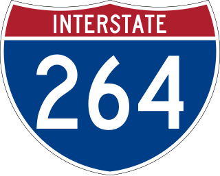
Interstate 264 (I-264) is a partial loop around the city of Louisville, Kentucky, south of the Ohio River. An auxiliary route of I-64, it is signed as the Shawnee Expressway for its first eight miles (13 km) from its western terminus at I-64/U.S. Route 150 (US 150) to US 31W/US 60 and as the Watterson Expressway for the remainder of its length from US 31W/US 60 to its northeastern terminus at I-71. It is 22.93 miles (36.90 km) in length and runs an open circle around central Louisville. It is the only auxiliary route of I-64 outside of Virginia.

The William H. Natcher Green River Parkway was the designation for a 72.3-mile (116.4 km) freeway that ran from Bowling Green to Owensboro in the US commonwealth of Kentucky. The Natcher Parkway was one of nine highways that were a part of Kentucky's parkway system. The portion north of Interstate 65 (I-65) was signed as I-165, and the portion south of I-65 as Kentucky Route 9007 on March 6, 2019.
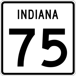
State Road 75, the highest two-digit route in the U.S. state of Indiana consists of two discontinuous north–south segments.

U.S. Route 31W is the westernmost of two parallel routes for U.S. Route 31 from Nashville, Tennessee to Louisville, Kentucky.

State Road 45 is a state route from Bean Blossom, Indiana to Scotland, Indiana in the southern half of the state.
U.S. Route 60 (US 60) is a major U.S. Highway in the American state of Kentucky. In the early days of the U.S. Highway System, US 60 was originally to be numbered as US 62. Following extensive lobbying and complaints filed by Kentucky governor William J. Fields to the American Association of State Highway Officials, the route was re-designated as US 60 before the system was finalized. In Kentucky, US 60 parallels the Ohio River. US 60 enters Kentucky from Cairo, Illinois, traveling northeast to Louisville, then takes a direct eastward route to rejoin the Ohio River in downtown Ashland, Kentucky. Both US 60 and US 23 run concurrently from Ashland to Catlettsburg where US 60 turns east and enters Kenova, West Virginia. US 60 is the longest route in Kentucky, running 495 miles (797 km) across the width of the state, passing through 22 of Kentucky's counties and through the cities of Paducah, Henderson, Owensboro, Louisville, the state capital of Frankfort, and Lexington.

Interstate 66 (I-66) is a canceled Interstate Highway designated in the Intermodal Surface Transportation Efficiency Act (ISTEA) of 1991 as the East–West TransAmerica Corridor and High Priority Corridor 3.
Interstate 65 (I-65) is part of the Interstate Highway System that runs 887.30 miles (1,427.97 km) north–south from Mobile, Alabama, to Gary, Indiana. The highway crosses Kentucky from south to north, from the Tennessee state line near Franklin to the Indiana state line in Louisville. I-65 passes through three of Kentucky's ten largest cities—Bowling Green, Elizabethtown, and Louisville—and serves Mammoth Cave National Park and Fort Knox. Kentucky was the first state to complete its portion of I-65, with the final section, located near Franklin, opening in 1970.
U.S. Route 231 is the longest numbered highway in Indiana, covering over 284 miles (457 km). It is a main north–south highway in the western part of the state. The southern terminus of US 231 in Indiana is at the Kentucky state line and the northern terminus is at US 41 just south of St. John. The highway is a mixture of expressway and two-lane roadway. The expressway portions exist mainly in southern Indiana and around the Lafayette-West Lafayette area, with the rest mainly being two lanes.
U.S. Route 231 in Kentucky runs 114 miles (183 km) from the Tennessee state line near Adolphus to the William H. Natcher Bridge on the Ohio River near Rockport, Indiana. It crosses the state mainly in the west-central region, traversing Allen, Warren, Butler, Ohio, and Daviess Counties.

Kentucky Route 9007 is a 2.1-mile-long (3.4 km) four-lane limited-access highway, and was the unsigned designation for the entirety of the former William H. Natcher Parkway. KY 9007 is now the designation of the southernmost section of the former parkway between Interstate 65 (I-65) and U.S. Route 231, which opened in November 2011. KY 9007 was signed on March 6, 2019, when the majority of the Natcher Parkway was redesignated as I-165. KY 9007 functions as a connector, providing a bypass for traffic to utilize to avoid driving into Bowling Green itself by directly connecting I-165 to US 231. It was constructed for this purpose in order to provide some relief to US 231 through Bowling Green.
The Wendell H. Ford Expressway, also known as the Owensboro Bypass, is a major partial beltway that runs around the outer parts of the city of Owensboro, Kentucky. With a length of 13.057 miles (21.013 km), the expressway includes parts of U.S. Route 60 (US 60) and US 231.

Kentucky Route 2155 is an urban secondary north–south state highway located entirely in Owensboro in northwest Kentucky.

Kentucky Route 2262 is a 1.494-mile (2.404 km) state highway in Kentucky and a small portion of Indiana. It runs from Kentucky Route 54 and J.R. Miller Boulevard in downtown Owensboro, Kentucky, to Indiana State Road 161 on the north end of the Glover Cary Bridge, 0.245 miles (0.394 km) north of the Indiana state line.

Interstate 165 (I-165) is a 70.2-mile-long (113.0 km) auxiliary Interstate Highway in the US state of Kentucky. A spur route of I-65, it extends from I-65 in Bowling Green to U.S. Route 60 (US 60) and US 231 in Owensboro. It opened in 1972 as the Green River Parkway and was renamed the William H. Natcher Parkway in 1994. It was designated as I-165 in 2019 after completion of a project that brought the highway up to Interstate Highway standards.


