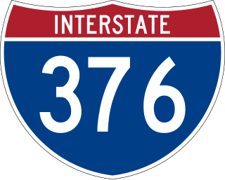
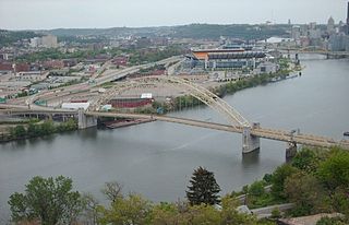
Interstate 376 (I-376) is a major auxiliary route of the Interstate Highway System in the US state of Pennsylvania, located within the Allegheny Plateau. It runs from I-80 near Sharon south and east to a junction with the Pennsylvania Turnpike in Monroeville, after having crossed the Pennsylvania Turnpike at an interchange in Big Beaver. The route serves Pittsburgh and its surrounding areas and is the main access road to Pittsburgh International Airport (PIT). Portions of the route are known as the Beaver Valley Expressway, Southern Expressway, and Airport Parkway. Within Allegheny County, the route runs along the majority of the Penn-Lincoln Parkway, known locally as Parkway West and Parkway East. It is currently the ninth-longest auxiliary Interstate route in the system and second only to I-476 within Pennsylvania.

The Marquam Bridge is a double-deck, steel-truss cantilever bridge that carries Interstate 5 traffic across the Willamette River from south of downtown Portland, Oregon, on the west side to the industrial area of inner Southeast on the east. It is the busiest bridge in Oregon, carrying 140,500 vehicles a day as of 2016. The upper deck carries northbound traffic; the lower deck carries southbound traffic. The Marquam also has on and off ramps for Interstate 405 on the south end of the bridge, while the terminus on the east bank of the river is near the interchange with Interstate 84.
The West End Bridge is a steel tied-arch bridge over the Ohio River in Pittsburgh, Pennsylvania, approximately 1 mile (1.6 km) below the confluence of the Allegheny and Monongahela Rivers. It connects the West End to the Chateau neighborhood on the North Side of Pittsburgh.

The Milton–Madison Bridge is a continuous truss bridge that connects Milton, Kentucky and Madison, Indiana. It carries approximately 10,000 cars a day. The old structure was replaced with a completely new continuous truss which was constructed on temporary piers adjacent to the operational span between 2011 and 2012 and slid into place after demolition of the old span using a construction method called "truss sliding." The new crossing opened to vehicle traffic in April 2014, and a pedestrian sidewalk opened that October.

The Fort Henry Bridge is a crossing of the Ohio River main channel in Wheeling, West Virginia. The tied-arch bridge carries two lanes in each direction of Interstate 70 (I-70), U.S. Route 40 (US 40), and US 250. The bridge opened after four years of construction work on September 8, 1955, costing $6.8 million, $1.8 million over budget. The bridge, along with the aging Wheeling Suspension Bridge, are the only two road links from Wheeling Island to downtown Wheeling, although this is the only one that allows vehicular traffic. In 2009, the structure carried an average of over 60,000 vehicles per day.

The Ironton–Russell Bridge can refer to either one of two bridges that carry/carried traffic along the Ohio River between Ironton, Ohio and Russell, Kentucky in the United States. The original blue cantilever Ironton–Russell Bridge, opened in 1922 and closed in 2016, carried two lanes of traffic and a narrow sidewalk. The new white cable-stayed bridge, officially named the Oakley C. Collins Memorial Bridge, has two lanes of traffic without a dedicated sidewalk and opened on November 23, 2016.
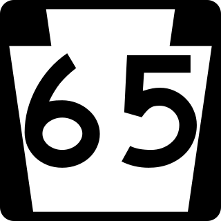
Pennsylvania Route 65 is a major 51-mile-long (82 km) state highway located in western Pennsylvania, United States. The route, traveling north–south from the Interstate 279/U.S. Route 19 Truck concurrency in Pittsburgh north to the PA 108/PA 168 concurrency in New Castle, connects downtown Pittsburgh to the northwestern portion of the Pittsburgh Metropolitan Area. PA 65 is similar in its purpose to PA 18 and PA 51, both of which run parallel to PA 65 at one point or another; however, the three routes pass through different cities for most of their respective alignments.
The George Rogers Clark Memorial Bridge, known locally as the Second Street Bridge, is a four-lane cantilevered truss bridge crossing the Ohio River between Louisville, Kentucky, and Jeffersonville, Indiana, that carries US 31.
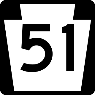
Pennsylvania Route 51 is a major state highway that is located in Western Pennsylvania in the United States. It runs for 89 miles (143 km) from Uniontown to the Ohio state line near Darlington, where it connects with Ohio State Route 14.

Pennsylvania Route 68 is a 90.036-mile-long (144.899 km) east–west state highway located in western Pennsylvania in the United States. The western terminus of the route is at the Ohio state line west of Glasgow, where PA 68 continues into Ohio as State Route 39. The eastern terminus is at U.S. Route 322 in Clarion. The route runs southwest-northeast across Beaver, Butler, Armstrong, and Clarion counties. PA 68 follows the Ohio River between the Ohio border and Beaver, where it crosses the Beaver River into Rochester and heads northeast away from the Ohio River. The route runs through rural areas to Butler County, where it intersects Interstate 79 (I-79) in Zelienople before serving Evans City and Butler. PA 68 passes through a section of Armstrong County before crossing the Allegheny River into Clarion County. Here, the route passes through Rimersburg and Sligo before it has an interchange with I-80 and continues to its terminus in Clarion.

The George C. Platt Memorial Bridge is a through truss bridge that carries PA 291 over the Schuylkill River in Southwest Philadelphia, Pennsylvania. It was opened to traffic in 1951, replacing a swing bridge to the south which carried Penrose Ferry Road across the river. Originally called the Penrose Avenue Bridge, it was renamed in 1979 to honor Civil War hero George Crawford Platt (1842–1912). Today, the Platt Bridge is a key arterial route which carries an average of 56,000 vehicles daily.
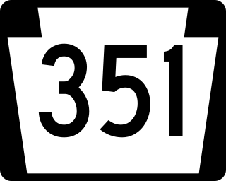
Pennsylvania Route 351 is a 17.2-mile-long (27.7 km) state highway located in Lawrence and Beaver counties in Pennsylvania. The western terminus is at the Ohio border in Little Beaver Township. The eastern terminus is at PA 65/PA 288 in Ellwood City. It is famous for its spotting of Raymond Robinson who would go on nighttime walks on the route making him an urban legend.

In the U.S. state of Pennsylvania, state highways are generally maintained by the Pennsylvania Department of Transportation (PennDOT). Each is assigned a four-digit State Route (SR) number in the present Location Referencing System. Traffic Routes are signed as Interstate Highways, U.S. Routes and Pennsylvania Routes, and are prefixed with one to three zeroes to give a four-digit number. PA Routes are also called Pennsylvania Traffic Routes, and formerly State Highway Routes.

The Carl E. Stotz Memorial Little League Bridge, formerly known as the Market Street Bridge, carries approximately 27,700 vehicles a day on U.S. Route 15 over the West Branch Susquehanna River between Williamsport and South Williamsport in Lycoming County, Pennsylvania, in the United States. It is the seventh bridge on the site and was built at a cost of over $60,000,000.

The Forksville Covered Bridge is a Burr arch truss covered bridge over Loyalsock Creek in the borough of Forksville, Sullivan County, in the U.S. state of Pennsylvania. It was built in 1850 and is 152 feet 11 inches (46.61 m) in length. The bridge was placed on the National Register of Historic Places in 1980. The Forksville bridge is named for the borough it is in, which in turn is named for its location at the confluence or "forks" of the Little Loyalsock and Loyalsock Creeks.
The Innerbelt Bridge was a truss arch bridge in Cleveland, Ohio carrying Interstate 90/Innerbelt Freeway over the Cuyahoga River.
The Masontown Bridge is a four-lane, concrete, plate girder bridge that carries vehicular traffic across the Monongahela River between Masontown, Pennsylvania and Monongahela Township, Pennsylvania, by way of Pennsylvania Route 21.

On May 23, 2013, at approximately 7:00 pm PDT, a span of the bridge carrying Interstate 5 over the Skagit River in the U.S. state of Washington collapsed. Three people in two different vehicles fell into the river below and were rescued by boat, escaping serious injury. The cause of the catastrophic failure was determined to be an oversize load striking several of the bridge's overhead support beams, leading to an immediate collapse of the northernmost span.

The Ocean-to-Ocean Bridge is a through truss bridge spanning the Colorado River in Yuma, Arizona. Built in 1915, it was the first highway crossing of the lower Colorado and is the earliest example of a through truss bridge in Arizona. It is also the only example of a Pennsylvania truss within Arizona. Originally the bridge carried the transcontinental Ocean-to-Ocean Highway and later carried its successor, US 80 until a new bridge was built to the west in 1956. Between 1988 and 2001, the bridge was closed to vehicular traffic and only traversable by pedestrians and bicyclists. After a major restoration, the bridge was rehabilitated and reopened to vehicular traffic in 2002, with a re-dedication by the Quechan nation and Yuma Crossing National Heritage Area. The bridge became part of Historic US 80 in 2018.

The Straight Street Bridge is a vehicular bridge over the Passaic River in Paterson, New Jersey, that is listed on the National Register of Historic Places.


