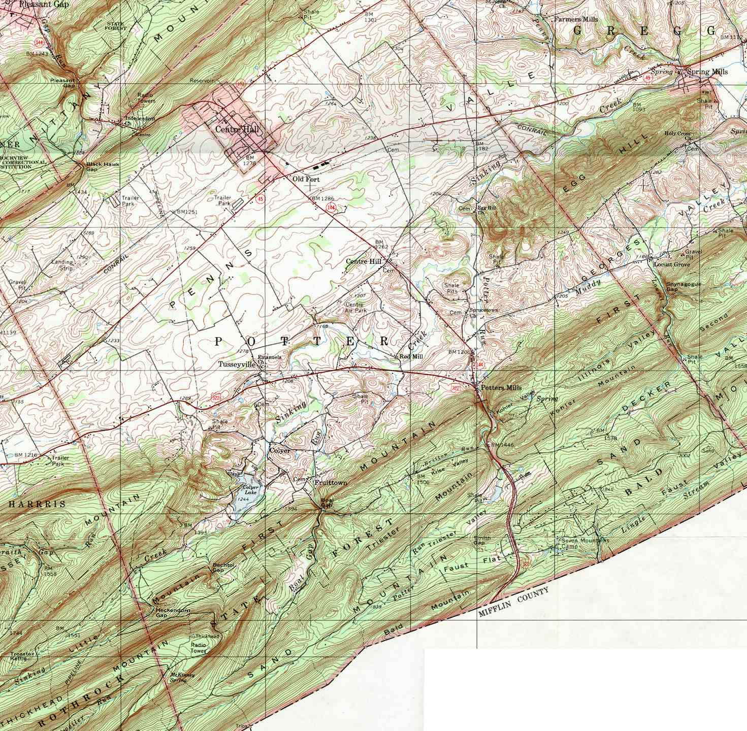
Potter Township, Centre County, Pennsylvania

Last updated
Potter Township,
Centre County,
Pennsylvania
Township
Potter Township, Centre County, farm scene.jpg
A farm along Pennsylvania Route 192 just East of Centre Hall
Map of Potter Township, Centre County, Pennsylvania Highlighted.png
Map of Centre County, Pennsylvania highlighting Potter Township
Map of Pennsylvania highlighting Centre County.svg
Map of Centre County, Pennsylvania
Country United States
State Pennsylvania
County Centre
Settled1767
Incorporated1774
Government
  TypeBoard of Supervisors
  ChairmanTom Sharer
  Vice-chairmanJake Tanis
  SupervisorRobert Corman
  SupervisorDick Decker
  SupervisorRon Sweitzer
Area
[1]
  Total58.98 sq mi (152.77 km2)
  Land58.86 sq mi (152.44 km2)
  Water0.13 sq mi (0.33 km2)
Population
 (2020) [2]
  Total3,614 Increase2.svg
  Estimate 
(2021) [2]
3,586
  Density60.50/sq mi (23.36/km2)
ZIP code
16875
Area code 814
FIPS code 42-027-62360
Website pottertownship.org

Potter Township is a township in Centre County, Pennsylvania, United States. It is part of the State College, Pennsylvania Metropolitan Statistical Area. The population was 3,614 at the 2020 census. [2]

Contents

History

Located in Potter Township are the following sites on the National Register of Historic Places: Andrew Gregg Homestead, Egg Hill Church, Maj. John Neff Homestead, Neff Round Barn, Leonard Rhone House, Potter-Allison Farm, and Daniel Waggoner Log House and Barn.

Geography

According to the United States Census Bureau, the township has a total area of 59.0 square miles (152.8 km2), of which 58.8 square miles (152.4 km2) is land and 0.12 square miles (0.3 km2), or 0.22%, is water. [3]

Potter Township is bordered by Benner, Spring and Walker townships to the north, Gregg Township to the east, Mifflin and Huntingdon counties to the south, and Harris Township to the west. The township also surrounds the separate borough of Centre Hall and is part of the Penns Valley region of Centre County.

Demographics

Historical population
CensusPop.Note
2000 3,339
2010 3,5175.3%
2020 3,6142.8%
2021 (est.)3,586 [2] −0.8%
U.S. Decennial Census [4]

As of the census [5] of 2000, there were 3,339 people, 1,267 households, and 952 families residing in the township. The population density was 57.5 inhabitants per square mile (22.2/km2). There were 1,467 housing units at an average density of 25.2/sq mi (9.7/km2). The racial makeup of the township was 98.71% White, 0.39% African American, 0.15% Native American, 0.18% Asian, 0.03% Pacific Islander, 0.21% from other races, and 0.33% from two or more races. Hispanic or Latino of any race were 0.45% of the population.

There were 1,267 households, out of which 31.3% had children under the age of 18 living with them, 65.8% were married couples living together, 5.9% had a female householder with no husband present, and 24.8% were non-families. 20.4% of all households were made up of individuals, and 8.3% had someone living alone who was 65 years of age or older. The average household size was 2.54 and the average family size was 2.94.

In the township the population was spread out, with 26.0% under the age of 18, 6.1% from 18 to 24, 29.0% from 25 to 44, 27.3% from 45 to 64, and 11.7% who were 65 years of age or older. The median age was 39 years. For every 100 females, there were 98.5 males. For every 100 females age 18 and over, there were 100.7 males.

The median income for a household in the township was $43,556, and the median income for a family was $50,000. Males had a median income of $36,571 versus $23,781 for females. The per capita income for the township was $21,320. About 7.0% of families and 8.1% of the population were below the poverty line, including 8.4% of those under age 18 and 8.2% of those age 65 or over.

Related Research Articles

<span class="mw-page-title-main">Gregg Township, Centre County, Pennsylvania</span> Township in Pennsylvania, United States

Gregg Township is a township in Centre County, Pennsylvania, United States. It is part of the State College, Pennsylvania Metropolitan Statistical Area. The population was 2,287 at the 2020 census.

<span class="mw-page-title-main">Haines Township, Centre County, Pennsylvania</span> Township in Pennsylvania, United States

Haines Township is a township in Centre County, Pennsylvania, United States. It is part of the State College, Pennsylvania Metropolitan Statistical Area. The population was 1,663 at the 2020 census.

<span class="mw-page-title-main">Harris Township, Centre County, Pennsylvania</span> Township in Pennsylvania, United States

Harris Township is a township in Centre County, Pennsylvania, United States. It is part of the State College, Pennsylvania Metropolitan Statistical Area. Boalsburg, a census-designated place (CDP), is located within the township. The population was 4,873 at the 2010 census, which is a 4.6% increase since the 2000 census.

<span class="mw-page-title-main">Howard Township, Centre County, Pennsylvania</span> Township in Pennsylvania, United States

Howard Township is a township in Centre County, Pennsylvania, United States. It is part of the State College, Pennsylvania Metropolitan Statistical Area. The population was 878 at the 2020 census. Part of Bald Eagle State Park is in Howard Township.

<span class="mw-page-title-main">Liberty Township, Centre County, Pennsylvania</span> Township in Pennsylvania, United States

Liberty Township is a township in Centre County, Pennsylvania, United States. It is part of the State College, Pennsylvania Metropolitan Statistical Area. The population was 1,825 at the 2020 census, an increase over the figure of 2,118 tabulated in 2010. Part of Bald Eagle State Park is in Liberty Township.

<span class="mw-page-title-main">Penn Township, Centre County, Pennsylvania</span> Township in Pennsylvania, United States

Penn Township is a township in Centre County, Pennsylvania, United States. It is part of the State College, Pennsylvania Metropolitan Statistical Area. The population was 1,214 at the 2020 census. Poe Valley State Park is in Penn Township.

<span class="mw-page-title-main">Spring Township, Centre County, Pennsylvania</span> Township in Pennsylvania, United States

Spring Township is a township in Centre County, Pennsylvania, United States. It is part of the State College, Pennsylvania Metropolitan Statistical Area. The population was 8,051 at the 2020 census, which was a 7.8% increase from the 2010 census.

<span class="mw-page-title-main">Walker Township, Centre County, Pennsylvania</span> Township in Pennsylvania, United States

Walker Township is a township in Centre County, Pennsylvania, United States. It is part of the State College, Pennsylvania Metropolitan Statistical Area. The population was 4,639 at the 2020 census, an increase over the figure of 3,433 tabulated in 2010.

<span class="mw-page-title-main">Greenwood Township, Clearfield County, Pennsylvania</span> Township in Pennsylvania, United States

Greenwood Township is a township in Clearfield County, Pennsylvania, United States. The township has a population of 362 people, according to the 2020 United States census. Between Mahaffey and Grampian on U.S. Route 219, Greenwood Township contains the villages of Curry Run and Bells Landing. The West Branch of the Susquehanna River passes through it, along with several abandoned and presently used railroad grades.

<span class="mw-page-title-main">Granville Township, Mifflin County, Pennsylvania</span> Township in Pennsylvania, United States

Granville Township is a township in Mifflin County, Pennsylvania, United States. The population was 4,638 at the 2020 census.

<span class="mw-page-title-main">Bingham Township, Potter County, Pennsylvania</span> Township in Pennsylvania, United States

Bingham Township is a township in Potter County, Pennsylvania, United States. The population was 621 at the 2020 census.

<span class="mw-page-title-main">Genesee Township, Potter County, Pennsylvania</span> Township in Pennsylvania, United States

Genesee Township is a township in Potter County, Pennsylvania, United States and lies near the source of the Genesee River. The population was 729 at the 2020 census. The name Genesee derives from Indian term for "beautiful valley".

<span class="mw-page-title-main">Harrison Township, Potter County, Pennsylvania</span> Township in Pennsylvania, United States

Harrison Township is a township in Potter County, Pennsylvania, United States. The population was 1,028 at the 2020 census.

<span class="mw-page-title-main">Hector Township, Potter County, Pennsylvania</span> Township in Pennsylvania, United States

Hector Township is a township in Potter County, Pennsylvania, United States. The population was 343 at the 2020 census.

<span class="mw-page-title-main">Oswayo Township, Potter County, Pennsylvania</span> Township in Pennsylvania, United States

Oswayo Township is a township in Potter County, Pennsylvania, United States. The population was 224 at the 2020 census.

<span class="mw-page-title-main">Pike Township, Potter County, Pennsylvania</span> Township in Pennsylvania, United States

Pike Township is a township in Potter County, Pennsylvania, United States. The population was listed at 330 on the 2020 census. The population rose to 324 people as of 2010.

<span class="mw-page-title-main">Stewardson Township, Potter County, Pennsylvania</span> Township in Pennsylvania, United States

Stewardson Township is a township in Potter County, Pennsylvania, United States. The population was 64 at the 2020 census. Ole Bull State Park, a Pennsylvania state park, is located in Stewardson Township.

<span class="mw-page-title-main">Summit Township, Potter County, Pennsylvania</span> Township in Pennsylvania, United States

Summit Township is a township in Potter County, Pennsylvania, United States. The population was 134 at the 2020 census. Two of the smallest Pennsylvania state parks, Prouty Place State Park and Patterson State Park are in Summit Township.

<span class="mw-page-title-main">West Branch Township, Potter County, Pennsylvania</span> Township in Pennsylvania, United States

West Branch Township is a township in Potter County, Pennsylvania, United States. The population was 399 at the 2020 census. There are two Pennsylvania state parks in West Branch Township. Cherry Springs State Park is a popular destination for astronomical observation. Lyman Run State Park is in the northern part of the township and is partially in neighboring Ulysses Township.

<span class="mw-page-title-main">Westfield Township, Tioga County, Pennsylvania</span> Township in Pennsylvania, United States

Westfield Township is a township in Tioga County, Pennsylvania, United States. The population was 988 at the 2020 census.

References

  1. "2016 U.S. Gazetteer Files". United States Census Bureau. Retrieved Aug 13, 2017.
  2. 1 2 3 4 Bureau, US Census. "City and Town Population Totals: 2020—2021". Census.gov. US Census Bureau. Retrieved August 13, 2022.
  3. "Geographic Identifiers: 2010 Census Summary File 1 (G001): Potter township, Centre County, Pennsylvania". U.S. Census Bureau, American Factfinder. Archived from the original on April 10, 2015. Retrieved April 10, 2015.
  4. "Census of Population and Housing". Census.gov. Retrieved June 4, 2016.
  5. "U.S. Census website". United States Census Bureau . Retrieved 2008-01-31.
40°52′31″N77°39′59″W / 40.87528°N 77.66639°W / 40.87528; -77.66639