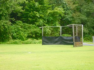
Orviston, Pennsylvania | |
---|---|
Coordinates: 41°6′22″N77°45′10″W / 41.10611°N 77.75278°W | |
Country | United States |
State | Pennsylvania |
County | Centre |
Township | Curtin |
Area | |
• Total | 0.11 sq mi (0.28 km2) |
• Land | 0.11 sq mi (0.28 km2) |
• Water | 0.00 sq mi (0.00 km2) |
Elevation | 849 ft (259 m) |
Population | |
• Total | 64 |
• Density | 598.13/sq mi (230.68/km2) |
Time zone | UTC-5 (Eastern (EST)) |
• Summer (DST) | UTC-4 (EDT) |
ZIP code | 16864 |
FIPS code | 42-57160 |
GNIS feature ID | 1183056 |
Orviston is an unincorporated community and census-designated place (CDP) in Curtin Township, Centre County, Pennsylvania, United States. As of the 2010 census, the population was 95. [3] It is located in far northern Centre County, near the Clinton County border. Beech Creek runs through the center of the town, flowing southeast towards Bald Eagle Creek in the West Branch Susquehanna River watershed.
Orviston is known as the last town accessible by the Monument/Orviston road - a 10.8-mile paved county road stemming from Beech Creek, Pennsylvania, and ending at the entrance to Orviston. Traffic can flow through Orviston, however, West on the Orviston-Kato road, South on the Orviston Mountain road to Romola and Marsh Creek, and North on the Dehass road to PA 144 N and E of Clarence. All are unpaved mountain roads. Formed prior to the mining boom, Orviston was so named in 1904 as replacement for its original name, Hayes Run, Pennsylvania, in honor of Judge Ellis Orvis, owner of the Orviston Fire Brick Company and President Judge of the 49th Judicial District of Pennsylvania. Judge Orvis owned a number of brick plants including the Centre Brick and Clay Company at the Western end of Orviston as well as the Snow Shoe Fire Brick Company in Snow Shoe among others. The now defunct Beech Creek Railroad - charted August 12, 1882 under the name Susquehanna and Southwestern Railroad which was absorbed by the New York Central Railroad which later became the Penn Central – ran through Orviston and its sister town, Monument, Pennsylvania, until the early 1960s.
Census | Pop. | Note | %± |
---|---|---|---|
2020 | 64 | — | |
U.S. Decennial Census [4] |
Orviston experienced damage to homes and properties during March 1936 ice flood as a result of two heavy storms hitting the northern United States. Excessive rainfall, coupled with melting snow, raised water levels in the Beech Creek stream by about 4 feet - a record breaking event at that time. There were no reported casualties in Orviston. In June 1972 the Beech Creek stream flooded again as a result of Hurricane Agnes dropping up to 30 inches of rainfall on Orviston and surrounding towns at a rate of 7 inches per hour during its peak. No casualties occurred during the Agnes flood and property damage was not significant or long lasting.
Clarence is a census-designated place (CDP) in Centre County, Pennsylvania, United States. It is part of the State College, Pennsylvania Metropolitan Statistical Area. The population was 626 at the 2010 census.
Monument is an unincorporated community and census-designated place in Centre County, Pennsylvania, United States. It is part of the State College, Pennsylvania Metropolitan Statistical Area. The population was 150 at the 2010 census.
Lock Haven is the county seat of Clinton County, in the U.S. state of Pennsylvania. Located near the confluence of the West Branch Susquehanna River and Bald Eagle Creek, it is the principal city of the Lock Haven Micropolitan Statistical Area, itself part of the Williamsport–Lock Haven combined statistical area. At the 2010 census, Lock Haven's population was 9,772.
Dauphin is a borough in Dauphin County, Pennsylvania, United States. The population was 796 at the 2020 census. Dauphin's ZIP code is 17018. It is part of the Harrisburg–Carlisle Metropolitan Statistical Area.
Williamsport is a city in, and the county seat of, Lycoming County, Pennsylvania, United States. As of the 2020 census, it had a population of 27,754. It is the principal city of the Williamsport Metropolitan Statistical Area, which has a population of about 114,000. Williamsport is the larger principal city of the Williamsport-Lock Haven Combined Statistical Area, which includes Lycoming and Clinton counties.
The Susquehanna River is a major river located in the Mid-Atlantic region of the United States, overlapping between the lower Northeast. At 444 miles (715 km) long, it is the longest river on the East Coast of the United States. By watershed area, it is the 16th-largest river in the United States, and also the longest river in the early 21st-century continental United States without commercial boat traffic.
Waverly is a census-designated place (CDP) comprising the central community within Waverly Township in Lackawanna County, Pennsylvania, United States. Originally called Abington Center, it was founded in the late 18th century by settlers from Connecticut, along the Warriors' Path. The population of the CDP at the 2010 census was 604.
Gordonville is an unincorporated community and census-designated place (CDP) in Leacock Township, Lancaster County, Pennsylvania, United States. The population was 508 as of the 2010 census. Though the village is little known outside its immediate area, the surrounding countryside has been portrayed in many books and magazine articles. The Old Order Amish constitute a significant cultural presence in the area of the village. Wendell Berry mentioned the town in one of his collections of essays.
Loyalsock Creek is a 64-mile-long (103 km) tributary of the West Branch Susquehanna River located chiefly in Sullivan and Lycoming counties in Pennsylvania in the United States. As the crow flies, Lycoming County is about 130 miles (209 km) northwest of Philadelphia and 165 miles (266 km) east-northeast of Pittsburgh.
White Deer Hole Creek is a 20.5-mile (33.0 km) tributary of the West Branch Susquehanna River in Clinton, Lycoming and Union counties in the U.S. state of Pennsylvania. A part of the Chesapeake Bay drainage basin, the White Deer Hole Creek watershed drains parts of ten townships. The creek flows east in a valley of the Ridge-and-valley Appalachians, through sandstone, limestone, and shale from the Ordovician, Silurian, and Devonian periods.
Beech Creek is a 27.3-mile-long (43.9 km) tributary of Bald Eagle Creek in Centre and Clinton counties, in Pennsylvania in the United States.
Bald Eagle Valley is a low-lying area in Pennsylvania that drains into Bald Eagle Creek between the Allegheny Front and Bald Eagle Mountain, south of the West Branch Susquehanna River, in the Ridge-and-valley Appalachians. The valley is located southwest of West Branch Susquehanna Valley and includes Williamsport, Nittany Valley, and State College in the central portion of Centre County and southern portion of Clinton County.
Bald Eagle Creek is a 55.2-mile-long (88.8 km) tributary of the West Branch Susquehanna River mostly in Centre County, Pennsylvania, in the United States.
Pennsylvania Route 144 is a state highway located in the U.S. state of Pennsylvania, covering a distance of about 109 miles (175 km). The southern terminus is located near an interchange with U.S. Route 322 (US 322) at State Route 2015 in Potter Township while the northern terminus is located at US 6 in Galeton. Between Snow Shoe and Renovo, PA 144 is known as the High Plateau Scenic Byway, a Pennsylvania Scenic Byway.
Plunketts Creek is an approximately 6.2-mile-long (10 km) tributary of Loyalsock Creek in Lycoming and Sullivan counties in the U.S. state of Pennsylvania. Two unincorporated villages and a hamlet are on the creek, and its watershed drains 23.6 square miles (61 km2) in parts of five townships. The creek is a part of the Chesapeake Bay drainage basin via Loyalsock Creek and the West Branch Susquehanna and Susquehanna Rivers.
The Bald Eagle and Spring Creek Navigation Company was a canal company in central Pennsylvania intended to link the iron industry of Bellefonte, Pennsylvania, with the Pennsylvania canal system. Opened for half its length in 1837, the remainder of the canal was not completed until 1848. Destroyed by flooding in 1865, it was not rebuilt; a paralleling railroad completed that year replaced it.
Moshannon is an unincorporated community and census-designated place (CDP) in Snow Shoe Township, Centre County, Pennsylvania, United States. As of the 2010 census, the population was 281 residents. It is located 4 miles (6 km) northwest of Interstate 80 at the convergence of Pennsylvania Routes 53 and 144. Black Moshannon Creek, part of the West Branch Susquehanna River watershed, runs through a 200-foot-deep (60 m) valley half a mile (0.8 km) south of the town.
Continental Courts is a mobile home park and census-designated place (CDP) in Centre County, Pennsylvania, United States. It was first listed as a CDP prior to the 2020 census.
Runville is an unincorporated community and census-designated place (CDP) in Centre County, Pennsylvania, United States. It was first listed as a CDP prior to the 2020 census.