Jacksonville, Centre County, Pennsylvania

Last updated

Jacksonville, Pennsylvania
Little Nittany Valley (4) Church along PA Route 26.jpg
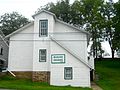
Emmanuel United Church of Christ
Map of Pennsylvania highlighting Centre County.svg
Map showing Centre County in Pennsylvania
USA Pennsylvania location map.svg
Red pog.svg
Jacksonville
Map showing Jacksonville in Centre County
Coordinates: 40°59′32″N77°37′55″W / 40.99222°N 77.63194°W / 40.99222; -77.63194
Country United States
State Pennsylvania
County Centre
Township Marion
Area
  Total0.14 sq mi (0.37 km2)
  Land0.14 sq mi (0.37 km2)
  Water0.0 sq mi (0.0 km2)
Elevation
902 ft (275 m)
Population
 (2010)
  Total95
  Density668/sq mi (258.1/km2)
Time zone UTC-5 (Eastern (EST))
  Summer (DST) UTC-4 (EDT)
FIPS code 42-37545
GNIS feature ID2584473

Jacksonville is an unincorporated American community and census-designated place [1] that is located in Marion Township, Centre County, Pennsylvania.

Contents

As of the 2010 census, the population was 95 residents. [2]

History and geography

The town is located in the Little Nittany Valley, 10 miles (16 km) northeast of Bellefonte, the Centre County seat.

Howard Gap in Bald Eagle Mountain is located just to the northwest of the town. Pennsylvania Route 26 passes through the gap, leading 2.5 miles (4.0 km) to the borough of Howard. Interstate 80 passes through the Little Nittany Valley just southeast of Jacksonville. Newly added Exit 163 serves Jacksonville and Howard.

Related Research Articles

<span class="mw-page-title-main">Interstate 99</span> Interstate Highway in Pennsylvania and New York

Interstate 99 (I-99) is an Interstate Highway in the United States with two segments: one located in central Pennsylvania and the other in southern New York. The southern terminus of the route is near exit 146 of the Pennsylvania Turnpike (I-70/I-76) north of Bedford, where the road continues south as U.S. Route 220 (US 220). The northern terminus of the Pennsylvania segment is at an at-grade intersection with Musser Lane just before reaching I-80 near Bellefonte. The New York segment follows US 15 from the Pennsylvania–New York border to an interchange with I-86 in Corning. Within Pennsylvania, I-99 passes through Altoona and State College—the latter home to the Pennsylvania State University—and is entirely concurrent with US 220. Long-term plans call for the two segments of I-99 to be connected using portions of I-80, US 220, and US 15 through Pennsylvania.

<span class="mw-page-title-main">Centre County, Pennsylvania</span> County in Pennsylvania, United States

Centre County is a county in the Commonwealth of Pennsylvania, United States. As of the 2020 census, the population was 158,172. Its county seat is Bellefonte. Centre County comprises the State College, PA Metropolitan Statistical Area. The northwestern part of Centre County is in the sparsely populated Pennsylvania Wilds region.

<span class="mw-page-title-main">Gap, Pennsylvania</span> Census-designated place in Pennsylvania, United States

Gap is a census-designated place (CDP) and unincorporated community in Salisbury Township, Lancaster County, Pennsylvania, United States, with a ZIP code of 17527. The population was 1,931 at the 2010 census. U.S. Route 30 passes through the town, which is also the terminus for four Pennsylvania highways: 772, 741, 897, and the heavily used 41, which leads toward Wilmington, Delaware.

<span class="mw-page-title-main">College Township, Centre County, Pennsylvania</span> Township in Pennsylvania, United States

College Township is a township in Centre County, Pennsylvania. It is part of the State College, Pennsylvania metropolitan statistical area. The population was 10,762 at the 2020 census, which was a 13% increase from the 2010 census. College Township was formed on November 25, 1875, from Howard Township.

<span class="mw-page-title-main">Julian, Pennsylvania</span> Census-designated place in Pennsylvania, United States

Julian is an unincorporated community and census-designated place (CDP) that is located in Centre County, Pennsylvania, United States. It is part of the State College, Pennsylvania Metropolitan Statistical Area. The population was 152 at the 2010 census. Most locals pronounce the name "Joo-lee-ānn".

<span class="mw-page-title-main">Madisonburg, Pennsylvania</span> Census designated place in Pennsylvania, United States

Madisonburg is an unincorporated community and census-designated place (CDP) in Miles Township, Centre County, Pennsylvania, United States. It is part of the State College, Pennsylvania Metropolitan Statistical Area. The population was 168 at the 2010 census.

<span class="mw-page-title-main">Pleasant Gap, Pennsylvania</span> Census-designated place in Pennsylvania, United States

Pleasant Gap is an unincorporated community and census-designated place (CDP) in Centre County, Pennsylvania, United States. It is part of the State College, Pennsylvania Metropolitan Statistical Area. The population was 2,879 at the 2010 census.

<span class="mw-page-title-main">Rebersburg, Pennsylvania</span> Census-designated place in Pennsylvania, United States

Rebersburg is an unincorporated community and census-designated place (CDP) in Centre County, Pennsylvania, United States. Rebersburg is part of the State College, Pennsylvania Metropolitan Statistical Area. The official town Mayor is Mr. Matthew S. Dunlap(Republican). The mayor was instrumental in securing funds for the purchase of Engine-Rescue 19 as well as funding for the purchase of a new road maintenance truck. Mayor Dunlap also chaired the rural water board which assisted in the township being granted funding for a water filter system at the water reservoir. The population was 494 at the 2010 census and includes many Amish in the area.

<span class="mw-page-title-main">State College, Pennsylvania</span> Home rule municipality in Pennsylvania, United States

State College is a home rule municipality in Centre County, Pennsylvania, United States. It is a college town, dominated economically, culturally, and demographically by the presence of the University Park campus of Penn State University.

<span class="mw-page-title-main">Woodward, Pennsylvania</span> Census-designated place in Pennsylvania, United States

Woodward is an unincorporated community and census-designated place in Haines Township, Centre County, Pennsylvania, United States. It is part of the State College, Pennsylvania, Metropolitan Statistical Area. The population was 110 at the 2010 census.

<span class="mw-page-title-main">Zion, Pennsylvania</span> Census-designated place in Pennsylvania, United States

Zion is an unincorporated community and census-designated place (CDP) in Centre County, Pennsylvania, United States.

<span class="mw-page-title-main">Loganton, Pennsylvania</span> Borough in Pennsylvania, United States

Loganton, officially the Borough of Loganton, is a borough in Clinton County, Pennsylvania, United States. The population was 469 at the 2020 census.

<span class="mw-page-title-main">Mechanicsburg, Pennsylvania</span> Borough in Pennsylvania, United States

Mechanicsburg is a borough in Cumberland County, Pennsylvania, United States. The borough is eight miles (13 km) west of Harrisburg. It is part of the Harrisburg–Carlisle metropolitan statistical area. As of the 2010 census, it had a population of 8,981. The 2020 census reported the population at 9,311.

<span class="mw-page-title-main">Penns Valley</span> Region in Pennsylvania, United States

Penns Valley is an eroded anticlinal valley of the Pennsylvania ridge and valley geologic region of the Appalachian Mountain range. The valley is located in southern Centre County, Pennsylvania. Along with the Nittany Valley to the north and east, it is part of the larger Nittany Anticlinorium. It is bordered by Mount Nittany to the north, the Seven Mountains range to the south, and connects to the larger Nittany Valley to the west. There are two smaller subordinate valleys typically associated with the greater valley: Georges Valley in the south, separated by Egg Hill, and Brush Valley in the north, separated by Brush Mountain.

<span class="mw-page-title-main">Lamar, Pennsylvania</span> Census-designated place in Pennsylvania, United States

Lamar is a census-designated place in Porter Township in southern Clinton County, Pennsylvania, United States. As of the 2010 census the population was 562.

<span class="mw-page-title-main">Mingoville, Pennsylvania</span> Census-designated place in Pennsylvania, United States

Mingoville is an unincorporated community and census-designated place (CDP) in Walker Township, Centre County, Pennsylvania, United States. As of the 2010 census, the population was 503 residents.

<span class="mw-page-title-main">Mount Eagle, Pennsylvania</span> Census designated place in Pennsylvania, United States

Mount Eagle is an unincorporated community and census-designated place in Howard Township, Centre County, Pennsylvania, United States. As of the 2010 census, the population was 103.

<span class="mw-page-title-main">Moshannon, Pennsylvania</span> Census designated place in Pennsylvania, United States

Moshannon is an unincorporated community and census-designated place (CDP) in Snow Shoe Township, Centre County, Pennsylvania, United States. As of the 2010 census, the population was 281 residents. It is located 4 miles (6 km) northwest of Interstate 80 at the convergence of Pennsylvania Routes 53 and 144. Black Moshannon Creek, part of the West Branch Susquehanna River watershed, runs through a 200-foot-deep (60 m) valley half a mile (0.8 km) south of the town.

<span class="mw-page-title-main">Nittany, Pennsylvania</span> Census designated place in Pennsylvania, United States

Nittany is an unincorporated community and census-designated place in Walker Township, Centre County, Pennsylvania, United States. As of the 2010 census, the population was 658.

<span class="mw-page-title-main">Rote, Pennsylvania</span> Census-designated place in Pennsylvania, United States

Rote is a census-designated place located in Lamar Township in southern Clinton County, Pennsylvania, United States. As of the 2010 census, the population was 507.

References

  1. "2010 U.S. Census website". United States Census Bureau . Retrieved February 13, 2016.
  2. "Geographic Identifiers: 2010 Census Summary File 1 (G001): Jacksonville CDP, Pennsylvania". U.S. Census Bureau, American Factfinder. Archived from the original on April 15, 2015. Retrieved April 15, 2015.