It is located in the Sto-Rox School District, which serves both Stowe Township and the neighboring borough of McKees Rocks. All locations in Stowe Township have McKees Rocks addresses.
Stowe Township has partnered with the Allegheny Together organization to revitalize its main business district on Broadway Avenue.
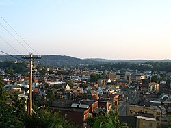
The area is served by Port Authority bus routes 21, 22, and 24.
According to the United States Census Bureau, the township has a total area of 2.3 square miles (6.0km2), of which 2.0 square miles (5.2km2) is land and 0.4 square miles (1.0km2), or 15.38%, is water.
Presston, a very small neighborhood of duplex townhomes, originally built as housing for the adjacent Pressed Steel Car Company. It was originally called Schoenville.
Norwood, a small, older neighborhood of small, mostly 2 story homes. This section of Stowe Township is inhabited by many families that are 2nd and 3rd generation Italian.
As of the census[7] of 2000, there were 6,706 people, 3,061 households, and 1,805 families residing in the township. The population density was 3,391.4 inhabitants per square mile (1,309.4/km2). There were 3,556 housing units at an average density of 1,798.3 per square mile (694.3/km2). The racial makeup of the township was 90.44% White, 8.04% African American, 0.21% Native American, 0.16% Asian, 0.22% from other races, and 0.92% from two or more races. 0.42% of the population were Hispanic or Latino of any race.
There were 3,061 households, out of which 21.9% had children under the age of 18 living with them, 38.0% were married couples living together, 15.8% had a female householder with no husband present, and 41.0% were non-families. 36.3% of all households were made up of individuals, and 16.7% had someone living alone who was 65 years of age or older. The average household size was 2.17 and the average family size was 2.83.
In the township the population was spread out, with 19.9% under the age of 18, 7.2% from 18 to 24, 27.1% from 25 to 44, 22.7% from 45 to 64, and 23.1% who were 65 years of age or older. The median age was 42 years. For every 100 females, there were 87.9 males. For every 100 females age 18 and over, there were 84.7 males.
The median income for a household in the township was $29,688, and the median income for a family was $36,688. Males had a median income of $31,151 versus $28,221 for females. The per capita income for the township was $17,783. About 9.0% of families and 13.3% of the population were below the poverty line, including 19.2% of those under age 18 and 8.0% of those age 65 or over.
This page is based on this Wikipedia article Text is available under the CC BY-SA 4.0 license; additional terms may apply. Images, videos and audio are available under their respective licenses.