Oakdale, Pennsylvania

Last updated

Oakdale, Pennsylvania
OakdalePublicSchool.jpg
Former Oakdale Public School, built in 1905
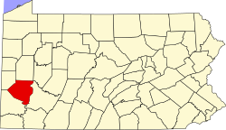
Allegheny County Pennsylvania incorporated and unincorporated areas Oakdale highlighted.svg
Location in Allegheny County and the state of Pennsylvania.
Coordinates: 40°23′58″N80°11′8″W / 40.39944°N 80.18556°W / 40.39944; -80.18556
Country United States
State Pennsylvania
County Allegheny
Government
  MayorSteve Trusnovic
Area
[1]
  Total0.47 sq mi (1.22 km2)
  Land0.47 sq mi (1.22 km2)
  Water0.00 sq mi (0.00 km2)
Population
 (2020) [2]
  Total1,475
  Density3,144.99/sq mi (1,213.11/km2)
Time zone UTC-5 (Eastern (EST))
  Summer (DST) UTC-4 (EDT)
FIPS code42-55840
Website www.oakdaleborough.com

Oakdale is a borough in Allegheny County, Pennsylvania, United States. The population was 1,475 at the 2020 census. [3] It is a suburb of Pittsburgh.

Contents

History

Oakdale Borough was incorporated in 1892. [4] On May 18, 1918, a TNT explosion in a local chemical factory killed 200 people. [5] On September 17, 2004, Oakdale was devastated by a flood resulting from the rain brought by the remnants of category 5 Hurricane Ivan. The downpour from Ivan followed a steady rain that had covered the Allegheny County area from category 4 Hurricane Frances, which struck the area just 10 days before Ivan hit. [6] The flooding caused a large-scale evacuation of the community, and brought Red Cross volunteers and National Guard members to the area in an effort to control the confusion. The flooding destroyed businesses, many of which never reopened, and displaced many residents whose homes were condemned.

Geography

According to the United States Census Bureau, the borough has a total area of 0.5 square miles (1.3 km2), all land.

Robinson Run, a tributary to Chartiers Creek, flows through the southeastern part of the borough. Oakdale is bordered by North Fayette Township to the north and South Fayette Township to the south. [7]

Demographics

Historical population
CensusPop.Note
1880 507
1900 1,147
1910 1,35318.0%
1920 1,61119.1%
1930 1,7035.7%
1940 1,7663.7%
1950 1,572−11.0%
1960 1,6957.8%
1970 2,13626.0%
1980 1,955−8.5%
1990 1,752−10.4%
2000 1,551−11.5%
2010 1,459−5.9%
2020 1,4751.1%
Sources: [8] [9] [10] [11] [12] [13] [2]

As of the 2000 census, [12] there were 1,551 people, 604 households, and 445 families residing in the borough. The population density was 2,956.0 inhabitants per square mile (1,141.3/km2). There were 640 housing units at an average density of 1,219.8 per square mile (471.0/km2). The racial makeup of the borough was 98.19% White, 0.90% African American, 0.06% Native American, 0.06% Asian, 0.39% from other races, and 0.39% from two or more races. Hispanic or Latino of any race were 0.71% of the population.

There were 604 households, out of which 28.6% had children under the age of 18 living with them, 62.1% were married couples living together, 8.8% had a female householder with no husband present, and 26.2% were non-families. 22.7% of all households were made up of individuals, and 9.6% had someone living alone who was 65 years of age or older. The average household size was 2.57 and the average family size was 3.04.

In the borough the population was spread out, with 22.8% under the age of 18, 6.8% from 18 to 24, 27.7% from 25 to 44, 30.6% from 45 to 64, and 12.1% who were 65 years of age or older. The median age was 41 years. For every 100 females, there were 93.2 males. For every 100 females age 18 and over, there were 94.3 males.

The median income for a household in the borough was $46,574, and the median income for a family was $55,865. Males had a median income of $37,125 versus $26,620 for females. The per capita income for the borough was $21,392. About 2.9% of families and 2.6% of the population were below the poverty line, including 2.9% of those under age 18 and 1.1% of those age 65 or over.

Government and politics

Local leaders

Political affiliation

Oakdale is predominantly supportive of the Republican Party. The town generally supported incumbent Republican president Donald Trump over Democratic challenger Joe Biden in the 2020 presidential election, though supported Biden at a slightly higher margin than for 2016 Democratic candidate Hillary Clinton. [18]

Presidential election results [19] [20] [21] [18]
Year Republican Democratic Third parties
2020 54%48844% 3961% 11
2016 55%41544% 3271% 9
2012 48% 35051%3711% 8

Education

Oakdale is served by the West Allegheny School District. Western Allegheny Community Library serves Findlay Township, North Fayette, and Oakdale.

Oakdale is home to Pittsburgh Technical College, (formerly Pittsburgh Technical Institute) as well as the West Hills branch of Community College of Allegheny County.

Transportation

Oakdale's main road is Pennsylvania Route 978, locally known as Clinton Ave. The road bisects the town while running in a generally northwest-southeast pattern. Oakdale is located approximately equidistant from Pennsylvania Route 576 and U.S. Route 22-30. [lower-alpha 1] Pittsburgh's Panhandle Trail also runs through central Oakdale.

Rail transport today into and through Oakdale is nonexistent, as the last freight railway has been converted into the Panhandle Trail. Public transport is also nonexistent within the town, aside from bus service to Pittsburgh Technical College.

Oakdale is located very close to Pittsburgh International Airport and is within a 20-minute drive.

Notable person

Notes

  1. Throughout much of western Allegheny County, U.S. routes 22 and 30 run concurrently.

Related Research Articles

<span class="mw-page-title-main">Aspinwall, Pennsylvania</span> Borough of Pennsylvania, United States

Aspinwall is a borough on the Allegheny River in Allegheny County, Pennsylvania, United States. It is part of the Pittsburgh metropolitan area. The population was 2,916 at the 2020 census.

<span class="mw-page-title-main">Baldwin Township, Pennsylvania</span> Township in Pennsylvania, United States

Baldwin Township is a township in Allegheny County, Pennsylvania, United States. The population was 1,984 at the 2020 census, a decrease from the figure of 1,992 tabulated in 2010.

<span class="mw-page-title-main">Bell Acres, Pennsylvania</span> Borough in Pennsylvania, United States

Bell Acres is a borough in Allegheny County, Pennsylvania, United States, part of the Pittsburgh Metro Area. The population was 1,505 at the 2020 census.

<span class="mw-page-title-main">Ben Avon, Pennsylvania</span> Borough in Pennsylvania, United States

Ben Avon is a borough in Allegheny County, Pennsylvania, United States, along the Ohio River. The population was 1,918 at the 2020 census. It is part of the Pittsburgh metropolitan area.

<span class="mw-page-title-main">Blawnox, Pennsylvania</span> Borough in Pennsylvania, United States

Blawnox is a borough in Allegheny County, Pennsylvania, United States. The population was 1,454 at the 2020 census. It is part of the Pittsburgh metropolitan area.

<span class="mw-page-title-main">Brackenridge, Pennsylvania</span> Borough in Pennsylvania, United States

Brackenridge is a borough in Allegheny County, Pennsylvania, United States, located along the Allegheny River. It is part of the Greater Pittsburgh metropolitan area.

<span class="mw-page-title-main">Bridgeville, Pennsylvania</span> Borough in Pennsylvania, United States

Bridgeville is a borough in Allegheny County, Pennsylvania, United States. The population was 4,804 at the 2020 census. It is a residential suburb of the Pittsburgh metropolitan area.

<span class="mw-page-title-main">Castle Shannon, Pennsylvania</span> Borough in Pennsylvania, United States

Castle Shannon is a borough in Allegheny County, Pennsylvania, United States. The population was 8,249 at the 2020 census. It is part of the Pittsburgh metropolitan area.

<span class="mw-page-title-main">Collier Township, Pennsylvania</span> Township in Pennsylvania, United States

Collier Township is a township in Allegheny County, Pennsylvania, United States. The population was 8,931 at the 2020 census, an increase over the figure of 7,080 tabulated in 2010.

<span class="mw-page-title-main">Findlay Township, Pennsylvania</span> Township in Pennsylvania, United States

Findlay Township is a township located west of Pittsburgh in Allegheny County, Pennsylvania. The population was 6,373 at the 2020 census.

<span class="mw-page-title-main">Haysville, Pennsylvania</span> Borough in Pennsylvania, United States

Haysville is a borough in Allegheny County, Pennsylvania, United States, along the Ohio River. The population was 81 according to the 2020 census, making it the least-populous municipality in Allegheny County.

<span class="mw-page-title-main">Ingram, Pennsylvania</span> Borough in Pennsylvania, United States

Ingram is a borough in Allegheny County, Pennsylvania, United States. The population was 3,391 at the 2020 census.

<span class="mw-page-title-main">Jefferson Hills, Pennsylvania</span> Borough in Pennsylvania, United States

Jefferson Hills is a borough in Allegheny County, Pennsylvania, United States. In the 2020 census, the population was 12,424. It is part of the Pittsburgh metropolitan area.

<span class="mw-page-title-main">North Fayette Township, Pennsylvania</span> Township in Pennsylvania, United States

The Township of North Fayette is a township in Allegheny County, Pennsylvania, United States. The township is a suburb of Pittsburgh. The population was 16,166 at the 2020 census.

<span class="mw-page-title-main">Pleasant Hills, Pennsylvania</span> Borough in Pennsylvania, United States

Pleasant Hills is a borough in Allegheny County, Pennsylvania, United States. As of the 2020 census, the population was 8,504. It is a suburb of the Pittsburgh metropolitan area.

<span class="mw-page-title-main">South Fayette Township, Pennsylvania</span> Township in Pennsylvania, United States

South Fayette Township is a township in Allegheny County, Pennsylvania, United States. The population was 14,416 at the 2010 census.

<span class="mw-page-title-main">West Homestead, Pennsylvania</span> Borough in Pennsylvania, United States

West Homestead is a borough in Allegheny County, Pennsylvania, United States, 8 miles (13 km) southeast of Pittsburgh, on the Monongahela River. Heavy industries associated with nearby steel mills existed here, such as axle works, brickworks, and manufactories of machinery, car wheels, etc. The largest concern was Mesta Machinery, which was one of the world's leading industrial manufacturers from 1898 until 1983. The population was 1,872 at the 2020 census.

<span class="mw-page-title-main">McDonald, Pennsylvania</span> Borough in Pennsylvania, United States

McDonald is a borough in Allegheny and Washington counties in the U.S. state of Pennsylvania, 18 miles (29 km) southwest of Pittsburgh. The population was 2,056 at the 2020 census. Of this, 1,661 were in Washington County, and 395 were in Allegheny County.

<span class="mw-page-title-main">Trafford, Pennsylvania</span> Borough in Pennsylvania, United States

Trafford is a borough in Allegheny and Westmoreland counties in the U.S. state of Pennsylvania. Located near Pittsburgh in western Pennsylvania, the borough lies primarily in Westmoreland County; only a small portion extends into Allegheny County. It was incorporated in 1904 from the northernmost corner of North Huntingdon Township, and was named by George Westinghouse for Trafford near Manchester, England. Westinghouse purchased the land in 1902, and the Trafford Foundry began operations on October 3, 1903. The population was 3,317 at the 2020 census. Of this, 3,113 were in Westmoreland County, and only 61 were in Allegheny County.

<span class="mw-page-title-main">Pittsburgh–New Castle–Weirton combined statistical area</span> Metropolitan area in the United States

The Pittsburgh–Weirton–Steubenville, PA–OH–WV Combined Statistical Area is a 13-county combined statistical (CSA) in the United States. The largest and principal in the area is Pittsburgh, Pennsylvania, but the CSA includes population centers from three states: Pennsylvania, West Virginia, and Ohio.

References

  1. "ArcGIS REST Services Directory". United States Census Bureau. Retrieved October 12, 2022.
  2. 1 2 "Census Population API". United States Census Bureau. Retrieved October 12, 2022.
  3. "Explore Census Data".
  4. "Western Allegheny Community Library" . Retrieved January 15, 2023.
  5. "TNT explosion in chemical factory in Oakdale, Pennsylvania kills 200". Brainy History. Retrieved January 5, 2009.
  6. McDonough, Tim (September 17, 2004). "Widespread flooding causes evacuations, blocks roads". Pittsburgh Post-Gazette. p. 1. Retrieved January 5, 2009.
  7. "US Gazetteer files: 2010, 2000, and 1990". United States Census Bureau. February 12, 2011. Retrieved April 23, 2011.
  8. "Population-Pennsylvania" (PDF). U.S. Census 1910. U.S. Census Bureau. Retrieved November 22, 2013.
  9. "Number and Distribution of Inhabitants:Pennsylvania-Tennessee" (PDF). Fifteenth Census. U.S. Census Bureau.
  10. "Number of Inhabitants: Pennsylvania" (PDF). 18th Census of the United States. U.S. Census Bureau. Retrieved November 22, 2013.
  11. "Pennsylvania: Population and Housing Unit Counts" (PDF). U.S. Census Bureau. Retrieved November 22, 2013.
  12. 1 2 "U.S. Census website". United States Census Bureau . Retrieved January 31, 2008.
  13. "Annual Estimates of the Resident Population". U.S. Census Bureau. Archived from the original on June 2, 2013. Retrieved November 22, 2013.
  14. 1 2 3 4 5 6 "Oakdale Borough Directory" . Retrieved January 15, 2023.
  15. "Oakdale Police Department" . Retrieved January 15, 2023.
  16. "Oakdale Hose Company" . Retrieved January 15, 2023.
  17. "Allegheny County Local EMA Coordinators" . Retrieved January 15, 2023.
  18. 1 2 Park, Alice; Smart, Charlie; Taylor, Rumsey; Watkins, Miles (February 2, 2021). "An Extremely Detailed Map of the 2020 Election". The New York Times. ISSN   0362-4331 . Retrieved November 9, 2022.
  19. EL. "2012 Allegheny County election". Pittsburgh Tribune-Review. Retrieved October 15, 2017.
  20. EL. "2016 Pennsylvania general election results". Pittsburgh Post-Gazette. Retrieved October 15, 2017.
  21. "Election Night Reporting".
  22. Lee, Carmen (September 13, 1988). "Psychologist Margaret B. McFarland". Pittsburgh Post-Gazette . p. 12.