Smithdale, Pennsylvania

Last updated
Smithdale, Pennsylvania
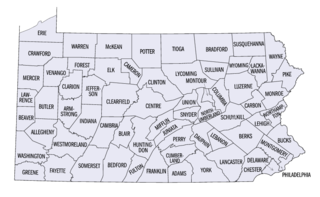
USA Pennsylvania location map.svg
Red pog.svg
Smithdale
Location within the state of Pennsylvania
Coordinates: 40°13′40″N79°47′29″W / 40.22778°N 79.79139°W / 40.22778; -79.79139 Coordinates: 40°13′40″N79°47′29″W / 40.22778°N 79.79139°W / 40.22778; -79.79139
Country United States
State Pennsylvania
County Allegheny
Township Elizabeth
Elevation
794 ft (242 m)
Time zone UTC-5 (Eastern (EST))
  Summer (DST) UTC-4 (EDT)
GNIS feature ID1204671 [1]

Smithdale is an unincorporated community and coal town in Allegheny County, Pennsylvania, United States. It is located in Elizabeth Township in the southeastern corner of Allegheny County, along the south bank of the Youghiogheny River. Immediately to the southeast is Collinsburg in Westmoreland County. To the north across the river is Sutersville, also in Westmoreland County.

Unincorporated area Region of land not governed by own local government

In law, an unincorporated area is a region of land that is not governed by a local municipal corporation; similarly an unincorporated community is a settlement that is not governed by its own local municipal corporation, but rather is administered as part of larger administrative divisions, such as a township, parish, borough, county, city, canton, state, province or country. Occasionally, municipalities dissolve or disincorporate, which may happen if they become fiscally insolvent, and services become the responsibility of a higher administration. Widespread unincorporated communities and areas are a distinguishing feature of the United States and Canada. In most other countries of the world, there are either no unincorporated areas at all, or these are very rare; typically remote, outlying, sparsely populated or uninhabited areas.

A coal town, also known as a coal camp or patch is typically situated in a remote place and provides residences for a population of miners to reside near a coal mine. A coal town is a type of company town or mining community established by the employer, a mining company, which imports workers to work the mineral find. The 'town founding' process is not limited to coal mining, nor mining, but is generally found where mineral wealth is located in a remote or undeveloped area, which is then opened for exploitation, normally first by having some transportation infrastructure brought into being first. Often, such minerals were the result of logging operations by pushing into a wilderness forest, which clear-cutting operations then allowed geologists and cartographers, to chart and plot the lands, allowing efficient discovery of natural resources and their exploitation.

Allegheny County, Pennsylvania County in the United States

Allegheny County is a county in the southwest of the U.S. state of Pennsylvania. As of 2017 the population was 1,223,048, making it the state's second-most populous county, following Philadelphia County. The county seat is Pittsburgh. Allegheny County is included in the Pittsburgh, PA Metropolitan Statistical Area, and in the Pittsburgh Designated Market Area.


Related Research Articles

Allegheny River river in western Pennsylvania and New York, United States

The Allegheny River is a 325-mile (523 km) long headwater stream of the Ohio River in western Pennsylvania and New York, United States. The Allegheny River runs from its headwaters just below the middle of Pennsylvania's northern border northwesterly into New York then in a zigzag southwesterly across the border and through Western Pennsylvania to join the Monongahela River at the Forks of the Ohio on the "Point" of Point State Park in Downtown Pittsburgh, Pennsylvania. The Allegheny River is, by volume, the main headstream of both the Ohio and Mississippi Rivers. Historically, the Allegheny was considered to be the upper Ohio River by both Native Americans and European settlers.

Westmoreland County, Pennsylvania County in the United States

Westmoreland County is a county located in the U.S. state of Pennsylvania. At the 2010 census, the population was 365,169. The county seat is Greensburg. Formed from, successively, Lancaster, Northumberland, and later Bedford Counties, Westmoreland County was founded on February 26, 1773, and was the first county in the colony of Pennsylvania whose entire territorial boundary was located west of the Allegheny Mountains. Westmoreland County originally included the present-day counties of Fayette, Washington, Greene, and parts of Beaver, Allegheny, Indiana, and Armstrong counties. It is named after Westmorland, a historic county of England.

Plum, Pennsylvania Borough in Pennsylvania, United States

Plum is a borough in Allegheny County in the U.S. state of Pennsylvania. A suburb of Pittsburgh, Pennsylvania, it is located northeast of the city of Pittsburgh, in what is commonly referred to as the East Hills suburbs. The population was 27,126 at the 2010 census.

Conemaugh River river in Pennsylvania

The Conemaugh River is a 70-mile (110 km) long tributary of the Kiskiminetas River in Westmoreland, Indiana, and Cambria counties in the U.S. state of Pennsylvania. It crosses both the Pittsburgh metropolitan area and the Johnstown, Pennsylvania metropolitan area. The name means 'Otter Creek', originating from the Unami-Lenape language word kwənəmuxkw 'otter'.

Kiskiminetas River river in western Pennsylvania

The Kiskiminetas River is a tributary of the Allegheny River, approximately 27 miles (43 km) long, in Western Pennsylvania in the United States. The region stretching from the northern side of Harmar Township, Pennsylvania to the Kiskiminetas towns is often referred to by the locals as the Alle-Kiski Valley after the rivers.

Yohogania County, Virginia

Yohogania County was created by the new state of Virginia in 1776, in an area long disputed between Virginia and Pennsylvania. The county ceased to exist after the border dispute between the two states was resolved in the 1780s. Thus, it is sometimes referred to as a "lost county," although 1.5 million people live within the territory it once claimed, which encompasses two entire counties and parts of four others in two states.

National Register of Historic Places listings in Pennsylvania Wikimedia list article

This is a list of properties and districts listed on the National Register of Historic Places in Pennsylvania. As of 2015, there are over 3,000 listed sites in Pennsylvania. Sixty-six of the 67 counties in Pennsylvania have listings on the National Register; Cameron County is the only county without any sites listed.

Allegheny Islands State Park

Allegheny Islands State Park is a 43-acre (17 ha) Pennsylvania state park in Harmar Township, Allegheny County, Pennsylvania in the United States. The undeveloped park is composed of three alluvial islands located in the middle of the Allegheny River northeast of Pittsburgh. The islands are just north of the boroughs of Oakmont and Plum, and southwest of Cheswick. Bridges for the Pennsylvania Turnpike and the Bessemer and Lake Erie Railroad Branch of the Canadian National Railway cross the Allegheny River at the middle island.

Geographic regions of the Commonwealth of Pennsylvania, United States of America.

Jacks Island is an alluvial island in the Allegheny River. Its southwestern half lies in the city of Lower Burrell, while its northeastern half lies in Allegheny Township, in Westmoreland County in the U.S. state of Pennsylvania. The island is situated across from Harrison Township in Allegheny County.

The 54th Pennsylvania House of Representatives District is located in Allegheny County and Westmoreland County and includes the following areas:

Pennsylvania Route 286 highway in Pennsylvania

Pennsylvania Route 286 is a 69-mile-long (111 km), east–west state highway located in Allegheny, Westmoreland, Indiana, and Clearfield Counties in Pennsylvania. The western terminus is at US 22 in Monroeville. The eastern terminus is at US 219 near Burnside.

Pennsylvania Route 366 highway in Pennsylvania

Pennsylvania Route 366 is a 14.8-mile-long (23.8 km) state highway located in Allegheny and Westmoreland Counties in Pennsylvania. The western terminus is at PA 28 in Tarentum. The eastern terminus is at PA 66 in Murrysville. The last 1/2 mile of the Red Belt route of the Allegheny County belt system runs along PA 366 in Tarentum from its eastbound beginning at the PA 28 interchange to the intersection of Freeport Rd. and Ross St. where the Red Belt terminates.

Chartiers Run is a tributary of the Allegheny River located in Westmoreland County in the U.S. state of Pennsylvania. It was named after Peter Chartier, a trapper of French and Native American parentage who established a trading post at the mouth of Chartiers Creek in 1743.

Pucketa Creek is a tributary of the Allegheny River located in both Allegheny and Westmoreland counties in the U.S. state of Pennsylvania.

Smithdale may refer to:

Loyalhanna Lake

Loyalhanna Lake is a reservoir of about 480 acres on Loyalhanna Creek located in Loyalhanna Township, Westmoreland County near Saltsburg. The dam that forms the lake is operated by the U.S. Army Corps of Engineers.

References