Collinsburg, Pennsylvania

Last updated

Collinsburg, Pennsylvania
CDP
Storefront Circa 1900.jpg
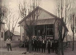
The first store built in Collinsburg, in the early 20th century
Country United States
State Pennsylvania
County Westmoreland
Area
[1]
  Total1.80 sq mi (4.66 km2)
  Land1.78 sq mi (4.60 km2)
  Water0.02 sq mi (0.06 km2)
Population
 (2020) [2]
  Total1,048
  Density589.76/sq mi (227.74/km2)
Time zone UTC-5 (Eastern (EST))
  Summer (DST) UTC-4 (EDT)
FIPS code 42-15248

Collinsburg is a census-designated place [3] located in Rostraver Township, Westmoreland County in the state of Pennsylvania, United States. As of the 2010 census [4] the population was 1,125 residents.

This structure was one of the first built in the village of Collinsburg Pennsylvania First Home of Collinsburg Band.jpg
This structure was one of the first built in the village of Collinsburg Pennsylvania
The community of Collinsburg established a village band in the late 19th century/early 20th century. Collinsburg Concert Band.jpg
The community of Collinsburg established a village band in the late 19th century/early 20th century.

Demographics

Historical population
CensusPop.Note
2020 1,048
U.S. Decennial Census [5] [2]

Related Research Articles

<span class="mw-page-title-main">Oscarville, Alaska</span> CDP in Alaska, United States

Oscarville is a census-designated place (CDP) in Bethel Census Area, Alaska, United States. The population was 70 at the 2010 census, up from 61 in 2000.

<span class="mw-page-title-main">Twin Lakes, New Mexico</span> CDP in New Mexico, United States

Twin Lakes is a census-designated place (CDP) in McKinley County, New Mexico, United States. The population was 1,069 at the 2000 census.

<span class="mw-page-title-main">Lenape Heights, Pennsylvania</span> Census-designated place in Pennsylvania, United States

Lenape Heights is a census-designated place (CDP) in Armstrong County, Pennsylvania, United States. The population was 1,144 at the 2020 census.

<span class="mw-page-title-main">Orchard Hills, Pennsylvania</span> Census-designated place in Pennsylvania, United States

Orchard Hills is a census-designated place (CDP) in Armstrong County, Pennsylvania, United States. The population was 1,949 at the 2020 census.

<span class="mw-page-title-main">Carbon Township, Pennsylvania</span> Township in Pennsylvania, United States

Carbon Township is a township in Huntingdon County, Pennsylvania, United States. As of the 2020 census, the township population was 318.

<span class="mw-page-title-main">Mount Aetna, Pennsylvania</span> Census-designated place in Pennsylvania, United States

Mount Aetna is a census-designated place in Tulpehocken Township, Berks County, Pennsylvania, United States. It is located along Pennsylvania Route 501 near the border of Lebanon County. The community is named after the active volcano, Mount Etna, in Sicily. As of the 2010 census, the population was 354 residents.

<span class="mw-page-title-main">Columbus, Pennsylvania</span> Census-designated place in Pennsylvania, United States

Columbus is a census-designated place located in Columbus Township, Warren County in the state of Pennsylvania, United States. The community is located along the famous U.S. Route 6 in northwestern Warren County. As of the 2010 census, the population was 824 residents. Columbus is within a few miles of the city of Corry, located in Erie County.

<span class="mw-page-title-main">Grier City, Pennsylvania</span> Census-designated place in Pennsylvania, United States

Grier City is a census-designated place located in Rush Township, Schuylkill County in the state of Pennsylvania, United States. Grier City was part of the Grier City-Park Crest CDP for the 2000 census, before splitting into two separate CDPs for the 2010 census, the other being Park Crest. The community is located off Interstate 81. As of the 2010 census, the population was 241 residents. As of the 2020 census, the population was 296 residents.

<span class="mw-page-title-main">Muir, Pennsylvania</span> Census-designated place in Pennsylvania, United States

Muir is a census-designated place located in Porter Township, Schuylkill County in the state of Pennsylvania, United States. Muir was part of the Reinerton-Orwin-Muir CDP at the 2000 census before splitting into three individual CDPs for the 2010 census. The other communities, along with Muir are Reinerton and Orwin. The community is located near the borough of Tower City along U.S. Route 209. As of the 2010 census, the population was 451 residents.

Orwin is a census-designated place located in Porter Township, Schuylkill County in the state of Pennsylvania, United States. Orwin was part of the Reinerton-Orwin-Muir CDP at the 2000 census before splitting into three individual CDPs for the 2010 census. The other communities, along with Orwin are Reinerton and Muir. The community is located near the community of Muir along U.S. Route 209. As of the 2010 census, the population was 314 residents.

Park Crest is a census-designated place located in Rush Township in Schuylkill County in the state of Pennsylvania, United States. Park Crest was part of the Grier City-Park Crest CDP for the 2000 census, before splitting into two separate CDPs for the 2010 census, the other being Grier City. The community is located off Interstate 81. As of the 2010 census, the population was 542 residents.

Edie is a census-designated place located in Lincoln Township, Somerset County in the state of Pennsylvania, United States. As of the 2010 census, the population was 83.

Hannasville is a census-designated place located in Canal Township, Venango County, in the state of Pennsylvania. The community is located along U.S. Route 322. As of the 2010 census the population was 176.

North Warren is a census-designated place located along the Conewango Creek in Conewango Township, Warren County in the state of Pennsylvania, United States. The community is located to the north of the city of Warren. As of the 2010 census the population was 1,934 residents.

Cross Creek is a census-designated place located in Cross Creek Township, Washington County in the state of Pennsylvania. The community is located in northern Washington County about 2 miles southwest of the community of Atlasburg. As of the 2010 census the population was 137 residents.

Elrama is a census-designated place located in Union Township, Washington County in the state of Pennsylvania. The community is located in far eastern tip of Union Township in Washington County, near the Monongahela River, along Pennsylvania Route 837. As of the 2010 census the population was 307 residents.

Hendersonville is a census-designated place located in Cecil Township, Washington County in the state of Pennsylvania. The community is located just to the east of Interstate 79. As of the 2010 census the population was 325 residents.

Joffre is a census-designated place located in Smith Township, Washington County in the state of Pennsylvania. The community is located in northern Washington County about 3 miles east of the borough of Burgettstown. As of the 2010 census the population was 536 residents.

Hostetter is a census-designated place located in Unity Township, Westmoreland County in the state of Pennsylvania, United States. It is located near Pennsylvania Route 981. As of the 2010 census the population was 740 residents.

Level Green is a census-designated place located in Penn Township, Westmoreland County in the state of Pennsylvania, United States. The community is located near Pennsylvania Route 130. As of the 2010 census, the population was 4,020 residents. It is the home of the legendary NASCAR veteran Norm Benning.

References

  1. "ArcGIS REST Services Directory". United States Census Bureau. Retrieved October 12, 2022.
  2. 1 2 "Census Population API". United States Census Bureau. Retrieved October 12, 2022.
  3. https://www.census.gov/2010census/popmap/ipmtext.php?fl=42:4215248 [ dead link ]
  4. https://www.census.gov/# [ not specific enough to verify ]
  5. "Census of Population and Housing". Census.gov. Retrieved June 4, 2016.

40°13′27″N79°46′06″W / 40.22417°N 79.76833°W / 40.22417; -79.76833