Moween, Pennsylvania

Last updated

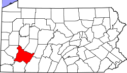
Moween is a village located on the Conemaugh River and is part of Loyalhanna Township in Westmoreland County, Pennsylvania, United States. The approximate population is 150 residents. [1] School age children in the village of Moween attend Saltsburg Jr./Sr. High School.

Moween is considered part of Saltsburg due to its proximity to the larger town.

40°28′54″N79°25′55″W / 40.48167°N 79.43194°W / 40.48167; -79.43194

Related Research Articles

<span class="mw-page-title-main">Westmoreland County, Pennsylvania</span> County in Pennsylvania, United States

Westmoreland County is a county in the Commonwealth of Pennsylvania, United States, located in the Pittsburgh Metropolitan Statistical Area. As of the 2020 census, the population was 354,663. The county seat is Greensburg and the most populous community is Hempfield Township. It is named after Westmorland, a historic county of England. The county is part of the Southwest Pennsylvania region of the state.

<span class="mw-page-title-main">Indiana County, Pennsylvania</span> County in Pennsylvania, United States

Indiana County is a county in the Commonwealth of Pennsylvania. It is located in the west central part of Pennsylvania. As of the 2020 census, the population was 83,246. Its county seat is Indiana. Indiana County comprises the Indiana, PA Micropolitan Statistical Area, which is also included in the Pittsburgh-New Castle-Weirton, PA-WV-OH Combined Statistical Area. The county is part of the Southwest Pennsylvania region of the state.

<span class="mw-page-title-main">Edgewood, Allegheny County, Pennsylvania</span> Borough in Pennsylvania, United States

Edgewood is a borough in Allegheny County, Pennsylvania, United States, adjacent to the city of Pittsburgh. The population was 3,145 at the 2020 census.

<span class="mw-page-title-main">Saltsburg, Pennsylvania</span> Borough in Pennsylvania, United States

Saltsburg is a borough in Indiana County, Pennsylvania, United States. Its location is in Western Pennsylvania, in the southwestern corner of Indiana County near its border with Westmoreland County.

<span class="mw-page-title-main">Hempfield Township, Westmoreland County, Pennsylvania</span> Township in Pennsylvania, United States

Hempfield Township is a township in Westmoreland County, Pennsylvania, United States. The population was 41,585 at the 2020 census, making it the largest suburb in the Pittsburgh Metropolitan Area by population. Its name is derived from Hempfield in Lancaster County, which was formed in 1729 and is named after the hemp fields in the area.

<span class="mw-page-title-main">Penn Township, Westmoreland County, Pennsylvania</span> Township in Pennsylvania, United States

Penn Township is a township in Westmoreland County, Pennsylvania, United States.

<span class="mw-page-title-main">Slickville, Pennsylvania</span> CDP in Pennsylvania, United States

Slickville is a census-designated place (CDP) in Westmoreland County, Pennsylvania, United States. The population was 372 at the 2000 census.

<span class="mw-page-title-main">Conemaugh River</span> River in Pennsylvania, United States

The Conemaugh River is a 70-mile (110 km) tributary of the Kiskiminetas River in Westmoreland, Indiana, and Cambria counties in the U.S. state of Pennsylvania. The name means 'Otter Creek', originating from the Unami-Lenape language word kwənəmuxkw 'otter'.

<span class="mw-page-title-main">Laurel Highlands</span> Region in Pennsylvania

The Laurel Highlands is a region in southwestern Pennsylvania made up of Fayette County, Somerset County, and Westmoreland County. It has a population of about 600,000 people.

Livermore, Pennsylvania is an abandoned town that was located on the Conemaugh River between Blairsville and Saltsburg in Derry Township, Westmoreland County, Pennsylvania. The town was abandoned and partially razed in the early 1950s following authorization by the Flood Control Act of 1936 and Flood Control Act of 1938 for construction of the Conemaugh Dam and Lake to prevent flooding of Pittsburgh. Much of the former town site now lies under the reservoir and floodplains.

<span class="mw-page-title-main">WHJB</span> Radio station in Greensburg, Pennsylvania

WHJB is a classic hits radio station serving the Westmoreland County area, including eastern Allegheny County. The station is owned by St. Pier Group LLC, a subsidiary of Renda Broadcasting Corporation, and broadcasts at 107.1 MHz with an ERP of 2.3 KW.

<span class="mw-page-title-main">River Valley School District (Pennsylvania)</span> School district in Pennsylvania

River Valley School District is a small, rural school district that spans portions of two counties. In Indiana County it covers the Boroughs of Blairsville and Saltsburg and Black Lick Township, Burrell Township and Conemaugh Township. In Westmoreland County it covers Loyalhanna Township. The district encompasses approximately 142 square miles (370 km2). Per the 2000 Census, the district had approximately 16,000 residents. According to 2000 federal census data, it serves a resident population of 14,363 people. In 2009, the district residents’ per capita income was $15,663, while the median family income was $37,257. In the Commonwealth, the median family income was $49,501 and the United States median family income was $49,445, in 2010.

<span class="mw-page-title-main">Clarksburg, Pennsylvania</span> Unincorporated community in Pennsylvania, US

Clarksburg is an unincorporated community in Conemaugh Township, in Indiana County, Pennsylvania, United States.

<span class="mw-page-title-main">Pennsylvania Route 286</span> State highway in Pennsylvania, US

Pennsylvania Route 286 is a 69-mile-long (111 km), east–west state highway located in Allegheny, Westmoreland, Indiana, and Clearfield counties in Pennsylvania.

Ruffs Dale, also spelled Ruffsdale, is an unincorporated community in East Huntingdon Township, Westmoreland County, Pennsylvania United States. It is located approximately forty miles from Pittsburgh. Ruffs Dale has its own post office, with zip code 15679, located at 875 State Route 31.

Webster is a census-designated place located in Rostraver Township, Westmoreland County in the state of Pennsylvania, United States. The community is located along Pennsylvania Route 906. It was laid out in 1833 by Benjamin Beazell, and named for the Federalist statesman Daniel Webster. As of the 2010 census the population was 255 residents.

<span class="mw-page-title-main">Five Star Trail</span>

The Five Star Trail runs nearly 8 miles through Westmoreland County, in the U.S. state of Pennsylvania. The trail is alongside an active railroad track, Southwestern Pennsylvania Railroad, that stretches between Lynch Field, a Greensburg city park and Youngwood. The trail then spurs off eastward to connect with the campus of Westmoreland County Community College and continues on to Armbrust.

Blairsville Middle-High School is one of two secondary schools in the Blairsville-Saltsburg School District. The campus is shared with the school's sole feeder school, Blairsville Elementary School and the District office at the intersection of US Routes 119 and 22 in Burrell Township. The campus is 36-acres in size and is in close proximity to Higher-level institutions in the area.

<span class="mw-page-title-main">Yukon, Pennsylvania</span> Census-designated place in Pennsylvania, United States

Yukon is a census-designated place located in South Huntingdon Township, Westmoreland County in the state of Pennsylvania, United States. The community is located near Interstate 70, north of the village of Wyano. As of the 2010 census the population was 677 residents.

Rector is a small unincorporated community in Ligonier Township, Westmoreland County, Pennsylvania, United States. Nearby attractions are Linn Run State Park, Powdermill Nature Reserve, and Flat Rock. As of 2000, the population of Rector was 600. Rector is composed of 26.4 miles2.

References

  1. "Moween Populated Place Profile / Westmoreland County, Pennsylvania Data". pennsylvania.hometownlocator.com. Retrieved January 24, 2024.