North Belle Vernon, Pennsylvania | |
---|---|
![]() Broad Avenue | |
![]() | |
Country | United States |
State | Pennsylvania |
County | Westmoreland |
Settled | 1758 |
Incorporated | February 26, 1876 |
Government | |
• Type | Borough Council |
• Mayor | Craig Ambrose |
Area | |
• Total | 0.42 sq mi (1.09 km2) |
• Land | 0.42 sq mi (1.09 km2) |
• Water | 0.00 sq mi (0.00 km2) |
Elevation | 945 ft (288 m) |
Population | |
• Total | 1,873 |
• Density | 4,459.52/sq mi (1,723.21/km2) |
Time zone | UTC-5 (Eastern (EST)) |
• Summer (DST) | UTC-4 (EDT) |
Zip code | 15012 |
FIPS code | 42-54776 |
North Belle Vernon is a borough in Westmoreland County, Pennsylvania, United States.
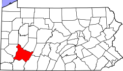
Located south of Pittsburgh adjacent to Interstate Highway 70, the borough has a total area of 0.4 square miles (1.0 km2), all of it land, with the Monongahela River to the southwest.
The Pittsburgh Coal Seam and several abandoned coal mines lie beneath North Belle Vernon. Mine subsidence has been an issue, and state-funded remediation has been undertaken. [2] [3] [4]
Census | Pop. | Note | %± |
---|---|---|---|
1880 | 208 | — | |
1890 | 435 | 109.1% | |
1900 | 810 | 86.2% | |
1910 | 1,522 | 87.9% | |
1920 | 2,605 | 71.2% | |
1930 | 3,072 | 17.9% | |
1940 | 3,022 | −1.6% | |
1950 | 3,147 | 4.1% | |
1960 | 3,148 | 0.0% | |
1970 | 2,916 | −7.4% | |
1980 | 2,425 | −16.8% | |
1990 | 2,112 | −12.9% | |
2000 | 2,107 | −0.2% | |
2010 | 1,971 | −6.5% | |
2020 | 1,873 | −5.0% | |
Sources: [5] [6] [7] [1] |
As of the census of 2020, there were 850 households and 956 housing units in the borough. The racial makeup of the borough was 93.2% White, 4.5% African American, and 2.3% from other races. The median income was $52,928. [8]