St. Clair Township, Pennsylvania

Last updated

St. Clair Township, Pennsylvania
Laurel Hill Furnace.jpg
The Laurel Hill Furnace, a historic landmark in St. Clair Township
Map of Westmoreland County, Pennsylvania Highlighting St. Clair Township.PNG
Map of Westmoreland County, Pennsylvania Highlighting St. Clair Township
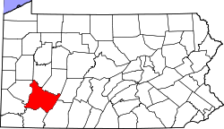
Map of Pennsylvania highlighting Westmoreland County.svg
Map of Pennsylvania highlighting
Westmoreland County
Country United States
State Pennsylvania
County Westmoreland
Settled1776
Incorporated1856
Area
[1]
  Total28.41 sq mi (73.58 km2)
  Land28.14 sq mi (72.88 km2)
  Water0.27 sq mi (0.71 km2)
Population
 (2020) [2]
  Total1,339 Decrease2.svg
  Estimate 
(2021) [2]
1,328
  Density51.85/sq mi (20.02/km2)
Time zone UTC-5 (Eastern (EST))
  Summer (DST) UTC-4 (EDT)
Area code(s) 724, 814
FIPS code 42-129-67240

St. Clair Township is a township in Westmoreland County, Pennsylvania, United States. The population was 1,339 at the 2020 census. [2] It is also one of three communities within the county to utilise the 814 area code, alongside New Florence and Seward.

Contents

History

The Squirrel Hill Site, an archaeological site and the location of a former Monongahela village, is located in St. Clair Township near the borough of New Florence. [3] It is listed on the National Register of Historic Places along with the Laurel Hill Furnace. [4]

Geography

According to the United States Census Bureau, the township has a total area of 28.7 square miles (74.4 km2), of which 28.4 square miles (73.5 km2) is land and 0.4 square mile (1.0 km2) (1.32%) is water.

Demographics

Historical population
CensusPop.Note
2000 1,398
2010 1,5188.6%
2020 1,339−11.8%
2021 (est.)1,328 [2] −0.8%
U.S. Decennial Census [5]

As of the 2010 census, [6] there were 1,518 people living in St. Clair township, in 634 households (including 446 families). The average household size was 2.39 people. In the census, 98.4 percent of the population identified as white, with 0.5 percent Asian, 0.3 percent African American or black, and 0.2 percent Alaskan or Native American. The remainder identified as multiracial or some other race. 1 percent identified as Latino or Hispanic.

Previously, in the census [7] of 2000, there were 1,398 people, 568 households, and 408 families living in the township. The population density was 49.3 inhabitants per square mile (19.0/km2). There were 665 housing units at an average density of 23.5/sq mi (9.1/km2). The racial makeup of the township was 98.43% White, 0.57% from other races, and 1.00% from two or more races. Hispanic or Latino of any race were 1.07% of the population. The median age was 44.4 years for males and 44.5 years for females.

There were 568 households, out of which 27.8% had children under the age of 18 living with them, 60.4% were married couples living together, 7.7% had a female householder with no husband present, and 28.0% were non-families. 25.4% of all households were made up of individuals, and 12.9% had someone living alone who was 65 years of age or older. The average household size was 2.46 and the average family size was 2.92.

In the township the population was spread out, with 22.0% under the age of 18, 5.7% from 18 to 24, 28.8% from 25 to 44, 25.4% from 45 to 64, and 18.0% who were 65 years of age or older. The median age was 41 years. For every 100 females, there were 98.6 males. For every 100 females age 18 and over, there were 99.6 males.

The median income for a household in the township was $29,000, and the median income for a family was $34,375. Males had a median income of $28,750 versus $20,694 for females. The per capita income for the township was $14,611. About 9.6% of families and 12.3% of the population were below the poverty line, including 18.1% of those under age 18 and 8.4% of those age 65 or over.

Related Research Articles

<span class="mw-page-title-main">China Township, Michigan</span> Charter township in Michigan, United States

China Township is a charter township of St. Clair County in the U.S. state of Michigan. The population was 3,551 at the 2010 Census. It is named after China, Maine.

<span class="mw-page-title-main">East China Township, Michigan</span> Charter township in Michigan, United States

East China Township is a charter township of St. Clair County in the U.S. state of Michigan. The population was 3,788 at the 2010 Census.

<span class="mw-page-title-main">Emmett, Michigan</span> Village in Michigan, United States

Emmett is a village in St. Clair County of the U.S. state of Michigan. The population was 269 at the 2010 census. The village is located within Emmett Township.

<span class="mw-page-title-main">Emmett Township, St. Clair County, Michigan</span> Civil township in Michigan, United States

Emmett Township is a civil township of St. Clair County in the U.S. state of Michigan. The population was 2,654 at the 2010 Census. The village of Emmett is located within the township. Emmett Township was set off from Clyde Township in 1850. It is named for Irish patriot Robert Emmet.

<span class="mw-page-title-main">Lynn Township, Michigan</span> Civil township in Michigan, United States

Lynn Township is a civil township of St. Clair County in the U.S. state of Michigan. The population was 1,229 at the 2010 Census.

<span class="mw-page-title-main">Port Huron Township, Michigan</span> Charter township in Michigan, United States

Port Huron Charter Township is a charter township of St. Clair County in the U.S. state of Michigan. The population was 10,654 at the 2010 Census. The city of Port Huron is adjacent to the township.

<span class="mw-page-title-main">Riley Township, St. Clair County, Michigan</span> Civil township in Michigan, United States

Riley Township is a civil township of St. Clair County in the U.S. state of Michigan. The population was 3,353 at the 2010 Census.

Callaway Township is a township in Becker County, Minnesota, United States. The population was 260 as of the 2000 census.

McPherson Township is a township in Blue Earth County, Minnesota, United States. The population was 470 as of the 2000 census.

<span class="mw-page-title-main">St. Clair, Minnesota</span> City in Minnesota, United States

St. Clair or Saint Clair is a city in Blue Earth County, Minnesota, United States, located along the Le Sueur River. The population was 750 at the 2020 census. It is part of the Mankato-North Mankato Metropolitan Statistical Area.

<span class="mw-page-title-main">Collins, Missouri</span> Village in Missouri, United States

Collins is a village in St. Clair County, Missouri, United States. The population was 125 at the 2020 census.

<span class="mw-page-title-main">Glenmoor, Ohio</span> Census-designated place in Ohio, United States

Glenmoor is an unincorporated community and census-designated place in southwestern St. Clair Township, Columbiana County, Ohio, United States. The population was 1,829 at the 2020 census. Glenmoor is located in the Salem micropolitan area and the greater Youngstown–Warren area.

<span class="mw-page-title-main">Elizabeth Township, Allegheny County, Pennsylvania</span> Township in Pennsylvania, United States

Elizabeth Township is a township in Allegheny County, Pennsylvania, United States. The population was 12,972 at the 2020 census. Elizabeth Township – along with Pitt, Plum, Versailles, St. Clair, Moon, and Mifflin – was one of the original seven townships of Allegheny County.

<span class="mw-page-title-main">East St. Clair Township, Pennsylvania</span> Township in Pennsylvania, United States

East St. Clair Township is a township in Bedford County, Pennsylvania, United States. The population was 2,897 at the 2020 census.

<span class="mw-page-title-main">West St. Clair Township, Pennsylvania</span> Township in Pennsylvania, United States

West St. Clair Township is a township that is located in Bedford County, Pennsylvania, United States. The population was 1,648 at the time of the 2020 census.

<span class="mw-page-title-main">Fairfield Township, Westmoreland County, Pennsylvania</span> Township in Pennsylvania, United States

Fairfield Township is a township in Westmoreland County, Pennsylvania, United States. The population was 2,051 at the 2020 census.

<span class="mw-page-title-main">Hempfield Township, Westmoreland County, Pennsylvania</span> Township in Pennsylvania, United States

Hempfield Township is a township in Westmoreland County, Pennsylvania, United States. The population was 41,585 at the 2020 census, making it the largest suburb in the Pittsburgh Metropolitan Area by population. Its name is derived from Hempfield in Lancaster County, which was formed in 1729 and is named after the hemp fields in the area.

<span class="mw-page-title-main">New Florence, Pennsylvania</span> Borough in Pennsylvania, United States

New Florence is a borough that is located in Westmoreland County, Pennsylvania, United States. The population was 689 as of the 2010 census, which is a decrease from the total of 784 that was recorded by the 2000 census.

<span class="mw-page-title-main">Calumet Township, Cook County, Illinois</span> Township in Illinois, United States

Calumet Township is one of 29 townships in Cook County, Illinois, United States. As of the 2020 census, its population was 18,609 and it contained 8,210 housing units.

<span class="mw-page-title-main">Richmond Township, Macomb County, Michigan</span> Civil township in Michigan, United States

Richmond Township is a civil township of Macomb County, Michigan, United States. At the 2020 census, the township population was 3,544, down from 3,665 in 2010. A portion of the city of Richmond is adjacent to the township, but is administratively autonomous.

References

  1. "2016 U.S. Gazetteer Files". United States Census Bureau. Retrieved August 14, 2017.
  2. 1 2 3 4 Bureau, US Census. "City and Town Population Totals: 2020—2021". Census.gov. US Census Bureau. Retrieved July 26, 2022.
  3. Dragoo, Don W. (April 19, 1977). "National Register of Historic Places InventoryNomination Form: Squirrel Hill Site" (PDF). National Park Service. Retrieved December 1, 2009.
  4. "National Register Information System". National Register of Historic Places . National Park Service. July 9, 2010.
  5. "Census of Population and Housing". Census.gov. Retrieved June 4, 2016.
  6. "U.S. Census website" . Retrieved November 29, 2015.
  7. "U.S. Census website". United States Census Bureau . Retrieved January 31, 2008.

40°21′46″N79°02′02″W / 40.3628°N 79.0339°W / 40.3628; -79.0339