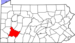
Madison, Pennsylvania

Last updated

Madison, Pennsylvania
Borough
Madison Pennsylvania Main Street 2010.jpg
Main Street
Westmoreland County Pennsylvania Incorporated and Unincorporated areas Madison Highlighted.svg
Location of Madison in Westmoreland County, Pennsylvania.
USA Pennsylvania location map.svg
Red pog.svg
Madison, Pennsylvania
Usa edcp location map.svg
Red pog.svg
Madison, Pennsylvania
Coordinates: 40°14′55″N79°40′46″W / 40.24861°N 79.67944°W / 40.24861; -79.67944
Country United States
State Pennsylvania
County Westmoreland
IncorporatedOctober 3, 1876
Government
  TypeBorough Council
Area
[1]
  Total
0.44 sq mi (1.13 km2)
  Land0.44 sq mi (1.13 km2)
  Water0.00 sq mi (0.00 km2)
Elevation
1,178 ft (359 m)
Population
 (2020) [2]
  Total
364
  Density834.86/sq mi (322.02/km2)
Time zone UTC-5 (Eastern (EST))
  Summer (DST) UTC-4 (EDT)
Zip code
15663
FIPS code 42-46488

Madison is a borough in Westmoreland County, Pennsylvania, United States. The population was 397 at the 2010 census. The borough was named for James Madison, fourth President of the United States. [3]

Contents

Geography

Madison is located at 40°14′55″N79°40′46″W / 40.24861°N 79.67944°W / 40.24861; -79.67944 (40.248616, -79.679527). [4]

According to the United States Census Bureau, the borough has a total area of 0.5 square miles (1.3 km2), all land.

Demographics

Historical population
CensusPop.Note
1880 190
1890 2015.8%
1900 464130.8%
1910 421−9.3%
1920 354−15.9%
1930 3653.1%
1940 40912.1%
1950 386−5.6%
1960 3993.4%
1970 4369.3%
1980 53121.8%
1990 5391.5%
2000 510−5.4%
2010 397−22.2%
2020 364−8.3%
Sources: [5] [6] [7] [2]

At the 2000 census there were 510 people, 219 households, and 158 families living in the borough. The population density was 962.6 inhabitants per square mile (371.7/km2). There were 225 housing units at an average density of 424.7 per square mile (164.0/km2). The racial makeup of the borough was 99.41% White, 0.20% Asian, and 0.39% from two or more races. [6] Of the 219 households 22.8% had children under the age of 18 living with them, 62.6% were married couples living together, 6.4% had a female householder with no husband present, and 27.4% were non-families. 23.3% of households were one person and 12.8% were one person aged 65 or older. The average household size was 2.33 and the average family size was 2.74.

The age distribution was 17.1% under the age of 18, 8.8% from 18 to 24, 23.1% from 25 to 44, 32.4% from 45 to 64, and 18.6% 65 or older. The median age was 46 years. For every 100 females, there were 96.2 males. For every 100 females age 18 and over, there were 91.4 males.

The median household income was $41,875 and the median family income was $46,250. Males had a median income of $27,321 versus $23,958 for females. The per capita income for the borough was $20,773. About 5.0% of families and 5.9% of the population were below the poverty line, including 5.7% of those under age 18 and 8.5% of those age 65 or over.

In fiction

The 1991 film My Girl takes place in Madison in the summer of 1972. [8] Its sequel, My Girl 2 , also took place in Madison in the first part, set in the 1973–74 school year.

Related Research Articles

<span class="mw-page-title-main">Whitaker, Pennsylvania</span> Borough in Pennsylvania, United States

Whitaker is a borough in Allegheny County, Pennsylvania, United States, and is on the Monongahela River 3 miles (5 km) upriver from Pittsburgh. The population was 1,179 at the 2020 census.

<span class="mw-page-title-main">Applewold, Pennsylvania</span> Borough in Pennsylvania, United States

Applewold is a borough in Armstrong County, Pennsylvania, United States. The population was 334 at the 2020 census.

<span class="mw-page-title-main">Atwood, Pennsylvania</span> Borough in Pennsylvania, United States

Atwood is a borough in Armstrong County, Pennsylvania, United States. The population was 112 at the 2020 census.

<span class="mw-page-title-main">Manorville, Pennsylvania</span> Borough in Pennsylvania, United States

Manorville is a borough in Armstrong County, Pennsylvania, United States. The population was 382 at the 2020 census.

<span class="mw-page-title-main">North Apollo, Pennsylvania</span> Borough in Pennsylvania, United States

North Apollo is a borough in Armstrong County, Pennsylvania, United States. The population was 1,252 at the 2020 census.

<span class="mw-page-title-main">West Kittanning, Pennsylvania</span> Borough in Pennsylvania, United States

West Kittanning is a borough in Armstrong County, Pennsylvania, United States. The population was 1,192 at the 2020 census.

<span class="mw-page-title-main">Ohioville, Pennsylvania</span> Borough in Pennsylvania, United States

Ohioville is a borough in western Beaver County, Pennsylvania, United States. The population was 3,349 at the 2020 census. It is part of the Pittsburgh metropolitan area.

<span class="mw-page-title-main">Creekside, Pennsylvania</span> Borough in Pennsylvania, United States

Creekside is a borough in Indiana County, Pennsylvania, United States. The population was 284 at the 2020 census.

Mount Gretna Heights is an unincorporated community and census-designated place (CDP) in Lebanon County, Pennsylvania, United States, adjacent to the borough of Mount Gretna. The population was 323 at the 2010 census.

<span class="mw-page-title-main">Dunlevy, Pennsylvania</span> Borough in Pennsylvania, United States

Dunlevy is a borough in Washington County, Pennsylvania, United States. The population was 369 at the 2020 census.

<span class="mw-page-title-main">Elco, Pennsylvania</span> Borough in Pennsylvania, United States

Elco is a borough in Washington County, Pennsylvania, United States. The population was 263 at the 2020 census.

<span class="mw-page-title-main">Long Branch, Pennsylvania</span> Borough in Pennsylvania, United States

Long Branch is a borough in Washington County, Pennsylvania, United States. The population was 421 at the 2020 census.

<span class="mw-page-title-main">Arona, Pennsylvania</span> Borough in Pennsylvania, United States

Arona is a borough in Westmoreland County, Pennsylvania, United States. The population was 253 at the 2020 census.

<span class="mw-page-title-main">East Vandergrift, Pennsylvania</span> Borough in Pennsylvania, United States

East Vandergrift is a borough in Westmoreland County in the U.S. state of Pennsylvania. The population was 601 at the 2020 census.

<span class="mw-page-title-main">Hyde Park, Pennsylvania</span> Borough in Pennsylvania, United States

Hyde Park is a borough in Westmoreland County, Pennsylvania, United States. The population was 509 at the 2020 census.

<span class="mw-page-title-main">Oklahoma, Pennsylvania</span> Borough in Pennsylvania, United States

Oklahoma is a borough in Westmoreland County, Pennsylvania, United States. The population was 809 at the time of the 2010 census.

<span class="mw-page-title-main">Penn, Pennsylvania</span> Borough in Pennsylvania, United States

Penn is a borough in Westmoreland County, Pennsylvania, United States. The population was 475 at the time of the 2010 census.

<span class="mw-page-title-main">Sewickley Township, Pennsylvania</span> Township in Pennsylvania, United States

Sewickley Township is a township in Westmoreland County, Pennsylvania, United States. The population was 5,590 at the 2020 census.

<span class="mw-page-title-main">Sutersville, Pennsylvania</span> Borough in Pennsylvania, United States

Sutersville is a borough in Westmoreland County, Pennsylvania, United States. The population was 605 at the 2010 census.

<span class="mw-page-title-main">West Leechburg, Pennsylvania</span> Borough in Pennsylvania, United States

West Leechburg is a borough in Westmoreland County, Pennsylvania, United States, along the Kiskiminetas River. The population was 1,294 at the 2010 census.

References

  1. "ArcGIS REST Services Directory". United States Census Bureau. Retrieved October 12, 2022.
  2. 1 2 "Census Population API". United States Census Bureau. Retrieved October 12, 2022.
  3. Linder, Lee (July 9, 1970). "Happenings in Pennsylvania". Observer-Reporter. pp. B3. Retrieved May 23, 2015.
  4. "US Gazetteer files: 2010, 2000, and 1990". United States Census Bureau. February 12, 2011. Retrieved April 23, 2011.
  5. "Census of Population and Housing". U.S. Census Bureau. Retrieved December 11, 2013.
  6. 1 2 "U.S. Census website". United States Census Bureau . Retrieved January 31, 2008.
  7. "Incorporated Places and Minor Civil Divisions Datasets: Subcounty Resident Population Estimates: April 1, 2010 to July 1, 2012". Population Estimates. U.S. Census Bureau. Archived from the original on June 11, 2013. Retrieved December 11, 2013.
  8. "My Girl". AFI Catalog of Feature Films. Retrieved October 10, 2023.