Penn, Pennsylvania | |
---|---|
Borough | |
Coordinates: 40°19′44″N79°38′25″W / 40.32889°N 79.64028°W | |
Country | United States |
State | Pennsylvania |
County | Westmoreland |
Settled | 1859 |
Incorporated | 1865 |
Government | |
• Type | Borough Council |
Area | |
• Total | 0.16 sq mi (0.41 km2) |
• Land | 0.16 sq mi (0.41 km2) |
• Water | 0.00 sq mi (0.00 km2) |
Elevation | 984 ft (300 m) |
Population | |
• Total | 435 |
• Density | 2,770.70/sq mi (1,071.57/km2) |
Time zone | UTC-5 (Eastern (EST)) |
• Summer (DST) | UTC-4 (EDT) |
Zip code | 15675 |
FIPS code | 42-58872 |
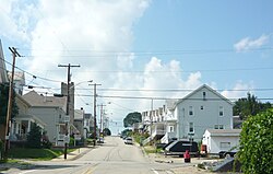
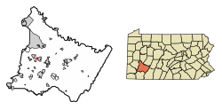
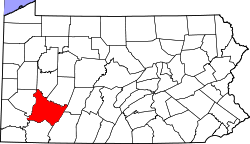
Penn is a borough in Westmoreland County, Pennsylvania, United States. The population was 475 at the time of the 2010 census.
The borough was named for Pennsylvania founder William Penn. [3]
Penn is located at 40°19′44″N79°38′25″W / 40.32889°N 79.64028°W (40.329018, -79.640141). [4]
According to the United States Census Bureau, the borough has a total area of 0.2 square miles (0.52 km2), all of it land.
Census | Pop. | Note | %± |
---|---|---|---|
1870 | 820 | — | |
1880 | 604 | −26.3% | |
1890 | 931 | 54.1% | |
1900 | 763 | −18.0% | |
1910 | 1,048 | 37.4% | |
1920 | 1,019 | −2.8% | |
1930 | 926 | −9.1% | |
1940 | 1,081 | 16.7% | |
1950 | 987 | −8.7% | |
1960 | 858 | −13.1% | |
1970 | 735 | −14.3% | |
1980 | 619 | −15.8% | |
1990 | 511 | −17.4% | |
2000 | 460 | −10.0% | |
2010 | 475 | 3.3% | |
2020 | 435 | −8.4% | |
Sources: [5] [6] [7] [2] |
At the time of the 2000 census there were 460 people, 182 households, and 133 families living in the borough.
The population density was 2,974.7 inhabitants per square mile (1,148.5/km2). There were 187 housing units at an average density of 1,209.3 units per square mile (466.9 units/km2).
The racial makeup of the borough was 96.52% White, 1.52% African American, 1.09% from other races, and 0.87% from two or more races. [6]
Of the 182 households 37.4% had children under the age of 18 living with them, 51.1% were married couples living together, 18.7% had a female householder with no husband present, and 26.4% were non-families. 25.8% of households were one person and 12.6% were one person aged 65 or older.
The average household size was 2.52 and the average family size was 2.99.
The age distribution was 27.6% under the age of 18, 6.1% from 18 to 24, 32.2% from 25 to 44, 18.0% from 45 to 64, and 16.1% 65 or older. The median age was 35 years.
For every 100 females, there were 81.8 males. For every 100 females age 18 and over, there were 77.1 males.
The median household income was $35,962 and the median family income was $40,481. Males had a median income of $32,031 compared with that of $22,875 for females.
The per capita income for the borough was $14,312.
Roughly 4.4% of families and 7.4% of the population were below the poverty line, including 9.1% of those under age 18 and 7.0% of those age 65 or over.
Blawnox is a borough in Allegheny County, Pennsylvania, United States. The population was 1,454 at the 2020 census. It is part of the Pittsburgh metropolitan area.
Chalfant is a borough in Allegheny County, Pennsylvania, United States. The population was 748 at the 2020 census.
Forward Township is a township in Allegheny County, Pennsylvania, United States. The population was 3,068 at the 2020 census. The township is named after Walter Forward, U.S. Secretary of the Treasury from 1841 to 1843.
Whitaker is a borough in Allegheny County, Pennsylvania, United States, and is on the Monongahela River 3 miles (5 km) upriver from Pittsburgh. The population was 1,179 at the 2020 census.
Dayton is a borough in Armstrong County, Pennsylvania, United States. The population was 549 at the 2020 census.
Centerport is a borough in north central Berks County, Pennsylvania, United States. The population was 314 at the 2020 census. The borough is in the Schuylkill Valley School District.
Mohnton is a borough in Berks County, Pennsylvania, United States. It had a population of 2,927 in the 2020 census.
Shoemakersville is a borough in Berks County, Pennsylvania, United States. The population was 1,360 at the 2020 census, a decline from the figure of 1,378 tabulated in 2010.
St. Lawrence, is a borough in Berks County, Pennsylvania, United States. The population was 1,892 at the 2020 census. It sits just east of Mount Penn and Reading. It is served by the Exeter Township School District.
Topton is a borough in Berks County, Pennsylvania, United States. The population was 2,041 at the 2020 census.
Blair Township is a township in Blair County, Pennsylvania, United States. The population was 4,785 at the 2020 census.
Valencia is a borough in Butler County, Pennsylvania, United States. The population was 551 at the 2010 census.
Bowmanstown is a borough in Carbon County, Pennsylvania. It is part of Northeastern Pennsylvania. The population was 937 at the 2010 census.
Strattanville is a borough in Clarion County, Pennsylvania, United States. The population was 537 at the 2020 census.
Clarendon is a borough in Warren County, Pennsylvania, United States. The population was 450 at the 2010 census.
California is a borough on the Monongahela River in Washington County, Pennsylvania, United States. The population was 5,479 as of the 2020 census. It is part of the Pittsburgh metropolitan area. Founded in 1849, the borough was named for the territory of California following the gold rush. It is the home of Pennsylvania Western University, California.
Elco is a borough in Washington County, Pennsylvania, United States. The population was 263 at the 2020 census.
Harrison City is a census-designated place (CDP) in Westmoreland County, Pennsylvania, United States. The population was 174 at the 2020 census.
Sutersville is a borough in Westmoreland County, Pennsylvania, United States. The population was 605 at the 2010 census.
Trafford is a borough in Allegheny and Westmoreland counties in the U.S. state of Pennsylvania. Located near Pittsburgh in western Pennsylvania, the borough lies primarily in Westmoreland County; only a small portion extends into Allegheny County. It was incorporated in 1904 from the northernmost corner of North Huntingdon Township, and was named by George Westinghouse for Trafford near Manchester, England. Westinghouse purchased the land in 1902, and the Trafford Foundry began operations on October 3, 1903. The population was 3,317 at the 2020 census. Of this, 3,113 were in Westmoreland County, and only 61 were in Allegheny County.