Hopewell | |
---|---|
Coordinates: 40°04′16″N79°20′39″W / 40.07111°N 79.34417°W Coordinates: 40°04′16″N79°20′39″W / 40.07111°N 79.34417°W | |
Country | United States |
State | Pennsylvania |
County | Westmoreland |
Elevation | 1,572 ft (479 m) |
Time zone | UTC-5 (Eastern (EST)) |
• Summer (DST) | UTC-4 (EDT) |
GNIS feature ID | 1203836 |
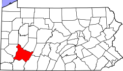
Hopewell is an unincorporated community in Westmoreland County, Pennsylvania, United States. It lies at an elevation of 1572 feet (479 m). [1]
In law, an unincorporated area is a region of land that is not governed by a local municipal corporation; similarly an unincorporated community is a settlement that is not governed by its own local municipal corporation, but rather is administered as part of larger administrative divisions, such as a township, parish, borough, county, city, canton, state, province or country. Occasionally, municipalities dissolve or disincorporate, which may happen if they become fiscally insolvent, and services become the responsibility of a higher administration. Widespread unincorporated communities and areas are a distinguishing feature of the United States and Canada. In most other countries of the world, there are either no unincorporated areas at all, or these are very rare; typically remote, outlying, sparsely populated or uninhabited areas.
Westmoreland County is a county located in the U.S. state of Pennsylvania. At the 2010 census, the population was 365,169. The county seat is Greensburg. Formed from, successively, Lancaster, Northumberland, and later Bedford Counties, Westmoreland County was founded on February 26, 1773, and was the first county in the colony of Pennsylvania whose entire territorial boundary was located west of the Allegheny Mountains. Westmoreland County originally included the present-day counties of Fayette, Washington, Greene, and parts of Beaver, Allegheny, Indiana, and Armstrong counties. It is named after Westmorland, a historic county of England.
Pennsylvania, officially the Commonwealth of Pennsylvania, is a state located in the northeastern, Great Lakes and Mid-Atlantic regions of the United States. The Appalachian Mountains run through its middle. The Commonwealth is bordered by Delaware to the southeast, Maryland to the south, West Virginia to the southwest, Ohio to the west, Lake Erie and the Canadian province of Ontario to the northwest, New York to the north, and New Jersey to the east.
Hannastown is an unincorporated community and important historical and archaeological site located in Hempfield Township, Westmoreland County, Pennsylvania. Although the village is not tracked by the Census Bureau, it has been assigned the ZIP code 15635.
Hopewell Furnace National Historic Site in southeastern Berks County, near Elverson, Pennsylvania, is an example of an American 19th century rural "iron plantation". The buildings include a blast furnace, the ironmaster's house and auxiliary structures including a blacksmith's shop, a company store and several worker's houses.
Rostraver Airport is a public use airport in Westmoreland County, Pennsylvania, United States. It is located five nautical miles east of the central business district of Monongahela, Pennsylvania in Rostraver Township. It is operated by the Westmoreland County Airport Authority, which also operates the Arnold Palmer Regional Airport in Unity Township, Pennsylvania.
This is a list of properties and districts listed on the National Register of Historic Places in Pennsylvania. As of 2015, there are over 3,000 listed sites in Pennsylvania. Sixty-six of the 67 counties in Pennsylvania have listings on the National Register; Cameron County is the only county without any sites listed.
French Creek State Park is a 7,526-acre (3,046 ha) Pennsylvania state park in North Coventry and Warwick Townships in Chester County and Robeson and Union Townships in Berks County, Pennsylvania in the United States. It straddles northern Chester County and southern Berks County along French Creek. It is located in the Hopewell Big Woods. The park is the home of two lakes: Hopewell Lake, a 68-acre (28 ha) warm water lake, and Scotts Run Lake, a 22-acre (8.9 ha) cold water lake. The state record smallmouth bass was caught in Scotts Run Lake. There are extensive forests, and almost 40 miles (64 km) of hiking and equestrian trails. The park is also friendly to mountain bikers, having some renowned technical trails. Hopewell Furnace National Historic Site, which features a cold blast furnace restored to its 1830s appearance, is surrounded by the park. The Six Penny Day Use Area and Group Camp are listed on the National Register of Historic Places. French Creek State Park is located off of Pennsylvania Route 345 to the south of Birdsboro.
The 56th district is located in Westmoreland County and has been represented by George Dunbar since 2010.
Hopewell, Pennsylvania may refer to:
Laurel Summit State Park is a 6-acre (2.4 ha) Pennsylvania state park in Cook Township, Westmoreland County, Pennsylvania in the United States. It is also a picnic area with a scenic view of Linn Run on the summit of Laurel Mountain. The temperatures at Laurel Summit State Park are generally several degrees cooler than the surrounding towns in the valleys. The elevation of the park is 2,739 feet (835 m) above sea level.
Laurel Mountain State Park is a 493-acre (200 ha) Pennsylvania state park in Ligonier Township, Westmoreland County and Jenner Township, Somerset County, Pennsylvania in the United States.
This is a list of the National Register of Historic Places listings in Westmoreland County, Pennsylvania.
Hopewell is an unincorporated community in Chester County, Pennsylvania, United States. It lies at an elevation of 344 feet. It is also home to Hanover Farms, Hopewell UMC and BSA Troop 8.
Lower Hopewell is an unincorporated community in Chester County, Pennsylvania, United States. It lies at an elevation of 322 feet.
Hopewell is a settlement in Westmoreland Parish, Jamaica.
The Five Star Trail runs nearly 8 miles through Westmoreland County, in the U.S. state of Pennsylvania. The trail is alongside an active railroad track, Southwestern Pennsylvania Railroad, that stretches between Lynch Field, a Greensburg city park and Youngwood. The trail then spurs off eastward to connect with the campus of Westmoreland County Community College and continues on to Armbrust.
Smithdale is an unincorporated community and coal town in Allegheny County, Pennsylvania, United States. It is located in Elizabeth Township in the southeastern corner of Allegheny County, along the south bank of the Youghiogheny River. Immediately to the southeast is Collinsburg in Westmoreland County. To the north across the river is Sutersville, also in Westmoreland County.
Westmoreland City is an unincorporated community located within North Huntingdon Township, Westmoreland County, Pennsylvania, United States.
The Pennsylvania State Game Lands Number 73 are Pennsylvania State Game Lands in Bedford, Blair and Huntingdon Counties in Pennsylvania in the United States providing hunting, bird watching, and other activities.
This Westmoreland County, Pennsylvania state location article is a stub. You can help Wikipedia by expanding it. |