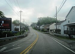
Tarrs, Pennsylvania

Last updated
Tarrs
USA Pennsylvania location map.svg
Red pog.svg
Tarrs
Location within the state of Pennsylvania
Coordinates: 40°10′12″N79°35′53″W / 40.17000°N 79.59806°W / 40.17000; -79.59806
Country United States
State Pennsylvania
County Westmoreland
Elevation
1,158 ft (353 m)
Time zone UTC-5 (Eastern (EST))
  Summer (DST) UTC-4 (EDT)
ZIP codes
15688
GNIS feature ID1189287 [1]

Tarrs is an unincorporated community and coal town that is located in East Huntingdon Township, Westmoreland County, Pennsylvania, United States.

Contents

Situated on Route 31, approximately three miles west of Mt. Pleasant, [2] it is the only location in Pennsylvania known to have an active and running ACA Allertor 125 Civil Defense warning siren. [3]

History

Tarrs has its own post office, with zip code 15688. It was established in April 1828. [4]

The town was the site of a coal mine, first developed in 1873 by D.A. Dillinger and Brothers. It was later acquired by the Southwest Coal and Coke Company and was known as the "No. 3" mine. Approximately 250 coke ovens were eventually located there.

In 1906, historian John Newton Boucher described Tarrs as being located along "the South-West Branch of the Pennsylvania Railroad" between Ruffs Dale and Alverton. Boucher also mentioned a location in Westmoreland County known as Tarr Station, presumably related to the railroad.

By 1910, the population had reached roughly five hundred. The mine and coke works closed in 1923. [5] [6]

Related Research Articles

<span class="mw-page-title-main">Crabtree, Pennsylvania</span> CDP in Pennsylvania, United States

Crabtree is a census-designated place (CDP) and former coal town in Salem Township, Westmoreland County, Pennsylvania, United States. The population was 277 at the 2010 census. It has its own post office, with postal code 15624.

<span class="mw-page-title-main">Donegal Township, Westmoreland County, Pennsylvania</span> Township in Pennsylvania, United States

Donegal Township is a township in Westmoreland County, Pennsylvania, United States. The population was 2,192 at the 2020 census, a decrease of 9% compared to 2010.

<span class="mw-page-title-main">Mount Pleasant, Pennsylvania</span> Borough in Pennsylvania, United States

Mount Pleasant is a borough in Westmoreland County, Pennsylvania, United States. It stands 45 miles (72 km) southeast of Pittsburgh. As of the 2020 census, the borough's population was 4,245.

<span class="mw-page-title-main">Scottdale, Pennsylvania</span> Borough in Pennsylvania, United States

Scottdale is a borough in Westmoreland County, Pennsylvania, United States, 32 miles (51 km) southeast of Pittsburgh.

<span class="mw-page-title-main">Smithton, Pennsylvania</span> Borough in Pennsylvania, United States

Smithton is a borough in Westmoreland County, Pennsylvania, United States. The population was 399 at the 2010 census. As of 2018, the population was listed at 378. Smithton has its own post office, with zip code 15479, and is serviced by Yough School District.

<span class="mw-page-title-main">Unity Township, Westmoreland County, Pennsylvania</span> Township in Pennsylvania, United States

Unity Township is a township in Westmoreland County, Pennsylvania, United States. The population was 21,724 at the 2020 census, a decline of approximately 4% compared to the 2010 census.

Hannastown is an unincorporated community and important historical and archaeological site located in Hempfield Township, Westmoreland County, Pennsylvania, United States. Although the village is not tracked by the Census Bureau, it has been assigned the ZIP code 15635.

<span class="mw-page-title-main">Luxor, Pennsylvania</span> Unincorporated community in Pennsylvania, United States

Luxor is an unincorporated community and coal town in Hempfield Township, Westmoreland County, Pennsylvania, United States.

Ruffs Dale, also spelled Ruffsdale, is an unincorporated community in East Huntingdon Township, Westmoreland County, Pennsylvania United States. It is located approximately forty miles from Pittsburgh. Ruffs Dale has its own post office, with zip code 15679, located at 875 State Route 31.

Calumet is a census-designated place in Mount Pleasant Township, Westmoreland County, Pennsylvania, United States. Although the United States Census Bureau included it as a census-designated place with the nearby community of Norvelt for the 2000 census, they are in reality two very different communities, each reflecting a different chapter in how the Great Depression affected rural Pennsylvanians. As of the 2010 census, Calumet-Norvelt was divided into two separate CDPs officially. Calumet was a typical "patch town," another name for a coal town, built by a single company to house coal miners as cheaply as possible. The closing of the Calumet mine during the Great Depression caused enormous hardship in an era when unemployment compensation and welfare payments were nonexistent. On the other hand, Norvelt was created during the depression by the US federal government as a model community, intended to increase the standard of living of laid-off coal miners.

<span class="mw-page-title-main">Brenizer, Pennsylvania</span> Unincorporated community in Pennsylvania, United States

Brenizer, also known as Breinizer, is an unincorporated community and coal town in Derry Township, Westmoreland County, Pennsylvania, United States.

<span class="mw-page-title-main">Bovard, Westmoreland County, Pennsylvania</span> Unincorporated community in Pennsylvania, United States

Bovard is an unincorporated community and coal town in Hempfield Township, Westmoreland County, Pennsylvania, United States. The community is located near U.S. Route 119, 2.3 miles (3.7 km) northeast of Greensburg and is also the former home of baseball standout, Anthony Marazza. Marazza, dubbed "MR. BOVARD", is notable for leading Bovard to 6 championships in the past decade in the ICL and Pittsburgh Leagues.

<span class="mw-page-title-main">Bradenville, Pennsylvania</span> Census-designated place in Pennsylvania, United States

Bradenville is a census-designated place and coal town in Derry Township in Westmoreland County, Pennsylvania, United States. The community is located within two miles of the city of Latrobe and is three miles from the borough of Derry.

<span class="mw-page-title-main">Pleasant Unity, Pennsylvania</span> Unincorporated community in Pennsylvania, United States

Pleasant Unity is an unincorporated community in a rural section of Unity Township, Westmoreland County, Pennsylvania, United States. It is located at the junction of state routes 130 and 981, 6.3 miles (10.1 km) southeast of Greensburg.

<span class="mw-page-title-main">Forbes Road, Pennsylvania</span> Unincorporated community in Pennsylvania, United States

Forbes Road is an unincorporated community in Westmoreland County, Pennsylvania, United States. The community is located along Pennsylvania Route 819, 3.7 miles (6.0 km) north of Greensburg. Forbes Road has a post office with ZIP code 15633, which opened on July 1, 1903.

Darragh is an unincorporated community in Hempfield Township, Westmoreland County, Pennsylvania, United States. Originally a coal town, the community is located along Pennsylvania Route 136, 1 mile (1.6 km) west of Arona. Darragh has a post office, with ZIP code 15625, which opened on July 21, 1892.

Leckrone is an unincorporated community that is located in Fayette County, Pennsylvania, United States. The community is situated 1.9 miles (3.1 km) northeast of Masontown. Leckrone has a post office, with ZIP code 15454.

Alverton is an unincorporated community in Westmoreland County, Pennsylvania, United States. The community is located along Pennsylvania Route 981, 2.5 miles (4.0 km) west of Mount Pleasant. Alverton has a post office, with ZIP code 15612.

Wendel is an unincorporated community and former coal town in Westmoreland County, Pennsylvania, United States. It is 2.2 miles (3.5 km) south of Irwin.

References

  1. U.S. Geological Survey Geographic Names Information System: Tarrs, Pennsylvania
  2. "Tarrs - Post Office". U.S. Postal Service.
  3. http://webpmt.usps.gov/pmt007.cfm%5B%5D
  4. "Postmaster Finder". USPS - Display Post Offices by County. United States Postal Service. Retrieved 27 June 2022.
  5. Muller, Edward K. and Carlisle, Ronald C. (1994). "WESTMORELAND COUNTY, PENNSYLVANIA: An Inventory of Historic Engineering and Industrial Sites". National Park Service, U.S. Department of the Interior. p. 157-158.{{cite web}}: CS1 maint: multiple names: authors list (link)
  6. Boucher, John Newton (1906). History of Westmoreland County, Pennsylvania. Lewis Publishing Company. p. 283, 390. Retrieved 25 June 2022.

See also

ACA Allertor 125 warning/Civil Defense siren video on Wikimedia Commons.