Oklahoma, Pennsylvania

Last updated
Oklahoma, Pennsylvania
Borough
Hancock from Grove, Oklahoma.jpg
Hancock Street residential area
Westmoreland County Pennsylvania Incorporated and Unincorporated areas Oklahoma Highlighted.svg
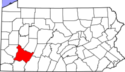
Location of Oklahoma in Westmoreland County, Pennsylvania.
USA Pennsylvania location map.svg
Red pog.svg
Oklahoma, Pennsylvania
Coordinates: 40°34′54″N79°34′29″W / 40.58167°N 79.57472°W / 40.58167; -79.57472
Country United States
State Pennsylvania
County Westmoreland
Incorporated1931
Government
  TypeBorough Council
Area
[1]
  Total0.64 sq mi (1.66 km2)
  Land0.61 sq mi (1.57 km2)
  Water0.03 sq mi (0.09 km2)
Elevation
1,056 ft (322 m)
Population
 (2020) [2]
  Total788
  Density1,298.19/sq mi (501.39/km2)
Time zone UTC-5 (Eastern (EST))
  Summer (DST) UTC-4 (EDT)
FIPS code 42-56496

Oklahoma is a borough in Westmoreland County, Pennsylvania, United States. The population was 809 at the time of the 2010 census.

Contents

Geography

Oklahoma is located at 40°34′54″N79°34′29″W / 40.58167°N 79.57472°W / 40.58167; -79.57472 (40.581613, -79.574586). [3]

According to the United States Census Bureau, the borough has a total area of 0.8 square miles (2.1 km2), of which 0.7 square miles (1.8 km2) is land and 0.04 square miles (0.10 km2) (5.06%) is water.

Surrounding communities

Oklahoma has two land borders, including the townships of Washington to the south and Allegheny to the northwest.

Across the Kiskiminetas River to the east, Oklahoma runs adjacent with the Armstrong County municipalities of (from north to south) North Apollo, Apollo (with a connector via 1st Street Bridge), and Kiskiminetas Township.

Demographics

Historical population
CensusPop.Note
1940 868
1950 9307.1%
1960 9835.7%
1970 1,08410.3%
1980 1,078−0.6%
1990 977−9.4%
2000 915−6.3%
2010 809−11.6%
2020 788−2.6%
Sources: [4] [5] [6] [2]

At the time of the 2000 census, there were 915 people, 375 households, and 270 families living in the borough.

The population density was 1,233.0 inhabitants per square mile (476.1/km2). There were 390 housing units at an average density of 525.5 per square mile (202.9/km2).

The racial makeup of the borough was 98.91% White, 0.66% African American, and 0.44% from two or more races. Hispanic or Latino of any race were 0.22%. [5]

Of the 375 households 31.5% had children under the age of 18 living with them, 56.0% were married couples living together, 10.9% had a female householder with no husband present, and 28.0% were non-families. 24.5% of households were one person and 14.4% were one person aged 65 or older. The average household size was 2.44 and the average family size was 2.89.

The age distribution was 24.2% under the age of 18, 5.9% from 18 to 24, 27.0% from 25 to 44, 24.6% from 45 to 64, and 18.4% 65 or older. The median age was 41 years.

For every 100 females, there were 86.4 males. For every 100 females age 18 and over, there were 87.1 males.

The median household income was $38,667 and the median family income was $41,477. Males had a median income of $35,313 compared with that of $23,750 for females.

The per capita income for the borough was $17,547.

Roughly 4.7% of families and 6.7% of the population were below the poverty line, including 4.6% of those under age 18 and 10.3% of those age 65 or over.

Related Research Articles

<span class="mw-page-title-main">Salem, Oklahoma</span> Census-designated place in Oklahoma, United States

Salem is a census-designated place (CDP) in Adair County, Oklahoma, United States. The population was 112 at the 2010 census.

<span class="mw-page-title-main">Apollo, Pennsylvania</span> Borough in Pennsylvania, United States

Apollo is a borough in Armstrong County, Pennsylvania, United States, 35 miles (56 km) northeast of Pittsburgh in a former coal-mining region. Apollo was settled in 1790, laid out in 1816, and incorporated as a borough in 1848. The population was 1,615 at the 2020 United States Census

<span class="mw-page-title-main">Applewold, Pennsylvania</span> Borough in Pennsylvania, United States

Applewold is a borough in Armstrong County, Pennsylvania, United States. The population was 334 at the 2020 census.

<span class="mw-page-title-main">Kiskiminetas Township, Armstrong County, Pennsylvania</span> Township in Pennsylvania, United States

Kiskiminetas Township is a township in Armstrong County, Pennsylvania, United States. The population was 4,604 at the 2020 census, a decrease from the figure of 4,800 tabulated in 2010, making it the most populous township or borough in the county.

<span class="mw-page-title-main">Leechburg, Pennsylvania</span> Borough in Pennsylvania, United States

Leechburg is a borough in southern Armstrong County in the U.S. state of Pennsylvania, 35 miles (56 km) northeast of Pittsburgh. A population of 2,149 residents live within the borough limits as of the 2020 census, according to US Census Bureau. Leechburg was founded by David Leech, for whom it was named, and was incorporated as a borough in 1850. Located along the Kiskiminetas River, Leechburg was a major port of the Pennsylvania Canal. Early in the 20th century, it was the site of extensive steel sheet works, foundries, cement plants, and productive coal mines. Leechburg was the first place where natural gas was used for industrial purposes.

<span class="mw-page-title-main">North Apollo, Pennsylvania</span> Borough in Pennsylvania, United States

North Apollo is a borough in Armstrong County, Pennsylvania, United States. The population was 1,252 at the 2020 census.

<span class="mw-page-title-main">Parks Township, Armstrong County, Pennsylvania</span> Township in Pennsylvania, United States

Parks Township is a township in Armstrong County in the U.S. state of Pennsylvania. The population was 2,471 at the 2020 census, a decrease from 2,744 at the 2010 census.

<span class="mw-page-title-main">South Heights, Pennsylvania</span> Borough in Pennsylvania, United States

South Heights is a borough in Beaver County, Pennsylvania, along the Ohio River. The population was 389 at the 2020 census. South Heights was first known as Ethel's Landing, a docking point on the Ohio River. The name of the town was changed to Shannopin when the Pittsburgh and Lake Erie Railroad established a station there. When the name of the town was changed to South Heights, the station became known as South Heights Station.

<span class="mw-page-title-main">Burlington Township, Bradford County, Pennsylvania</span> Township in Pennsylvania, United States

Burlington Township is a township in Bradford County, Pennsylvania, United States. It is part of Northeastern Pennsylvania. The population was 791 at the 2010 census. Children residing in the township are assigned to attend the Troy Area School District.

<span class="mw-page-title-main">Vanderbilt, Pennsylvania</span> Borough in Pennsylvania, United States

Vanderbilt is a borough in Fayette County, Pennsylvania, United States. The population was 414 at the 2020 census, a decline from the figure of 476 tabulated in 2010. The town is named for the railroad tycoon Cornelius Vanderbilt and is served by the Connellsville Area School District.

<span class="mw-page-title-main">Conemaugh Township, Indiana County, Pennsylvania</span> Township in Pennsylvania, United States

Conemaugh Township is a township in Indiana County, Pennsylvania, United States. The population was 2,080 at the 2020 census. The township includes the communities of Clarksburg, Foster, Lewisville, McKeeverville, Nowrytown, Tunnelton, and White.

<span class="mw-page-title-main">Creekside, Pennsylvania</span> Borough in Pennsylvania, United States

Creekside is a borough in Indiana County, Pennsylvania, United States. The population was 284 at the 2020 census.

<span class="mw-page-title-main">Coal Center, Pennsylvania</span> Borough in Pennsylvania, United States

Coal Center is a borough on the Monongahela River in Washington County, Pennsylvania, United States and part of the Pittsburgh metropolitan area since 1950. The population was 110 at the 2020 census.

<span class="mw-page-title-main">Dunlevy, Pennsylvania</span> Borough in Pennsylvania, United States

Dunlevy is a borough in Washington County, Pennsylvania, United States. The population was 369 at the 2020 census.

<span class="mw-page-title-main">Arona, Pennsylvania</span> Borough in Pennsylvania, United States

Arona is a borough in Westmoreland County, Pennsylvania, United States. The population was 253 at the 2020 census.

<span class="mw-page-title-main">East Vandergrift, Pennsylvania</span> Borough in Pennsylvania, United States

East Vandergrift is a borough in Westmoreland County in the U.S. state of Pennsylvania. The population was 601 at the 2020 census.

<span class="mw-page-title-main">Hyde Park, Pennsylvania</span> Borough in Pennsylvania, United States

Hyde Park is a borough in Westmoreland County, Pennsylvania, United States. The population was 509 at the 2020 census.

<span class="mw-page-title-main">Sutersville, Pennsylvania</span> Borough in Pennsylvania, United States

Sutersville is a borough in Westmoreland County, Pennsylvania, United States. The population was 605 at the 2010 census.

<span class="mw-page-title-main">West Leechburg, Pennsylvania</span> Borough in Pennsylvania, United States

West Leechburg is a borough in Westmoreland County, Pennsylvania, United States, along the Kiskiminetas River. The population was 1,294 at the 2010 census.

<span class="mw-page-title-main">Youngwood, Pennsylvania</span> Borough in Pennsylvania, United States

Youngwood is a borough in Westmoreland County, Pennsylvania, United States.

References

  1. "ArcGIS REST Services Directory". United States Census Bureau. Retrieved October 12, 2022.
  2. 1 2 "Census Population API". United States Census Bureau. Retrieved Oct 12, 2022.
  3. "US Gazetteer files: 2010, 2000, and 1990". United States Census Bureau. 2011-02-12. Retrieved 2011-04-23.
  4. "Census of Population and Housing". U.S. Census Bureau. Retrieved 11 December 2013.
  5. 1 2 "U.S. Census website". United States Census Bureau . Retrieved 2008-01-31.
  6. "Incorporated Places and Minor Civil Divisions Datasets: Subcounty Resident Population Estimates: April 1, 2010 to July 1, 2012". Population Estimates. U.S. Census Bureau. Archived from the original on June 11, 2013. Retrieved 11 December 2013.