Level Green, Pennsylvania

Last updated

Level Green, Pennsylvania
CDP
Country United States
State Pennsylvania
County Westmoreland
Area
[1]
  Total3.80 sq mi (9.85 km2)
  Land3.80 sq mi (9.85 km2)
  Water0.00 sq mi (0.00 km2)
Population
 (2020) [2]
  Total3,898
  Density1,025.25/sq mi (395.81/km2)
Time zone UTC-5 (Eastern (EST))
  Summer (DST) UTC-4 (EDT)
FIPS code 42-42912

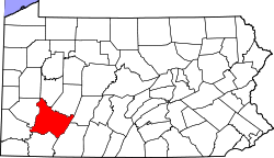
Level Green is a census-designated place [3] located in Penn Township, Westmoreland County in the state of Pennsylvania, United States. The community is located near Pennsylvania Route 130. As of the 2010 census, [4] the population was 4,020 residents.
Demographics

Historical population
CensusPop.Note
2020 3,898
U.S. Decennial Census [5]

Related Research Articles

<span class="mw-page-title-main">Garrett County, Maryland</span> County in Maryland, United States

Garrett County is the westernmost county of the U.S. state of Maryland completely within the Appalachian Mountains. As of the 2020 census, the population was 28,806, making it the third-least populous county in Maryland. Its county seat is Oakland. The county was named for John Work Garrett (1820–1884), president of the Baltimore and Ohio Railroad. Created from Allegany County in 1872, it was the last county to be formed in the state.

<span class="mw-page-title-main">Brackenridge, Pennsylvania</span> Borough in Pennsylvania, United States

Brackenridge is a borough in Allegheny County, Pennsylvania, United States, located along the Allegheny River. It is part of the Greater Pittsburgh metropolitan area.

<span class="mw-page-title-main">Chalfant, Pennsylvania</span> Borough in Pennsylvania, United States

Chalfant is a borough in Allegheny County, Pennsylvania, United States. The population was 748 at the 2020 census.

<span class="mw-page-title-main">Churchill, Pennsylvania</span> Borough in Pennsylvania, United States

Churchill is a borough in Allegheny County, Pennsylvania, United States. The population was 3,157 at the 2020 census. It is a residential suburb of the Pittsburgh metropolitan area. The town was named from the hilltop Beulah Presbyterian Church.

<span class="mw-page-title-main">Elizabeth, Pennsylvania</span> Borough in Pennsylvania, United States

Elizabeth is a borough in Allegheny County, Pennsylvania, United States, on the east bank of the Monongahela River, where Pennsylvania Route 51 crosses, 15 miles (24 km) upstream (south) of Pittsburgh and close to the county line. The population was 1,398 at the 2020 census. The borough of Elizabeth is entirely contained within the 15037 USPS ZIP code. The local school district is the Elizabeth Forward School District. The borough is home to neighborhoods Walker Heights and Town Hill. Elizabeth Borough is the birthplace of Town Hill Hockey established in 1978.

<span class="mw-page-title-main">Dayton, Pennsylvania</span> Borough in Pennsylvania, United States

Dayton is a borough in Armstrong County, Pennsylvania, United States. The population was 549 at the 2020 census.

<span class="mw-page-title-main">Leechburg, Pennsylvania</span> Borough in Pennsylvania, United States

Leechburg is a borough in southern Armstrong County in the U.S. state of Pennsylvania, 35 miles (56 km) northeast of Pittsburgh. A population of 2,149 residents live within the borough limits as of the 2020 census, according to United States Census Bureau. Leechburg was founded by David Leech, for whom it was named, and was incorporated as a borough in 1850.

Chevy Chase Heights is a census-designated place within White Township, Indiana County, Pennsylvania, United States. The population was 1,502 at the 2010 census.

<span class="mw-page-title-main">New Philadelphia, Pennsylvania</span> Borough in Pennsylvania, United States

New Philadelphia, also known as New Philly, is a borough in Schuylkill County, Pennsylvania, United States. The population was 1,060 at the 2020 census.

<span class="mw-page-title-main">Avonmore, Pennsylvania</span> Borough in Pennsylvania, United States

Avonmore is a borough in Westmoreland County, Pennsylvania, United States. The population was 901 at the 2020 census.

<span class="mw-page-title-main">Penn, Pennsylvania</span> Borough in Pennsylvania, United States

Penn is a borough in Westmoreland County, Pennsylvania, United States. The population was 475 at the time of the 2010 census.

<span class="mw-page-title-main">Penn Township, Westmoreland County, Pennsylvania</span> Township in Pennsylvania, United States

Penn Township is a township in Westmoreland County, Pennsylvania, United States.

<span class="mw-page-title-main">Idaville, Pennsylvania</span> Census-designated place in Pennsylvania, United States

Idaville is a census-designated place that is located in Huntington Township, Adams County, Pennsylvania, United States. As of the 2020 census, its population was 176. Idaville is served by the Bermudian Springs School District.

Boston is a census-designated place located in Elizabeth Township, Allegheny County in the state of Pennsylvania. As of the 2020 census the population was 549.

Edie is a census-designated place located in Lincoln Township, Somerset County in the state of Pennsylvania, United States. As of 2021, the population was estimated to be 62.

Elrama is a census-designated place located in Union Township, Washington County in the state of Pennsylvania. The community is located in far eastern tip of Union Township in Washington County, near the Monongahela River, along Pennsylvania Route 837. As of the 2020 census the population was 285 residents.

Hendersonville is a census-designated place located in Cecil Township, Washington County in the state of Pennsylvania. The community is located just to the east of Interstate 79. As of the 2010 census the population was 325 residents.

<span class="mw-page-title-main">Collinsburg, Pennsylvania</span> CDP in Pennsylvania, United States

Collinsburg is a census-designated place located in Rostraver Township, Westmoreland County in the state of Pennsylvania, United States. As of the 2010 census the population was 1,125 residents.

Fellsburg is a census-designated place located in Rostraver Township, Westmoreland County in the state of Pennsylvania, United States. It is home to the Fells Church, overlooking the Monongahela and Youhgiogheny Valleys. As of the 2010 census the population was 1,180 residents.

Hostetter is a census-designated place located in Unity Township, Westmoreland County in the state of Pennsylvania, United States. It is located near Pennsylvania Route 981. As of the 2010 census the population was 740 residents.

References

  1. "ArcGIS REST Services Directory". United States Census Bureau. Retrieved October 12, 2022.
  2. "Census Population API". United States Census Bureau. Retrieved October 12, 2022.
  3. 2010 Census Interactive Population Search: PA - Level Green CDP.
  4. US Census Bureau
  5. "Census of Population and Housing". Census.gov. Retrieved June 4, 2016.

40°23′35″N79°43′14″W / 40.39306°N 79.72056°W / 40.39306; -79.72056