Carbon, Pennsylvania

Last updated
Carbon
USA Pennsylvania location map.svg
Red pog.svg
Carbon
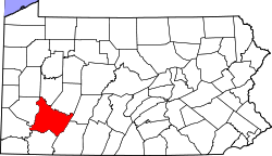
Location within the state of Pennsylvania
Coordinates: 40°17′25″N79°33′37″W / 40.29028°N 79.56028°W / 40.29028; -79.56028 Coordinates: 40°17′25″N79°33′37″W / 40.29028°N 79.56028°W / 40.29028; -79.56028
Country United States
State Pennsylvania
County Westmoreland
Elevation
1,099 ft (335 m)
Time zone UTC-5 (Eastern (EST))
  Summer (DST) UTC-4 (EDT)
GNIS feature ID1171187 [1]

Carbon is an unincorporated community and coal town in Westmoreland County, Pennsylvania, United States.

Unincorporated area Region of land not governed by own local government

In law, an unincorporated area is a region of land that is not governed by a local municipal corporation; similarly an unincorporated community is a settlement that is not governed by its own local municipal corporation, but rather is administered as part of larger administrative divisions, such as a township, parish, borough, county, city, canton, state, province or country. Occasionally, municipalities dissolve or disincorporate, which may happen if they become fiscally insolvent, and services become the responsibility of a higher administration. Widespread unincorporated communities and areas are a distinguishing feature of the United States and Canada. In most other countries of the world, there are either no unincorporated areas at all, or these are very rare; typically remote, outlying, sparsely populated or uninhabited areas.

A coal town, also known as a coal camp or patch is typically situated in a remote place and provides residences for a population of miners to reside near a coal mine. A coal town is a type of company town or mining community established by the employer, a mining company, which imports workers to work the mineral find. The 'town founding' process is not limited to coal mining, nor mining, but is generally found where mineral wealth is located in a remote or undeveloped area, which is then opened for exploitation, normally first by having some transportation infrastructure brought into being first. Often, such minerals were the result of logging operations by pushing into a wilderness forest, which clear-cutting operations then allowed geologists and cartographers, to chart and plot the lands, allowing efficient discovery of natural resources and their exploitation.

Westmoreland County, Pennsylvania County in the United States

Westmoreland County is a county located in the U.S. state of Pennsylvania. At the 2010 census, the population was 365,169. The county seat is Greensburg. Formed from, successively, Lancaster, Northumberland, and later Bedford Counties, Westmoreland County was founded on February 26, 1773, and was the first county in the colony of Pennsylvania whose entire territorial boundary was located west of the Allegheny Mountains. Westmoreland County originally included the present-day counties of Fayette, Washington, Greene, and parts of Beaver, Allegheny, Indiana, and Armstrong counties. It is named after Westmorland, a historic county of England.


Related Research Articles

Carbon County, Pennsylvania County in the United States

Carbon County is a county located in the U.S. state of Pennsylvania. As of the 2010 census, the population was 65,249. Its county seat is Jim Thorpe, founded in 1818 as Mauch Chunk, a company town of the Lehigh Coal & Navigation Company (LC&N) as it built a wagon road nine miles to their coal mine at today's Summit Hill, and constructed the Lehigh Canal navigations.

Anthracite A hard, compact variety of coal that has a submetallic luster

Anthracite, often referred to as hard coal, is a hard, compact variety of coal that has a submetallic luster. It has the highest carbon content, the fewest impurities, and the highest energy density of all types of coal and is the highest ranking of coals.

Pocono Mountains geographical, geological, and cultural region located in northeastern Pennsylvania, United States

The Pocono Mountains, commonly referred to as The Poconos, are a geographical, geological, and cultural region in Northeastern Pennsylvania, United States. The Poconos are an upland of the larger Allegheny Plateau. Forming a 2,400-square-mile (6,200 km2) escarpment overlooking the Delaware River and Delaware Water Gap to the east, the mountains are bordered on the north by Lake Wallenpaupack, on the west by the Wyoming Valley and the Coal Region, and to the south by the Lehigh Valley. The name comes from the Munsee word Pokawachne, which means "Creek Between Two Hills." Much of the Poconos region lies within the Greater New York-Newark, NY-NJ-CT-PA Combined Statistical Area. The wooded hills and valleys have long been a popular recreation area, accessible within a two-hour drive to millions of metropolitan area residents, with many communities having resort hotels with fishing, hunting, skiing, and other sports facilities.

National Register of Historic Places listings in Pennsylvania Wikimedia list article

This is a list of properties and districts listed on the National Register of Historic Places in Pennsylvania. As of 2015, there are over 3,000 listed sites in Pennsylvania. Sixty-six of the 67 counties in Pennsylvania have listings on the National Register; Cameron County is the only county without any sites listed.

Carbon Lehigh Intermediate Unit #21 (CLIU), located in Schnecksville, Pennsylvania, Lehigh County USA, is one of twenty nine Intermediate Unit Educational Service Agencies created by an Act of the General Assembly of Pennsylvania in 1971. CLIU provides services to 14 public school districts, non-public schools in its service region and two Vocational-Technical schools in Carbon County and Lehigh County. The agency has no taxing power. Its revenues come from federal grants, state grants, private grants, annual payments from each public school district in its region and charges to individuals for some services like driver's education. The agency provides many services including specialized special education services and training for teachers to meet their state mandated continuing professional education with some offered online. CLIU21 also operates a Librarians' Consortium for librarians from public libraries, private libraries, school libraries and higher education librarians.

Township (Pennsylvania) township in the U.S. state of Pennsylvania

A Pennsylvania township or township under Pennsylvania laws is one class of the three types of municipalities codified, in Pennsylvania—smaller municipal class legal entities providing local self-government functions in the majority of land areas in the more rural regions. Townships act as the lowest level municipal corporations of governance of the Commonwealth of Pennsylvania, a U.S. state of the United States of America.

Weiser State Forest

Weiser State Forest is a Pennsylvania State Forest in Pennsylvania Bureau of Forestry District #18. The main offices are located in Cressona in Schuylkill County, Pennsylvania in the United States.

Big Pocono State Park

Big Pocono State Park is a 1,305.6-acre (528.4 ha) Pennsylvania state park in Jackson and Pocono townships in Monroe County, Pennsylvania in northeastern Pennsylvania in the United States. The park is on Camelback Mountain and is maintained jointly by the Pennsylvania Department of Conservation and Natural Resources and Camelback Ski Corporation.

Geographic regions of the Commonwealth of Pennsylvania, United States of America.

Locust Lake State Park

Locust Lake State Park is a Pennsylvania state park on 1,089 acres (441 ha) in Ryan Township, Schuylkill County, Pennsylvania in the United States. Locust Lake State Park is located approximately 7 miles (11 km) north of Pottsville, 3 miles (5 km) south of Mahanoy City, 8 miles (13 km) west of Tamaqua and 6 miles (10 km) west of Tuscarora State Park. The lake is 52 acres (21 ha). The park offers hiking, camping, boating, fishing, swimming, biking, and a wide array of other seasonal activities.

Beltzville State Park

Beltzville State Park is a 2,972.39-acre (1,202.88 ha) Pennsylvania state park in Franklin and Towamensing townships, Carbon County, Pennsylvania in the United States. The park opened in 1972, and was developed around the U.S. Army Corps of Engineers flood control project, Beltzville Dam on Pohopoco Creek. The village of Big Creek Valley was vacated in 1966 to make way for Beltzville Lake. Beltzville Lake is a 951.5 acres (385.1 ha) with 19.8 miles (31.9 km) of shoreline. Beltzville State Park is 5 miles (8.0 km) east of Lehighton just off U.S. Route 209. The park is at an elevation of 633 feet (193 m).

Nescopeck State Park

Nescopeck State Park is a Pennsylvania state park on 3,550 acres (1,437 ha) in Butler and Dennison Townships, Luzerne County, Pennsylvania. The park is one of the newest state parks in Pennsylvania. In the early 1970s, the state acquired 164 properties which made up the park. The park's Environmental Education Center is one of its newest additions; it opened in April 2005. Nescopeck Creek runs through the valley between Mount Yeager and Nescopeck Mountain. The park is near Interstate 80 just off Pennsylvania Route 309.

Lehigh Gorge State Park Pennsylvania state park

Lehigh Gorge State Park is a 4,548 acres (1,841 ha) Pennsylvania state park in Luzerne and Carbon Counties, Pennsylvania in the United States. The park encompasses the Lehigh Gorge, which stretches along the Lehigh River from a U.S. Army Corps of Engineers flood control dam in Luzerne County to Jim Thorpe in Carbon County. The primary recreational activity at Lehigh Gorge State Park is white water rafting.

Pennsylvania House of Representatives, District 57

The 57th Pennsylvania House of Representatives District is in Southwestern Pennsylvania and has been represented by Eric Nelson since 2016.

The 124th Pennsylvania House of Representatives District is located in Berks County, Carbon County and Schuylkill County and includes the following areas:

National Register of Historic Places listings in Carbon County, Pennsylvania Wikimedia list article

This is a list of the National Register of Historic Places listings in Carbon County, Pennsylvania.

Glen Carbon, Pennsylvania Populated place in Pennsylvania, United States

Glen Carbon is a populated place in Schuylkill County, Pennsylvania, United States.
Carbon Plaza Mall is an indoor/outdoor shopping mall on the south side of Route 443 in Mahoning Township, Carbon County, Pennsylvania, United States, just outside Lehighton. It is anchored by a Giant Supermarket and a Big Lots location and has an eight-screen theatre. Other major stores include Payless ShoeSource, Rent-A-Center, and Rite Aid. There are several fast food outlets in the parking lot.

Indian Mountain Lake, Pennsylvania Census-designated place in Pennsylvania, United States

Indian Mountain Lake is a census-designated place (CDP) in Carbon County and Monroe County, Pennsylvania, United States. The Carbon County portion of the CDP is in Penn Forest Township, while the Monroe County portion is in Tunkhannock and Chestnuthill townships. As of the 2010 census, the population of the community was 4,372.

Pennsylvania State Game Lands Number 40

The Pennsylvania State Game Lands Number 40 are Pennsylvania State Game Lands in Carbon County in Pennsylvania in the United States providing hunting, bird watching, and other activities.

References