Hutchinson, Pennsylvania

Last updated
Hutchinson
Village
USA Pennsylvania location map.svg
Red pog.svg
Hutchinson
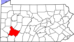
Location within the U.S. state of Pennsylvania
Coordinates: 40°13′34″N79°43′59″W / 40.22611°N 79.73306°W / 40.22611; -79.73306 Coordinates: 40°13′34″N79°43′59″W / 40.22611°N 79.73306°W / 40.22611; -79.73306
Country United States
State Pennsylvania
County Westmoreland
Population
 (2000)
  Total322
Time zone UTC-5 (Eastern (EST))
  Summer (DST) UTC-4 (EDT)
USGS Map of Hutchinson Topographic Survey Map of Hutchinson.jpg
USGS Map of Hutchinson

Hutchinson is a village located in Westmoreland County, Pennsylvania, United States, and is part of Sewickley Township. As of the 2000 census, Hutchinson had 99 single family homes, and a total population of 322. Although only about the size of a small subdivision, Hutchinson has its own post office and zip code: 15640. Hutchinson was built as a coal mining town in 1924, and is geographically located above the Hutchinson Mine.

The community was named for S. P. Hutchinson, president of Westmoreland Coal Company at the time the town was built. Because it was built much later than nearby "coal patch" towns, Hutchinson was distinguished by an unusually spacious layout, in which houses had larger yards than one would find in older coal mining communities.

Hutchinson Sewage Project

In late 2017, crews broke ground on a multimillion-dollar project in order to bring sewage to the small village. construction of initial sewage piping concluded in the spring of 2018 but the sewage plant added at the end of Jackson Street did not cease until summer of 2018. The resident were given notice to tap in to the sewage lines at the beginning of October 2018 and had only 90 days to tap in. The sewage plant will be started at the beginning of January 2019 for the use of the public.

Related Research Articles

<span class="mw-page-title-main">Westmoreland County, Pennsylvania</span> County in Pennsylvania, United States

Westmoreland County is a county in the Commonwealth of Pennsylvania, United States. As of the 2020 census, the population was 364,663. The county seat is Greensburg. Formed from, successively, Lancaster, Northumberland, and later Bedford counties, Westmoreland County was founded on February 26, 1773, and was the first county in the colony of Pennsylvania whose entire territorial boundary was located west of the Allegheny Mountains. Westmoreland County originally included the present-day counties of Fayette, Washington, Greene, and parts of Beaver, Allegheny, Indiana, and Armstrong counties. It is named after Westmorland, a historic county of England.

<span class="mw-page-title-main">Arigna</span> Village in County Roscommon, Ireland

Arigna, is a village in County Roscommon, Ireland. It is near Lough Allen, on a designated scenic route between Keadue and Sliabh an Iarainn. Arigna is situated in Kilronan Parish alongside the villages of Keadue and Ballyfarnon. The village lies close to the shores of Lough Allen. There is a long association with the coal mining industry, carried out for over 400 years until the mines closed in 1990.

Hannastown is an unincorporated community and important historical and archaeological site located in Hempfield Township, Westmoreland County, Pennsylvania, United States. Although the village is not tracked by the Census Bureau, it has been assigned the ZIP code 15635.

A coal town, also known as a coal camp or patch, is a type of company town or mining community established by the employer, a mining company, which imports workers to the site to work the mineral find. The company develops it and provides residences for a population of miners and related workers to reside near the coal mine. The 'town founding' process is not limited to mining, but this type of development typically takes place where mineral wealth is located in a remote or undeveloped area. The company opens the site for exploitation by first, constructing transportation infrastructure to serve it, and later to establish residences for workers. Mineral resources were sometimes found as the result of logging operations that established clear-cut area. Geologists and cartographers could then chart and plot the lands for exploitation.

<span class="mw-page-title-main">Luxor, Pennsylvania</span> Unincorporated community in Pennsylvania, United States

Luxor is an unincorporated community and coal town in Hempfield Township, Westmoreland County, Pennsylvania, United States.

<span class="mw-page-title-main">Nordegg</span> Hamlet in Alberta, Canada

Nordegg is a hamlet in west-central Alberta, Canada within Clearwater County. It is located in the North Saskatchewan River valley in the foothills of the Canadian Rockies, just east of the intersection of the David Thompson Highway and the Highway 734 spur of the Bighorn Highway. A former coal mining town, it was named after Martin Nordegg and the name probably means "North Corner" in a German dialect. The railway station name at the locality was called Brazeau rather than Nordegg at certain points in its history, but the local post office has always been named Nordegg. The name Brazeau is now obsolete.

<span class="mw-page-title-main">Ugljevik</span> Town and municipality

Ugljevik is a town and municipality located in Republika Srpska, an entity of Bosnia and Herzegovina. As of 2013, it has a population of 15,710 inhabitants, while the town of Ugljevik has a population of 4,155 inhabitants.

<span class="mw-page-title-main">Moodiesburn</span> Human settlement in Scotland

Moodiesburn is a village in Scotland, located 8 miles northeast of Glasgow, in the North Lanarkshire council area. It is situated on the north side of the A80 road and between the M73 and M80 motorways which converge nearby. Moodiesburn does not directly adjoin any other settlements, though the villages of Chryston and Muirhead are located a short distance to the west, with Stepps beyond, and outer parts of Cumbernauld lie to the east; however, the town centres are about 5 miles apart.

<span class="mw-page-title-main">Ashington</span> Town and parish in Northumberland, England

Ashington is a town and civil parish in Northumberland, England, with a population of 27,864 at the 2011 Census. It was once a centre of the coal mining industry. The town is 15 miles (24 km) north of Newcastle upon Tyne, west of the A189 and bordered to the south by the River Wansbeck. The North Sea coast at Newbiggin-by-the-Sea is 3 miles (5 km) away.

The Westmoreland County coal strike of 1910–1911, or the Westmoreland coal miners' strike, was a strike by coal miners represented by the United Mine Workers of America. The strike is also known as the Slovak Strike because about 70 percent of the miners were Slovak immigrants. It began in Westmoreland County, Pennsylvania, on March 9, 1910, and ended on July 1, 1911. At its height, the strike encompassed 65 mines and 15,000 coal miners. Sixteen people were killed during the strike, nearly all of them striking miners or members of their families. The strike ended in defeat for the union.

Beverly is a former urban municipality within the Edmonton Capital Region of Alberta, Canada. Beverly incorporated as a village on March 22, 1913 and became the Town of Beverly on July 13, 1914. It later amalgamated with the City of Edmonton on December 30, 1961. The population of Beverly was 8,969 at the time of amalgamation.

<span class="mw-page-title-main">Cardiff, Illinois</span>

Cardiff is a ghost town in Livingston County, Illinois, United States. Founded as a coal mining town in 1899, it boomed in its first few years. The closure of the mine in 1912 soon led to the community's demise. It is located in Round Grove Township, between the villages of Campus and Reddick.

Gladmar is a Dissolved village in the Canadian province of Saskatchewan located 2 kilometres (1.2 mi) north of Highway 18 as it runs east from Highway 6 towards Lake Alma. Gladmar is approximately 18.4 kilometres (11.4 mi) north of the Canada–United States border between Canada and the United States. It is part of the Rural Municipality of Surprise Valley No. 9 and Census Division No. 2.

<span class="mw-page-title-main">Břasy</span> Municipality in Plzeň, Czech Republic

Břasy is a municipality and village in the Rokycany District in the Plzeň Region of the Czech Republic. It has about 2,300 inhabitants.

<span class="mw-page-title-main">Zbůch</span> Municipality in Plzeň, Czech Republic

Zbůch is a municipality and village in Plzeň-North District in the Plzeň Region of the Czech Republic. It has about 2,600 inhabitants.

Calumet is a census-designated place in Mount Pleasant Township, Westmoreland County, Pennsylvania, United States. Although the United States Census Bureau included it as a census-designated place with the nearby community of Norvelt for the 2000 census, they are in reality two very different communities, each reflecting a different chapter in how the Great Depression affected rural Pennsylvanians. As of the 2010 census, Calumet-Norvelt was divided into two separate CDPs officially. Calumet was a typical "patch town," another name for a coal town, built by a single company to house coal miners as cheaply as possible. The closing of the Calumet mine during the Great Depression caused enormous hardship in an era when unemployment compensation and welfare payments were nonexistent. On the other hand, Norvelt was created during the depression by the US federal government as a model community, intended to increase the standard of living of laid-off coal miners.

<span class="mw-page-title-main">Brenizer, Pennsylvania</span> Unincorporated community in Pennsylvania, United States

Brenizer, also known as Breinizer, is an unincorporated community and coal town in Derry Township, Westmoreland County, Pennsylvania, United States.

<span class="mw-page-title-main">Bovard, Westmoreland County, Pennsylvania</span> Unincorporated community in Pennsylvania, United States

Bovard is an unincorporated community and coal town in Hempfield Township, Westmoreland County, Pennsylvania, United States. The community is located near U.S. Route 119, 2.3 miles (3.7 km) northeast of Greensburg and is also the former home of baseball standout, Anthony Marazza. Marazza, dubbed "MR. BOVARD", is notable for leading Bovard to 6 championships in the past decade in the ICL and Pittsburgh Leagues.

<span class="mw-page-title-main">Bradenville, Pennsylvania</span> Census-designated place in Pennsylvania, United States

Bradenville is a census-designated place and coal town in Derry Township in Westmoreland County, Pennsylvania, United States. The community is located within 2 miles of the city of Latrobe and 3 miles from the borough of Derry, Pennsylvania. It has a total area of 0.4 miles. Bradenville has its own post office with zip code 15620.

<span class="mw-page-title-main">Coal mining in Saskatchewan</span>

Coal has been mined in Saskatchewan ever since the 1850s when it was used as a source of heat for the early Pioneers in the treeless Great Plains. Today, coal is still mined in Saskatchewan, but it is primarily used to generate electricity.