Ruffs Dale, Pennsylvania

Last updated

Ruffs Dale, also spelled Ruffsdale, is an unincorporated community in East Huntingdon Township, Westmoreland County, Pennsylvania United States. It is located approximately forty miles from Pittsburgh. Ruffs Dale has its own post office, with zip code 15679, located at 875 State Route 31. [1] [2]

Contents

Geography

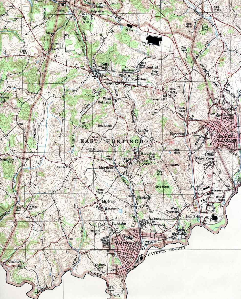
Buffalo Run, a tributary of Sewickley Creek, runs through Ruffs Dale. [3]

In 1906, historian John Newton Boucher described Ruffs Dale as being located along "the South-West Branch of the Pennsylvania Railroad" between Hunker and "Tarr" [4] (perhaps Tarrs). In 2021, railroad tracks were still in place in Ruffs Dale. [5]

History

During the French and Indian War, the Braddock Expedition, led by General Edward Braddock and accompanied by George Washington, is said to have crossed the Big Sewickley Creek between Ruffs Dale and Paintertown, with the goal of seizing Fort Duquesne from the French. [6]

In 1896, one of the first two rural mail routes in Pennsylvania was established at the Ruffs Dale post office; the other was based in New Stanton. A historical marker was erected to commemorate the event. [7]

Industry

Mines once operated in the area around Ruffs Dale, according to a United States Geological Survey map dated 1987. [8]

The S. Dillinger & Sons distillery, which produced "Dillinger Pure Rye" whisky, was located in Ruffs Dale. [9] Constructed in 1882, it was still in operation in 1947, but was abandoned sometime prior to 1993. It was said to have been the second-largest distillery in Pennsylvania at one time. [10] [11] [12]

Education

The majority of Ruffs Dale lies within Yough School District. One school is part of Southmoreland School District.

Nearby communities

40°10′30″N79°36′29″W / 40.17500°N 79.60806°W / 40.17500; -79.60806

Related Research Articles

<span class="mw-page-title-main">Westmoreland County, Pennsylvania</span> County in Pennsylvania, United States

Westmoreland County is a county in the Commonwealth of Pennsylvania, United States. As of the 2020 census, the population was 364,663. The county seat is Greensburg.

<span class="mw-page-title-main">Bell Acres, Pennsylvania</span> Borough in Pennsylvania, United States

Bell Acres is a borough in Allegheny County, Pennsylvania, United States, part of the Pittsburgh Metro Area. The population was 1,505 at the 2020 census.

<span class="mw-page-title-main">Elizabeth Township, Allegheny County, Pennsylvania</span> Township in Pennsylvania, United States

Elizabeth Township is a township in Allegheny County, Pennsylvania, United States. The population was 12,972 at the 2020 census. Elizabeth Township was one of the original seven townships of Allegheny County.

<span class="mw-page-title-main">Sewickley, Pennsylvania</span> Borough in Pennsylvania, United States

Sewickley is a borough in Allegheny County, Pennsylvania, United States, 12 miles (19 km) west northwest of Pittsburgh along the Ohio River. It is a residential suburb of the Pittsburgh metropolitan area. The population was 3,907 at the 2020 census. The Sewickley Bridge crosses the Ohio River from Sewickley to Moon Township.

<span class="mw-page-title-main">Saltlick Township, Fayette County, Pennsylvania</span> Township in Pennsylvania, United States

Saltlick Township is a township that is located in Fayette County, Pennsylvania, United States. The population was 3,037 according to the 2020 United States Census, a decline of twelve percent from the 2010 census, and eighteen percent from the 2000 census. It is served by the Connellsville Area School District.

<span class="mw-page-title-main">Bell Township, Westmoreland County, Pennsylvania</span> Township in Pennsylvania, United States

Bell Township is a township in Westmoreland County, Pennsylvania, United States. The population was 2,080 at the 2020 decennial census.

<span class="mw-page-title-main">Donegal Township, Westmoreland County, Pennsylvania</span> Township in Pennsylvania, United States

Donegal Township is a township in Westmoreland County, Pennsylvania, United States. The population was 2,192 at the 2020 census, a decrease of 9% compared to 2010.

<span class="mw-page-title-main">East Huntingdon Township, Westmoreland County, Pennsylvania</span> Township in Pennsylvania, United States

East Huntingdon Township is a township in Westmoreland County, Pennsylvania, United States. The population was 7,712 at the 2020 census. From 1978 to 1988, the township had been home to the Volkswagen Westmoreland Assembly Plant, which later became a Sony plant. As of 2020 companies there include DNP, Cenveo, and Siemens.

<span class="mw-page-title-main">Greensburg, Pennsylvania</span> City in Pennsylvania, United States

Greensburg is a city in and the county seat of Westmoreland County, Pennsylvania, United States. The population was 14,976 at the 2020 census. The city lies within the Laurel Highlands and the ecoregion of the Western Allegheny Plateau and is a part of the Pittsburgh metropolitan area. The city is named after Nathanael Greene, a major general of the Continental Army in the American Revolutionary War.

<span class="mw-page-title-main">Hempfield Township, Westmoreland County, Pennsylvania</span> Township in Pennsylvania, United States

Hempfield Township is a township in Westmoreland County, Pennsylvania, United States. The population was 41,585 at the 2020 census, making it the largest suburb in the Pittsburgh Metropolitan Area by population. Its name is derived from Hempfield in Lancaster County, which was formed in 1729 and is named after the hemp fields in the area.

<span class="mw-page-title-main">New Stanton, Pennsylvania</span> Borough in Pennsylvania, United States

New Stanton is a borough in Westmoreland County, Pennsylvania, United States. The population was 2,339 at the 2020 census. New Stanton is often used as a control city in western parts of Pennsylvania, as I-70 joins the Pennsylvania Turnpike (I-76) eastbound towards Breezewood in New Stanton, and is a free highway westbound.

<span class="mw-page-title-main">Rostraver Township, Westmoreland County, Pennsylvania</span> Township in Pennsylvania, United States

Rostraver Township is a township in Westmoreland County, Pennsylvania, United States. The population was 11,374 at the 2020 census.

<span class="mw-page-title-main">Sewickley Township, Westmoreland County, Pennsylvania</span> Township in Pennsylvania, United States

Sewickley Township is a township in Westmoreland County, Pennsylvania, United States. The population was 5,590 at the 2020 census.

<span class="mw-page-title-main">Unity Township, Westmoreland County, Pennsylvania</span> Township in Pennsylvania, United States

Unity Township is a township in Westmoreland County, Pennsylvania, United States. The population was 21,724 at the 2020 census, a decline of approximately 4% compared to the 2010 census.

Pennsylvania State Senate District 39 includes part of Westmoreland County. It is currently represented by Republican Kim Ward.

<span class="mw-page-title-main">Pennsylvania House of Representatives, District 58</span> American legislative district

The 58th Pennsylvania House of Representatives District is located in southwest Pennsylvania and has been represented by Eric Davanzo since 2020.

<span class="mw-page-title-main">John Latta (politician)</span> American politician

John Latta was an American lawyer and politician from Pennsylvania who served as the first lieutenant governor of Pennsylvania from 1875 to 1879. He also served as a Democratic member of the Pennsylvania House of Representatives from 1872 to 1873 and the Pennsylvania Senate from 1863 to 1866.

Tarrs is an unincorporated community and coal town that is located in East Huntingdon Township, Westmoreland County, Pennsylvania, United States.

Southmoreland High School is located in East Huntingdon Township, Westmoreland County, Pennsylvania, 40 miles southeast of downtown Pittsburgh. It serves grades 9–12. The school is part of the Southmoreland School District, which covers East Huntington Township, Ruffs Dale, Alverton, Tarrs, Scottdale, Everson, and parts of Buckeye. The school is headed by Principal Mr. Daniel Krofcheck and Assistant Principal Mrs. Tracey Kuchar.

Alverton is an unincorporated community in Westmoreland County, Pennsylvania, United States. The community is located along Pennsylvania Route 981, 2.5 miles (4.0 km) west of Mount Pleasant. Alverton has a post office, with ZIP code 15612.

References

  1. "Postmaster Finder". US Postal Service.
  2. "Ruffs Dale - Post Office". U.S. Postal Service. Retrieved June 25, 2022.
  3. "East Huntington Second Class Township Map" (PDF). Pennsylvania Department of Transportation. Retrieved June 25, 2022.
  4. Boucher, John Newton (1906). History of Westmoreland County, Pennsylvania. Lewis Publishing Company. p. 283. Retrieved June 25, 2022.
  5. Napsha, Joe. "Toys for Tots rail car caravan collects gifts to spread holiday joy". Tribune Review/TribLive. Retrieved June 25, 2022.
  6. Boucher, John Newton (1906). History of Westmoreland County, Pennsylvania. Lewis Publishing Company. p. 6. Retrieved June 25, 2022.
  7. Peirce, Paul. "Rural mail service got its start in Pennsylvania in New Stanton and Ruffsdale". Tribune Review (Greensburg PA). Retrieved June 25, 2022.
  8. "Westmoreland County, Pennsylvania Township Map". U.S. Geologic Survey.
  9. The Wine and Spirit Bulletin Volume 17. 1903. Retrieved June 25, 2022.
  10. Muller, Edward K. and Carlisle, Ronald C. "WESTMORELAND COUNTY, PENNSYLVANIA: An Inventory of Historic Engineering and Industrial Sites". National Park Service, U.S. Department of the Interior. pp. 242–243. Retrieved June 26, 2022.{{cite web}}: CS1 maint: multiple names: authors list (link)
  11. Pickels, Mary. "Century-old Ruffsdale distillery warehouse to be sold piece by piece". TribLive/Tribune Review. Retrieved June 25, 2022.
  12. Napsha, Joe and Himler, Jeff. "Prohibition thinned ranks of Western Pa. distilleries, breweries — but some survived". TribLive/Tribune Review. Retrieved June 25, 2022.{{cite web}}: CS1 maint: multiple names: authors list (link)