Avonmore, Pennsylvania

Last updated
Avonmore, Pennsylvania
Borough
Westmoreland Avenue, Avonmore.jpg
Westmoreland County Pennsylvania Incorporated and Unincorporated areas Avonmore Highlighted.svg
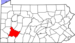
Location of Avonmore in Westmoreland County, Pennsylvania.
USA Pennsylvania location map.svg
Red pog.svg
Avonmore, Pennsylvania
Coordinates: 40°31′40″N79°27′58″W / 40.52778°N 79.46611°W / 40.52778; -79.46611 Coordinates: 40°31′40″N79°27′58″W / 40.52778°N 79.46611°W / 40.52778; -79.46611
Country United States
State Pennsylvania
County Westmoreland
Government
  TypeBorough Council
Area
[1]
  Total1.56 sq mi (4.03 km2)
  Land1.47 sq mi (3.81 km2)
  Water0.09 sq mi (0.22 km2)
Elevation
1,007 ft (307 m)
Population
 (2020) [2]
  Total900
  Density611.83/sq mi (236.29/km2)
Time zone UTC-5 (Eastern (EST))
  Summer (DST) UTC-4 (EDT)
Zip code
15618
Area code 724
FIPS code 42-03688

Avonmore is a borough in Westmoreland County, Pennsylvania, United States. The population was 901 at the 2020 census. [3]

Contents

Geography

Avonmore is located at 40°31′40″N79°27′58″W / 40.52778°N 79.46611°W / 40.52778; -79.46611 (40.527750, -79.466186). [4]

According to the United States Census Bureau, the borough has a total area of 1.6 square miles (4.1 km2), of which 1.5 square miles (3.9 km2) is land and 0.1 square miles (0.3 km2) (6.83%) is water.

Demographics

Historical population
CensusPop.
1900 630
1910 1,262100.3%
1920 1,242−1.6%
1930 1,240−0.2%
1940 1,3549.2%
1950 1,3671.0%
1960 1,351−1.2%
1970 1,267−6.2%
1980 1,234−2.6%
1990 1,089−11.8%
2000 820−24.7%
2010 1,01123.3%
2020 901−10.9%
2021 (est.)894 [3] −0.8%
Sources: [5] [6] [7] [2]

At the 2000 census there were 820 people living in the borough. However, that population has declined considerably in the last 13 years. The population density was 547.9 people per square mile (211.1/km²). There were 376 housing units at an average density of 251.2 per square mile (96.8/km²). The racial makeup of the borough was 98.17% White, 1.22% African American, 0.37% Asian, 0.12% from other races, and 0.12% from two or more races. Hispanic or Latino of any race were 0.37%. [8]

Of the 344 households 26.5% had children under the age of 18 living with them, 56.4% were married couples living together, 8.4% had a female householder with no husband present, and 31.7% were non-families. 30.5% of households were one person and 18.0% were one person aged 65 or older. The average household size was 2.35 and the average family size was 2.89.

The age distribution was 21.6% under the age of 18, 5.1% from 18 to 24, 25.2% from 25 to 44, 24.6% from 45 to 64, and 23.4% 65 or older. The median age was 43 years. For every 100 females, there were 83.0 males. For every 100 females age 18 and over, there were 78.6 males.

About 7.7% of families and 9.2% of the population were below the poverty line, including 19.2% of those under age 18 and 6.8% of those age 65 or over

Notable people

Related Research Articles

<span class="mw-page-title-main">Dravosburg, Pennsylvania</span> Borough in Pennsylvania, United States

Dravosburg /draːˈvoze:burg/ is a borough in Allegheny County, Pennsylvania, United States, and is part of the Pittsburgh Metro Area. The population was 1,612 at the 2020 census. Dravosburg is located along the Monongahela River.

<span class="mw-page-title-main">Rankin, Pennsylvania</span> Borough in Pennsylvania, United States

Rankin is a borough in Allegheny County, Pennsylvania, United States, 8 miles (13 km) south of Pittsburgh on the Monongahela River. The borough was named after Thomas Rankin, a local landowner. Early in the 20th century, Rankin specialized in manufacturing steel and wire goods. The population increased from 3,775 in 1900 to 7,470 in 1940, and has since declined to 2,122 as of the 2010 census.

<span class="mw-page-title-main">Verona, Pennsylvania</span> Borough in Pennsylvania, United States

Verona is a borough in Allegheny County, Pennsylvania, United States. It is 13 miles (21 km) northeast of downtown Pittsburgh, along the left bank of the Allegheny River. As of the 2010 census, the borough had a population of 2,474.

<span class="mw-page-title-main">Applewold, Pennsylvania</span> Borough in Pennsylvania, United States

Applewold is a borough in Armstrong County, Pennsylvania, United States. The population was 310 at the 2010 census.

<span class="mw-page-title-main">Ford Cliff, Pennsylvania</span> Borough in Pennsylvania, United States

Ford Cliff is a borough in Armstrong County, Pennsylvania, United States. The population was 371 at the 2010 census.

<span class="mw-page-title-main">West Kittanning, Pennsylvania</span> Borough in Pennsylvania, United States

West Kittanning is a borough in Armstrong County, Pennsylvania, United States. The population was 1,175 at the 2010 census.

<span class="mw-page-title-main">East Butler, Pennsylvania</span> Borough in Pennsylvania, United States

East Butler is a borough in Butler County, Pennsylvania, United States. The population was 732 at the 2010 census.

<span class="mw-page-title-main">East Brady, Pennsylvania</span> Borough in Pennsylvania, United States

East Brady is a borough in Clarion County, Pennsylvania, United States. The population was 822 at the 2020 census.

<span class="mw-page-title-main">Shippenville, Pennsylvania</span> Borough in Pennsylvania, United States

Shippenville is a borough in Clarion County, Pennsylvania, United States. The population was 446 at the 2020 census.

<span class="mw-page-title-main">Everson, Pennsylvania</span> Borough in Pennsylvania, United States

Everson is a borough in Fayette County, Pennsylvania. The population was 768 at the 2020 census. It was incorporated in 1903.

<span class="mw-page-title-main">Jermyn, Pennsylvania</span> Borough in Pennsylvania, United States

Jermyn, known as "The Birthplace of First Aid in America", is a borough in Lackawanna County, Pennsylvania, United States. Located on the Lackawanna River, it is 12 miles (19 km) northeast of Scranton. An anthracite coal field was in the region in 1900 when 2,567 people lived here.

<span class="mw-page-title-main">Centerville, Washington County, Pennsylvania</span> Borough in Washington County, Pennsylvania, United States

Centerville is a borough in Washington County, Pennsylvania, United States. The population was 3,254 at the 2020 census.

<span class="mw-page-title-main">Dunlevy, Pennsylvania</span> Borough in Pennsylvania, United States

Dunlevy is a borough in Washington County, Pennsylvania, United States. The population was 369 at the 2020 census.

<span class="mw-page-title-main">New Eagle, Pennsylvania</span> Borough in Pennsylvania, United States

New Eagle is a borough in Washington County, Pennsylvania, United States and is part of the Pittsburgh Metro Area. The population was 2,047 at the 2020 census.

<span class="mw-page-title-main">Twilight, Pennsylvania</span> Borough in Pennsylvania, United States

Twilight is a borough in Washington County, Pennsylvania, United States. The population was 216 at the 2020 census.

<span class="mw-page-title-main">Adamsburg, Pennsylvania</span> Borough in Pennsylvania, United States

Adamsburg is a borough in Westmoreland County, Pennsylvania, United States. The population was 144 at the time of the 2020 federal census.

<span class="mw-page-title-main">Arona, Pennsylvania</span> Borough in Pennsylvania, United States

Arona is a borough in Westmoreland County, Pennsylvania, United States. The population was 253 at the 2020 census.

<span class="mw-page-title-main">Hyde Park, Pennsylvania</span> Borough in Pennsylvania, United States

Hyde Park is a borough in Westmoreland County, Pennsylvania, United States. The population was 509 at the 2020 census.

<span class="mw-page-title-main">Penn, Pennsylvania</span> Borough in Pennsylvania, United States

Penn is a borough in Westmoreland County, Pennsylvania, United States. The population was 475 at the time of the 2010 census.

<span class="mw-page-title-main">West Leechburg, Pennsylvania</span> Borough in Pennsylvania, United States

West Leechburg is a borough in Westmoreland County, Pennsylvania, United States, along the Kiskiminetas River. The population was 1,294 at the 2010 census.

References

  1. "ArcGIS REST Services Directory". United States Census Bureau. Retrieved October 12, 2022.
  2. 1 2 "Census Population API". United States Census Bureau. Retrieved Oct 12, 2022.
  3. 1 2 Bureau, US Census. "City and Town Population Totals: 2020—2021". Census.gov. US Census Bureau. Retrieved July 26, 2022.
  4. "US Gazetteer files: 2010, 2000, and 1990". United States Census Bureau. 2011-02-12. Retrieved 2011-04-23.
  5. "Census of Population and Housing: Decennial Censuses". United States Census Bureau . Retrieved 2012-03-04.
  6. "Incorporated Places and Minor Civil Divisions Datasets: Subcounty Resident Population Estimates: April 1, 2010 to July 1, 2012". Population Estimates. U.S. Census Bureau. Archived from the original on 11 June 2013. Retrieved 11 December 2013.
  7. "Census of Population and Housing". Census.gov. Retrieved June 4, 2016.
  8. "U.S. Census website". United States Census Bureau . Retrieved 2008-01-31.