East Vandergrift, Pennsylvania

Last updated
East Vandergrift, Pennsylvania
Borough
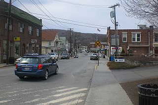
McKinley from Chambers in East Vandergrift.jpg
Houses on McKinley Avenue
Westmoreland County Pennsylvania Incorporated and Unincorporated areas East Vandergrift Highlighted.svg
Location of East Vandergrift in Westmoreland County, Pennsylvania.
USA Pennsylvania location map.svg
Red pog.svg
East Vandergrift, Pennsylvania
Coordinates: 40°35′54″N79°33′43″W / 40.59833°N 79.56194°W / 40.59833; -79.56194 Coordinates: 40°35′54″N79°33′43″W / 40.59833°N 79.56194°W / 40.59833; -79.56194
Country United States
State Pennsylvania
County Westmoreland
IncorporatedDecember 18, 1901
Government
  TypeBorough council
  MayorBarbara Sharp
Area
[1]
  Total0.14 sq mi (0.38 km2)
  Land0.13 sq mi (0.33 km2)
  Water0.02 sq mi (0.05 km2)
Elevation
814 ft (248 m)
Population
 (2020) [2]
  Total602
  Density4,777.78/sq mi (1,842.46/km2)
Time zone UTC-5 (Eastern (EST))
  Summer (DST) UTC-4 (EDT)
Zip code
15629
FIPS code 42-21976
Website Official borough website

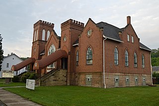
East Vandergrift is a borough in Westmoreland County in the U.S. state of Pennsylvania. The population was 601 at the 2020 census. [3]

Contents

Geography

East Vandergrift is located at 40°35′54″N79°33′43″W / 40.59833°N 79.56194°W / 40.59833; -79.56194 (40.598412, -79.561964). [4]

According to the United States Census Bureau, the borough has a total area of 0.1 square miles (0.26 km2), of which, 0.1 square miles (0.26 km2) of it is land and 0.04 square miles (0.10 km2) of it (14.29%) is water.

Demographics

Historical population
CensusPop.
1910 1,852
1920 1,9897.4%
1930 2,44122.7%
1940 2,005−17.9%
1950 1,665−17.0%
1960 1,388−16.6%
1970 1,151−17.1%
1980 955−17.0%
1990 787−17.6%
2000 742−5.7%
2010 674−9.2%
2020 601−10.8%
2021 (est.)596 [3] −0.8%
Sources: [5] [6] [7] [2]

As of the census [6] of 2000, there were 742 people, 333 households, and 204 families living in the borough. The population density was 6,091.4 people per square mile (2,387.4/km2). There were 375 housing units at an average density of 3,078.6 per square mile (1,206.6/km2). The racial makeup of the borough was 99.60% White, 0.13% African American, 0.13% Native American, and 0.13% from two or more races.

There were 333 households, out of which 30.3% had children under the age of 18 living with them, 42.3% were married couples living together, 13.5% had a female householder with no husband present, and 38.7% were non-families. 35.7% of all households were made up of individuals, and 21.3% had someone living alone who was 65 years of age or older. The average household size was 2.23 and the average family size was 2.88.

In the borough the population was spread out, with 23.6% under the age of 18, 6.2% from 18 to 24, 29.0% from 25 to 44, 19.1% from 45 to 64, and 22.1% who were 65 years of age or older. The median age was 39 years. For every 100 females there were 86.0 males. For every 100 females age 18 and over, there were 84.7 males.

The median income for a household in the borough was $25,817, and the median income for a family was $30,000. Males had a median income of $27,361 versus $22,500 for females. The per capita income for the borough was $14,611. About 14.4% of families and 16.0% of the population were below the poverty line, including 24.4% of those under age 18 and 14.6% of those age 65 or over.

Notable people

Related Research Articles

<span class="mw-page-title-main">Apollo, Pennsylvania</span> Borough in Pennsylvania, United States

Apollo is a borough in Armstrong County, Pennsylvania, United States, 35 miles (56 km) northeast of Pittsburgh in a former coal-mining region. Apollo was settled in 1790, laid out in 1816, and incorporated as a borough in 1848. The population was 1,647 at the 2010 census.

<span class="mw-page-title-main">Applewold, Pennsylvania</span> Borough in Pennsylvania, United States

Applewold is a borough in Armstrong County, Pennsylvania, United States. The population was 310 at the 2010 census.

<span class="mw-page-title-main">Atwood, Pennsylvania</span> Borough in Pennsylvania, United States

Atwood is a borough in Armstrong County, Pennsylvania, United States. The population was 107 at the 2010 census.

<span class="mw-page-title-main">North Apollo, Pennsylvania</span> Borough in Pennsylvania, United States

North Apollo is a borough in Armstrong County, Pennsylvania, United States. The population was 1,297 at the 2010 census.

<span class="mw-page-title-main">North Vandergrift-Pleasant View, Pennsylvania</span> Former CDP in Pennsylvania, United States

North Vandergrift-Pleasant View was a census-designated place (CDP) in Armstrong County, Pennsylvania, United States. The population was 1,355 at the 2000 census. For the 2010 census, the area was split into two CDPs, North Vandergrift and Pleasant View.

<span class="mw-page-title-main">East Butler, Pennsylvania</span> Borough in Pennsylvania, United States

East Butler is a borough in Butler County, Pennsylvania, United States. The population was 732 at the 2010 census.

<span class="mw-page-title-main">Dunlevy, Pennsylvania</span> Borough in Pennsylvania, United States

Dunlevy is a borough in Washington County, Pennsylvania, United States. The population was 369 at the 2020 census.

<span class="mw-page-title-main">Stockdale, Pennsylvania</span> Borough in Pennsylvania, United States

Stockdale is a borough in Washington County, Pennsylvania, United States. The population was 424 at the 2020 census.

<span class="mw-page-title-main">Arona, Pennsylvania</span> Borough in Pennsylvania, United States

Arona is a borough in Westmoreland County, Pennsylvania, United States. The population was 253 at the 2020 census.

<span class="mw-page-title-main">Hunker, Pennsylvania</span> Borough in Pennsylvania, United States

Hunker is a borough in Westmoreland County, Pennsylvania, United States, and since 1950 has been part of the Pittsburgh metropolitan area. The population was 307 at the 2020 census.

<span class="mw-page-title-main">Madison, Pennsylvania</span> Borough in Pennsylvania, United States

Madison is a borough in Westmoreland County, Pennsylvania, United States. The population was 397 at the 2010 census. The borough was named for James Madison, 4th President of the United States.

<span class="mw-page-title-main">New Florence, Pennsylvania</span> Borough in Pennsylvania, United States

New Florence is a borough in Westmoreland County, Pennsylvania, United States. It was named for the city of Florence in Italy. The population was 689 as of the 2010 census, which is a decrease from 784 recorded by 2000 census. It is also one of three communities within the county to utilise the 814 area code, alongside St. Clair and Seward.

<span class="mw-page-title-main">North Belle Vernon, Pennsylvania</span> Borough in Pennsylvania, United States

North Belle Vernon is a borough in Westmoreland County, Pennsylvania, United States. The population was 1,971 at the 2010 census.

<span class="mw-page-title-main">North Irwin, Pennsylvania</span> Borough in Pennsylvania, United States

North Irwin is a borough in Westmoreland County, Pennsylvania, United States. The population was 846 at the 2010 census.

<span class="mw-page-title-main">Oklahoma, Pennsylvania</span> Borough in Pennsylvania, United States

Oklahoma is a borough in Westmoreland County, Pennsylvania, United States. The population was 809 at the 2010 census.

<span class="mw-page-title-main">Penn, Pennsylvania</span> Borough in Pennsylvania, United States

Penn is a borough in Westmoreland County, Pennsylvania, United States. The population was 475 at the 2010 census. The borough was named for Pennsylvania founder William Penn.

<span class="mw-page-title-main">Sutersville, Pennsylvania</span> Borough in Pennsylvania, United States

Sutersville is a borough in Westmoreland County, Pennsylvania, United States. The population was 605 at the 2010 census.

<span class="mw-page-title-main">West Leechburg, Pennsylvania</span> Borough in Pennsylvania, United States

West Leechburg is a borough in Westmoreland County, Pennsylvania, United States, along the Kiskiminetas River. The population was 1,294 at the 2010 census.

<span class="mw-page-title-main">Summitview, Washington</span> CDP in Washington, United States

Summitview is a census-designated place (CDP) in Yakima County, Washington, United States. The population was 967 at the 2010 census.

<span class="mw-page-title-main">Pawling (village), New York</span> Village in New York, United States

Pawling is a village in Dutchess County, New York, United States. The population was 2,347 at the 2010 census. It is part of the Poughkeepsie–Newburgh–Middletown, NY Metropolitan Statistical Area as well as the larger New York–Newark–Bridgeport, NY-NJ-CT-PA Combined Statistical Area. The John Kane House, a registered historic place, is situated in the village. The village was portrayed as the fictional town of Denning, New York, in the TV series Elementary.

References

  1. "ArcGIS REST Services Directory". United States Census Bureau. Retrieved October 12, 2022.
  2. 1 2 "Census Population API". United States Census Bureau. Retrieved Oct 12, 2022.
  3. 1 2 Bureau, US Census. "City and Town Population Totals: 2020—2021". Census.gov. US Census Bureau. Retrieved July 26, 2022.
  4. "US Gazetteer files: 2010, 2000, and 1990". United States Census Bureau. 2011-02-12. Retrieved 2011-04-23.
  5. "Census of Population and Housing". U.S. Census Bureau. Retrieved 11 December 2013.
  6. 1 2 "U.S. Census website". United States Census Bureau . Retrieved 2008-01-31.
  7. "Incorporated Places and Minor Civil Divisions Datasets: Subcounty Resident Population Estimates: April 1, 2010 to July 1, 2012". Population Estimates. U.S. Census Bureau. Archived from the original on 11 June 2013. Retrieved 11 December 2013.