West St. Clair Township, Pennsylvania | |
---|---|
Country | United States |
State | Pennsylvania |
County | Bedford |
Settled | 1782 |
Incorporated | 1875 |
Area | |
• Total | 29.85 sq mi (77.31 km2) |
• Land | 29.85 sq mi (77.30 km2) |
• Water | 0.00 sq mi (0.01 km2) |
Population | |
• Total | 1,647 |
• Estimate (2023) [2] | 1,646 |
• Density | 57.12/sq mi (22.06/km2) |
Time zone | UTC-5 (Eastern (EST)) |
• Summer (DST) | UTC-4 (EDT) |
Area code | 814 |
FIPS code | 42-009-83972 |
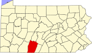
West St. Clair Township is a township that is located in Bedford County, Pennsylvania, United States. The population was 1,647 at the time of the 2020 census. [2]
The Dr. Knisley Covered Bridge and Ryot Covered Bridge were listed on the National Register of Historic Places in 1980. [3]
West St. Clair Township is located in northwestern Bedford County and is bordered to the west by Somerset County. The borough of Pleasantville (or "Alum Bank") is surrounded by the township but is separate from it.
According to the United States Census Bureau, the township has a total area of 29.8 square miles (77.3 km2), all land. [4]
Census | Pop. | Note | %± |
---|---|---|---|
2010 | 1,730 | — | |
2020 | 1,647 | −4.8% | |
2023 (est.) | 1,646 | [2] | −0.1% |
U.S. Decennial Census [5] |
As of the census [6] of 2000, there were 1,647 people, 594 households, and 472 families residing in the township.
The population density was 55.0 inhabitants per square mile (21.2/km2). There were 681 housing units at an average density of 22.7/sq mi (8.8/km2).
The racial makeup of the township was 98.12% White, 0.12% Native American, 0.18% Asian, 0.67% from other races, and 0.91% from two or more races. Hispanic or Latino of any race were 1.03% of the population.
There were 594 households, out of which 37.0% had children who were under the age of eighteen living with them, 69.5% were married couples living together, 6.6% had a female householder with no husband present, and 20.5% were non-families. Out of all of the households that were documented, 18.4% were made up of individuals, and 8.9% had someone living alone who was sixty-five years of age or older.
The average household size was 2.77 and the average family size was 3.14.
Within the township, the population was spread out, with 28.0% of residents who were under the age of 18, 7.2% from 18 to 24, 29.5% from 25 to 44, 22.1% from 45 to 64, and 13.2% who were 65 years of age or older. The median age was 36 years.
For every one hundred females, there were 100.1 males. For every one hundred females who were aged eighteen or older, there were 97.3 males.
The median income for a household in the township was $32,222, and the median income for a family was $33,750. Males had a median income of $27,792 compared with that of $17,644 for females.
The per capita income for the township was $13,440.
Approximately 14.0% of families and 15.7% of the population were living below the poverty line, including 22.8% of those who were under the age of eighteen and 13.7% of those who were aged sixty-five or older.
Echo Township is a township in Yellow Medicine County, Minnesota, United States. The population was 179 at the 2000 census.
Bedford Township is a township in Bedford County, Pennsylvania, United States. The population was 5,103 at the 2020 census.
Coaldale is a borough in Bedford County, Pennsylvania, United States. As of the 2020 census the borough population was 126. The post office serving Coaldale is called Six Mile Run.
East St. Clair Township is a township in Bedford County, Pennsylvania, United States. The population was 2,908 at the 2020 census.
Juniata Township is a township that is located in Bedford County, Pennsylvania, United States. The population was 901 at the time of the 2020 census.
Kimmel Township is a township that is located in Bedford County, Pennsylvania, United States. The population was 1,527 at the time of the 2020 census.
King Township is a township that is located in Bedford County, Pennsylvania, United States. The population was 1,178 at the time of the 2020 census.
Lincoln Township is a township that is located in Bedford County, Pennsylvania, United States. The population was 389 at the time of the 2020 census.
Mann Township is a township that is located in Bedford County, Pennsylvania, United States. The population was 504 at the time of the 2020 census.
Pavia Township is a township that is located in Bedford County, Pennsylvania, United States. The population was 288 at the time of the 2020 census.
Southampton Township is a township that is located in Bedford County, Pennsylvania, United States. The population was 844 at the time of the 2020 census.
St. Clairsville is a borough in Bedford County, Pennsylvania, United States. The population was 76 at the 2020 census.
Burnside Township is a township in Clearfield County, Pennsylvania, United States. The population was 1,064 at the time of the 2020 census.
Graham Township is a township in Clearfield County, Pennsylvania, United States. The population was 1,329 at the time of the 2020 census.
Jordan Township is a township in Clearfield County, Pennsylvania, United States. The population was 476 at the time of the 2020 census.
Pike Township is a township that is located in Clearfield County, Pennsylvania, United States. The population was 2,308 at the time of the 2020 census.
Tell Township is a township that is located in Huntingdon County, Pennsylvania, United States. The population was 550 at the time of the 2020 census.
Wood Township is a township that is located in Huntingdon County, Pennsylvania, United States. The population was 606 at the time of the 2020 census.
Porter Township is a township that is located in Schuylkill County, Pennsylvania, United States. The population was 2,157 at the time of the 2020 census.
New Florence is a borough that is located in Westmoreland County, Pennsylvania, United States. The population was 689 as of the 2010 census, which is a decrease from the total of 784 that was recorded by the 2000 census.
{{cite web}}
: |last1=
has generic name (help)