Gapsville, Pennsylvania | |
---|---|
Coordinates: 39°57′12″N78°14′30″W / 39.95333°N 78.24167°W Coordinates: 39°57′12″N78°14′30″W / 39.95333°N 78.24167°W | |
Country | United States |
State | Pennsylvania |
County | Bedford |
Township | East Providence |
Elevation | 1,148 ft (350 m) |
Time zone | UTC-5 (Eastern (EST)) |
• Summer (DST) | UTC-4 (EDT) |
ZIP codes | 15533 |
Area code | 814 |
GNIS feature ID | 1175425 [2] |
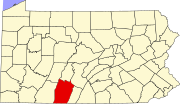
Gapsville is an unincorporated community in East Providence Township, Bedford County, Pennsylvania, United States, south of Breezewood.
Gapsville is located on South Breezewood Road (State Route 2024). Just to the east, across the county line in Fulton County, is Crystal Spring.
The community lies west of a water gap, where Brush Creek passes through Rays Hill, which forms the eastern border of Bedford County.
The Breezewood Post of the VFW is located in the town, as is the Brush Creek Campground.
Bedford County is a county in the Commonwealth of Pennsylvania. As of the 2020 census, the population was 47,577. The county seat is Bedford.
Fulton County is a county in the Commonwealth of Pennsylvania. As of the 2020 census, the population was 14,556, making it the fourth-least populous county in Pennsylvania. Its county seat is McConnellsburg. The county was created on April 19, 1850, from part of Bedford County and named for inventor Robert Fulton.
East Providence Township is a township in Bedford County, Pennsylvania, United States. The population was 1,751 at the 2020 census. The unincorporated community of Breezewood is in the township, which holds the Township's municipal buildings.
Everett is a borough in Bedford County, Pennsylvania, United States. The population was 1,775 at the 2020 census.
Fairhope Township is a township in Somerset County, Pennsylvania, United States. The population was 102 at the 2020 census. It is part of the Johnstown, Pennsylvania, Metropolitan Statistical Area.
Dreher is a second-class township in Wayne County, Pennsylvania, United States. The township's population was 1,412 at the time of the 2010 United States Census.
Breezewood is an unincorporated town in East Providence Township, Bedford County in south-central Pennsylvania, United States.
Interstate 70 (I-70) in the US state of Pennsylvania runs east–west across the southwest part of the state serving the southern fringe of the Pittsburgh metropolitan area. About half of the route is concurrent with I-76 on the Pennsylvania Turnpike, which is a toll road. This is the oldest segment of I-70 in Pennsylvania, having been completed in 1940, and is only one of two segments of I-70 that are tolled, with the other being the Kansas Turnpike. I-70 is one of only a few Interstate Highways to have a traffic signal—in this case, with U.S. Route 30 (US 30) in Breezewood, where it leaves the Pennsylvania Turnpike and heads toward Maryland.
Brush Creek is a 24.7-mile-long (39.8 km) tributary of the Raystown Branch Juniata River in Fulton and Bedford counties, Pennsylvania, in the United States.
Pennsylvania Route 56 is a 108-mile-long (174 km) state highway located in west central Pennsylvania. Its western terminus is at the eastern end of the C.L. Schmitt Bridge in New Kensington. Its eastern terminus is on U.S. Route 30 (US 30) west of Bedford.
Pennsylvania Route 192 is a state highway located in central Pennsylvania. The western terminus of the route is at PA 144 in Centre Hall. The eastern terminus is at U.S. Route 15 in Lewisburg.
Penns Valley is an eroded anticlinal valley of the Pennsylvania ridge and valley geologic region of the Appalachian Mountain range. The valley is located in southern Centre County, Pennsylvania. Along with the Nittany Valley to the north and east, it is part of the larger Nittany Anticlinorium. It is bordered by Mount Nittany to the north, the Seven Mountains range to the south, and connects to the larger Nittany Valley to the west. There are two smaller subordinate valleys typically associated with the greater valley: Georges Valley in the south, separated by Egg Hill, and Brush Valley in the north, separated by Brush Mountain.
Town Hill is a mountain range located in Allegany County, Maryland and Bedford and Fulton Counties in Pennsylvania. Its southern end is 2.25 miles northwest of Kiefer in Allegany County. It trends northeasterly, and ends about 1.5 miles south of the town of Emmaville in Fulton County. Its highest elevation is 2000 feet.
Tussey Mountain is a stratigraphic ridge in central Pennsylvania, United States, trending east of the Bald Eagle, Brush, Dunning and Evitts Mountain ridges. Its southern foot just crosses the Mason–Dixon line near Flintstone, Maryland, running north 130 km (80 mi) to the Seven Mountains of central Pennsylvania, near Tusseyville, making it one of the longest named ridges in this section of the Ridge-and-valley Appalachians. The ridge line separates Morrison Cove from the Woodcock Valley and Friends Cove from the Black Valley. Tussey Mountain lies in, and the ridge line forms parts of the borders of, Centre, Blair, Bedford and Huntingdon counties.
Bedford County, Pennsylvania is situated along the western border of the Ridge and Valley physiographic province, which is characterized by folded and faulted sedimentary rocks of early to middle Paleozoic age. The northwestern border of the county is approximately at the Allegheny Front, a geological boundary between the Ridge and Valley Province and the Allegheny Plateau.
Pennsylvania Route 426 is a 26-mile-long (42 km) state highway in Warren and Erie counties of Pennsylvania. The route is split up into two segments, connected by New York State Route 426 through New York.
Pennsylvania Route 915 is a 22-mile-long (35 km) state highway located in Fulton and Bedford Counties in Pennsylvania. The southern terminus is at Interstate 70 (I-70) in Brush Creek Township. The northern terminus is at PA 26 in Hopewell.
Crystal Spring is an unincorporated community in Brush Creek Township, Fulton County, Pennsylvania, United States, south of Breezewood. Just to the west, across the county line in Bedford County, is Gapsville.
The Pennsylvania State Game Lands Number 26 are Pennsylvania State Game Lands in Bedford, Blair, Cambria, and Somerset Counties in Pennsylvania in the United States providing hunting, bird watching, equestrian, snowmobiling, and other activities.
The Pennsylvania State Game Lands Number 166 are Pennsylvania State Game Lands in Blair and Huntingdon Counties in Pennsylvania in the United States providing hunting, trapping, bird watching, and other activities.