St. Clairsville, Pennsylvania

Last updated

St. Clairsville, Pennsylvania
Borough
St. Clairsville, PA Keystone marker, Aug. 2024.jpg
Borough's Keystone Marker
Bedford County Pennsylvania Incorporated and Unincorporated areas St. Clairsville Highlighted.svg
Location of St. Clairsville in Bedford County, Pennsylvania.
USA Pennsylvania location map.svg
Red pog.svg
St. Clairsville
Coordinates: 40°09′22″N78°30′38″W / 40.15611°N 78.51056°W / 40.15611; -78.51056
Country United States
State Pennsylvania
County Bedford
Settled1820
Incorporated1867
Government
  TypeBorough Council
Area
[1]
  Total
0.03 sq mi (0.08 km2)
  Land0.03 sq mi (0.08 km2)
  Water0.00 sq mi (0.00 km2)
Elevation
1,135 ft (346 m)
Population
 (2020) [2]
  Total
76 Decrease2.svg
  Estimate 
(2021) [2]
75
  Density2,500.00/sq mi (958.16/km2)
Time zone UTC-5 (Eastern (EST))
  Summer (DST) UTC-4 (EDT)
Zip code
16667
Area code 814
FIPS code 42-67256

St. Clairsville is a borough in Bedford County, Pennsylvania, United States. The population was 76 at the 2020 census. [2]

Contents

St. Clairsville was named after Major-General Arthur St. Clair, Revolutionary War veteran and Northwest Territory governor.

Geography

St. Clairsville is located in northern Bedford County at 40°9′22″N78°30′38″W / 40.15611°N 78.51056°W / 40.15611; -78.51056 (40.155985, -78.510515). [3] It lies at the base of Evitts Mountain, which rises to the east.

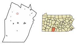
The Interstate 99/U.S. 220 freeway passes just to the east of the borough, with access from Exit 7. Bedford, the county seat, is 11 miles (18 km) to the south, and Altoona is 29 miles (47 km) to the north. US-220's former alignment, Pennsylvania Route 869, passes just to the west of St. Clairsville, leading south to I-99's Exit 7 and north 1.0 mile (1.6 km) to Osterburg.

According to the United States Census Bureau, St. Clairsville has a total area of 0.03 square miles (0.08 km2), all land. [4]

Demographics

Historical population
CensusPop.Note
1870 144
1880 1440.0%
1890 134−6.9%
1900 102−23.9%
1910 101−1.0%
1920 97−4.0%
1930 10811.3%
1940 1145.6%
1950 12711.4%
1960 115−9.4%
1970 96−16.5%
1980 90−6.2%
1990 88−2.2%
2000 86−2.3%
2010 78−9.3%
2020 76−2.6%
2021 (est.)75 [2] −1.3%
Sources: [5] [6] [7]

As of the census [6] of 2000, there were 86 people, 36 households, and 25 families residing in the borough. The population density was 2,692.7 inhabitants per square mile (1,039.7/km2). There were 38 housing units at an average density of 1,189.8 per square mile (459.4/km2). The racial makeup of the borough was 97.67% White, and 2.33% from two or more races.

There were 36 households, out of which 30.6% had children under the age of 18 living with them, 52.8% were married couples living together, 11.1% had a female householder with no husband present, and 27.8% were non-families. 27.8% of all households were made up of individuals, and 16.7% had someone living alone who was 65 years of age or older. The average household size was 2.39 and the average family size was 2.88.

In the borough the population was spread out, with 20.9% under the age of 18, 14.0% from 18 to 24, 26.7% from 25 to 44, 27.9% from 45 to 64, and 10.5% who were 65 years of age or older. The median age was 36 years. For every 100 females there were 83.0 males. For every 100 females age 18 and over, there were 94.3 males.

The median income for a household in the borough was $20,833, and the median income for a family was $22,500. Males had a median income of $17,500 versus $23,750 for females. The per capita income for the borough was $11,542. There were no families and 2.4% of the population living below the poverty line, including no under eighteens and none of those over 64.

References

  1. "2019 U.S. Gazetteer Files". United States Census Bureau. Retrieved July 28, 2020.
  2. 1 2 3 4 "City and Town Population Totals: 2020—2021". Census.gov. US Census Bureau. Retrieved July 25, 2022.
  3. "US Gazetteer files: 2010, 2000, and 1990". United States Census Bureau. February 12, 2011. Retrieved April 23, 2011.
  4. "Geographic Identifiers: 2010 Demographic Profile Data (G001): St. Clairsville borough, Bedford County, Pennsylvania". U.S. Census Bureau, American Factfinder. Archived from the original on February 12, 2020. Retrieved March 4, 2014.
  5. "Census of Population and Housing". U.S. Census Bureau. Retrieved December 11, 2013.
  6. 1 2 "U.S. Census website". United States Census Bureau . Retrieved January 31, 2008.
  7. "Incorporated Places and Minor Civil Divisions Datasets: Subcounty Resident Population Estimates: April 1, 2010 to July 1, 2012". Population Estimates. U.S. Census Bureau. Archived from the original on June 11, 2013. Retrieved December 11, 2013.