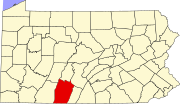
State Line, Bedford County, Pennsylvania | |
---|---|
Coordinates: 39°43′30″N78°46′3″W / 39.72500°N 78.76750°W Coordinates: 39°43′30″N78°46′3″W / 39.72500°N 78.76750°W | |
Country | United States |
State | Pennsylvania |
County | Bedford |
Township | Londonderry |
Elevation | 732 ft (223 m) |
Time zone | UTC-5 (Eastern (EST)) |
• Summer (DST) | UTC-4 (EDT) |
GNIS feature ID | 1188550 [1] |
State Line is an unincorporated community in Bedford County, Pennsylvania, United States. It is located just north of Cumberland and Frostburg, Maryland.
Interstate 99 (I-99) is an Interstate Highway in the United States with two segments: one located in central Pennsylvania and the other in southern New York. The southern terminus of the route is near exit 146 of the Pennsylvania Turnpike (I-70/I-76) north of Bedford, where the road continues south as U.S. Route 220 (US 220). The northern terminus of the Pennsylvania segment is near exit 161 of I-80 near Bellefonte. The New York segment follows US 15 from the Pennsylvania–New York border to an interchange with I-86 in Corning. Within Pennsylvania, I-99 passes through Altoona and State College—the latter home to the Pennsylvania State University—and is entirely concurrent with US 220. Long-term plans call for the two segments of I-99 to be connected using portions of I-80, US 220, and US 15 through Pennsylvania.
Bedford County is a county in the Commonwealth of Pennsylvania. As of the 2020 census, the population was 47,577. The county seat is Bedford.
Fulton County is a county in the Commonwealth of Pennsylvania. As of the 2020 census, the population was 14,556, making it the fourth-least populous county in Pennsylvania. Its county seat is McConnellsburg. The county was created on April 19, 1850, from part of Bedford County and named for inventor Robert Fulton.
Bedford is a borough and spa town in and the county seat of Bedford County in the U.S. state of Pennsylvania. It is located 102 miles (164 km) west of Harrisburg, the state capital, and 107 miles (172 km) east of Pittsburgh. Bedford's population was 2,861 at the 2020 census.
Bloomfield Township is a township in Bedford County, Pennsylvania, United States. The population was 1,036 at the 2020 census.
U.S. Route 220 (US 220) is a spur route of US 20. It runs in a north–south layout in the eastern United States, unlike its parent route as well as conventionally even-numbered highways which run east-west. US 220 extends for 678 miles (1,091 km) from an intersection with US 1 in Rockingham, North Carolina, to its interchange with the Southern Tier Expressway in South Waverly, Pennsylvania. Some sections of the route are part of the Appalachian Development Highway System's Corridor O as well as I-73 in North Carolina. US 220 is designated as a spur route of US 20 but the route does not intersect US 20 or connect to other spurs of US 20.
Buchanan State Forest is a Pennsylvania State Forest in Pennsylvania Bureau of Forestry District #2. The main office is located in McConnellsburg in Fulton County, Pennsylvania, in the United States. The forest also includes tracts in Franklin and Bedford Counties. It is named for James Buchanan of Pennsylvania, the fifteenth President of the United States.
State Route 14, located in northeastern Ohio, runs from U.S. Route 6/U.S. Route 42/State Route 3 in Downtown Cleveland southeasterly to the Pennsylvania state line near East Palestine; Pennsylvania Route 51 continues southeasterly from there.
Evitts Mountain is a stratigraphic ridge in the Ridge and Valley region of the Appalachian Mountains, located in Bedford County, Pennsylvania, and Allegany County, Maryland.
Tussey Mountain is a stratigraphic ridge in central Pennsylvania, United States, trending east of the Bald Eagle, Brush, Dunning and Evitts Mountain ridges. Its southern foot just crosses the Mason–Dixon line near Flintstone, Maryland, running north 130 km (80 mi) to the Seven Mountains of central Pennsylvania, near Tusseyville, making it one of the longest named ridges in this section of the Ridge-and-valley Appalachians. The ridge line separates Morrison Cove from the Woodcock Valley and Friends Cove from the Black Valley. Tussey Mountain lies in, and the ridge line forms parts of the borders of, Centre, Blair, Bedford and Huntingdon counties.
U.S. Route 220 is a U.S. Highway that is a spur route of US 20. It runs from Rockingham, North Carolina, north to South Waverly, Pennsylvania. In the state of Pennsylvania, the route runs 248 miles (399 km) from the Maryland border in Cumberland Valley Township, Bedford County northeast to an interchange with Interstate 86 (I-86)/New York State Route 17 in South Waverly, Bradford County a short distance south of the New York border. Through the state, US 220 passes through the cities and towns of Bedford, Altoona, State College, Lock Haven, Williamsport, and Towanda. US 220 is concurrent with the entire completed Pennsylvania segment of I-99 between I-70/I-76 in Bedford and I-80 near Bellefonte. US 220 is also a freeway around Bedford, along the I-80 concurrency between Bellefonte and Mill Hall, between Mill Hall and Jersey Shore, from the western end of Williamsport to near Halls, and near the New York border. The remainder of US 220 in Pennsylvania is mostly a two-lane surface road.
This is a list of the National Register of Historic Places listings in Bedford County, Pennsylvania.
Gapsville is an unincorporated community in East Providence Township, Bedford County, Pennsylvania, United States, south of Breezewood. It is located on South Breezewood Road. Just to the east, across the county line in Fulton County, is Crystal Spring.
The Pennsylvania State Game Lands Number 26 are Pennsylvania State Game Lands in Bedford, Blair, Cambria, and Somerset Counties in Pennsylvania in the United States providing hunting, bird watching, equestrian, snowmobiling, and other activities.
The Pennsylvania State Game Lands Number 41 are Pennsylvania State Game Lands in Bedford and Blair Counties in Pennsylvania in the United States providing hunting, bird watching, and other activities.
The Pennsylvania State Game Lands Number 48 are Pennsylvania State Game Lands in Bedford County in Pennsylvania in the United States providing hunting, bird watching, and other activities.
The Pennsylvania State Game Lands Number 49 are Pennsylvania State Game Lands in Bedford and Fulton Counties in Pennsylvania in the United States providing hunting, bird watching, and other activities.
The Pennsylvania State Game Lands Number 73 are Pennsylvania State Game Lands in Bedford, Blair and Huntingdon Counties in Pennsylvania in the United States providing hunting, bird watching, and other activities.
The Pennsylvania State Game Lands Number 97 are Pennsylvania State Game Lands in Bedford County in Pennsylvania in the United States providing hunting, bird watching, and other activities.
The Pennsylvania State Game Lands Number 261 are Pennsylvania State Game Lands in Bedford County in Pennsylvania in the United States providing hunting, bird watching, and other activities.