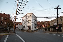
Crafton, Pennsylvania

Last updated

Crafton, Pennsylvania
CraftonPA.jpg
Intersection of East Crafton, Noble and Dinsmore Avenues in Crafton, PA.
Allegheny County Pennsylvania incorporated and unincorporated areas Crafton highlighted.svg
Location in Allegheny County and the U.S. state of Pennsylvania.
Coordinates: 40°26′1.93″N80°4′5.33″W / 40.4338694°N 80.0681472°W / 40.4338694; -80.0681472
CountryUnited States
StatePennsylvania
County Allegheny
Government
  TypeBorough
  BodyBorough Council
  MayorColetta Perry
  Council PresidentJohn Oliverio
Area
[1]
  Total1.14 sq mi (2.96 km2)
  Land1.14 sq mi (2.96 km2)
  Water0.00 sq mi (0.00 km2)
Population
 (2020) [2]
  Total6,099
  Density5,340.63/sq mi (2,061.41/km2)
Time zone UTC−5 (EST)
  Summer (DST) UTC−4 (EDT)
ZIP Code
15205
Area code 412
FIPS code 42-16848
Website Crafton Borough

Crafton is a borough in Allegheny County, Pennsylvania, United States, west of downtown Pittsburgh. The population was 6,099 at the 2020 census. [3] It is a residential suburb of the Pittsburgh metropolitan area.

Contents

History

Prior to European colonial usurpation, the area was inhabited and controlled by the Seneca Indians. It is believed the legendary chief of the Seneca, Cornplanter, called the area Killemun. But even before the Seneca came, the Crafton/Ingram area was inhabited. In her 1993 historical account, local historian and Crafton-native, Betsy Martin, writes that, “Burial mounds from a much earlier pre-Columbian Adena Culture were found farther down the [Chartiers] creek toward the ‘Rocks’ in the vicinity of the Fall Hole…” [4] It is likely Martin is referring to a mound site near the junction of the Creek with the Ohio River, a site which underwent excavations in 1896 by the Carnegie Museum. The excavation unearthed at least 33 burials, all “Early Woodland Adena in affiliation.” [5] The Indians who built the mounds are believed to be Algonquin. While there is no way of knowing exactly which mounds Martin is describing, the reality is that such ancient interment mounds and early-indigenous habitation sites were strewn across the entire Chartiers Valley region, including Crafton/Ingram. Throughout the 20th Century, however, most of the sites were destroyed as a result of industrial development and building construction.

For obvious reasons, the Chartiers Creek was the dominant geographical feature during the premodern era, winding a northwesterly path to its terminus in the Ohio River at McKees Rocks. By 1749/1750, The French, under the aegis of King Louis XV, were staking land claims throughout the creek valley and surrounding forested hills and open meadows. George Washington passed through the area for the first time in 1752, along with his guide, Christopher Gist.

Crafton is named after James S. Craft, a frontier attorney who was granted land near the "forks of the Ohio" in present-day Oakland. [6] The sale of this land part financed purchases of land in the Chartiers valley. Charles Craft, son of James, divided the land into lots on the death of his father and submitted it to the Allegheny County Courthouse as Crafton. Following a period of building, the borough was incorporated on January 8, 1892, with Charles as the first burgess. [7]

Crafton was linked to downtown Pittsburgh by trolley in 1896. The service ended when the Fort Pitt Bridge was built without trolley tracks.

Geography

Crafton is located at 40°26′2″N80°4′5″W / 40.43389°N 80.06806°W / 40.43389; -80.06806 (40.433869, -80.068146). [8]

According to the United States Census Bureau, the borough has a total area of 1.1 square miles (2.8 km2), all land.

Surrounding and adjacent neighborhoods

Crafton has six land borders, including Ingram to the north and the Pittsburgh neighborhoods of Crafton Heights to the northeast, Westwood to the east, Oakwood and East Carnegie to the south, and Fairywood to the northwest. Across Chartiers Creek, Crafton runs adjacent with Thornburg to the west and Rosslyn Farms to the southwest.

Demographics

Historical population
CensusPop.Note
1900 1,927
1910 4,583137.8%
1920 5,95429.9%
1930 7,00417.6%
1940 7,1632.3%
1950 8,06612.6%
1960 8,4184.4%
1970 8,233−2.2%
1980 7,623−7.4%
1990 7,188−5.7%
2000 6,706−6.7%
2010 5,951−11.3%
2020 6,0992.5%
Sources: [9] [10] [11] [12] [13] [14] [2]

As of the 2000 census, [13] there were 6,706 people, 3,079 households, and 1,613 families residing in the borough. The population density was 5,916.0 people per square mile (2,284.2 people/km2). There were 3,344 housing units at an average density of 2,950.1 per square mile (1,139.0/km2). The racial makeup of the borough was 95.50% White, 2.74% African American, 0.10% Native American, 0.60% Asian, 0.07% Pacific Islander, 0.15% from other races, and 0.84% from two or more races. Hispanic or Latino of any race were 0.57% of the population.

There were 3,080 households, out of which 24.9% had children under the age of 18 living with them, 38.2% were married couples living together, 10.6% had a female householder with no husband present, and 47.6% were non-families. 40.2% of all households were made up of individuals, and 14.3% had someone living alone who was 65 years of age or older. The average household size was 2.17 and the average family size was 3.01.

In the borough the population was spread out, with 21.6% under the age of 18, 8.6% from 18 to 24, 32.5% from 25 to 44, 22.6% from 45 to 64, and 14.8% who were 65 years of age or older. The median age was 38 years. For every 100 females, there were 90.1 males. For every 100 females age 18 and over, there were 86.9 males.

The median income for a household in the borough was $38,323, and the median income for a family was $52,386. Males had a median income of $38,292 versus $24,497 for females. The per capita income for the borough was $21,441. About 3.4% of families and 6.9% of the population were below the poverty line, including 6.5% of those under age 18 and 6.2% of those age 65 or over.

Government and politics

Presidential elections results [15] [16] [17]
Year Republican Democratic Third parties
2020 36%1,35360%2,2322%78
2016 37%1,17557%1,8105%170
2012 41%1,19157%1,6772%53

Notable people

Related Research Articles

<span class="mw-page-title-main">Bridgeville, Pennsylvania</span> Borough in Pennsylvania, United States

Bridgeville is a borough in Allegheny County, Pennsylvania, United States. The population was 4,804 at the 2020 census. It is a residential suburb of the Pittsburgh metropolitan area.

<span class="mw-page-title-main">Carnegie, Pennsylvania</span> Borough in Pennsylvania, United States

Carnegie is a borough in Allegheny County, Pennsylvania, United States. The population was 8,134 in the 2020 census. It is part of the Pittsburgh metropolitan area.

<span class="mw-page-title-main">East Pittsburgh, Pennsylvania</span> Borough in Pennsylvania, United States

East Pittsburgh is a borough in Allegheny County, Pennsylvania, United States, approximately 11 miles (18 km) southeast of the confluence of the Monongahela and the Allegheny rivers at Pittsburgh. The population in 1900 stood at 2,883, and in 1910, at 5,615. As of the 2020 census, the borough population was 1,927, having fallen from 6,079 in 1940. George Westinghouse erected large works there which supplied equipment to the great power plants at Niagara Falls and for the elevated and rapid-transit systems of New York City. Nearby, the George Westinghouse Bridge over Turtle Creek is a prominent fixture in the area, which is very near the borough of Braddock.

<span class="mw-page-title-main">Edgeworth, Pennsylvania</span> Borough in Pennsylvania, United States

Edgeworth is a borough in Allegheny County, Pennsylvania, United States, along the Ohio River, approximately 14 miles (22.5 km) northwest of Pittsburgh. The population was 1,669 at the 2020 census. Edgeworth is the wealthiest town in Pennsylvania.

<span class="mw-page-title-main">Heidelberg, Pennsylvania</span> Borough in Pennsylvania, United States

Heidelberg is a borough located southwest of Pittsburgh in Allegheny County, Pennsylvania, United States. The population was 1,288 at the 2020 census. The borough was named after Heidelberg in Germany, the native home of a large share of the early settlers.

<span class="mw-page-title-main">Ingram, Pennsylvania</span> Borough in Pennsylvania, United States

Ingram is a borough in Allegheny County, Pennsylvania, United States. The population was 3,391 at the 2020 census.

<span class="mw-page-title-main">Leet Township, Allegheny County, Pennsylvania</span> Township in Pennsylvania, United States

Leet Township is a township in Allegheny County, Pennsylvania, United States. The population was 1,620 at the 2020 census. Leet Township includes the neighborhood of Fair Oaks and Leet Township's fire department includes the name "Fair Oaks Volunteer Fire Department".

<span class="mw-page-title-main">Leetsdale, Pennsylvania</span> Borough in Allegheny county, Pennsylvania

Leetsdale is a borough in Allegheny County, Pennsylvania, United States. Located along the Ohio River, it is part of the Pittsburgh Metro Area. The population was 1,162 at the 2020 census.

<span class="mw-page-title-main">McKees Rocks, Pennsylvania</span> Borough in Pennsylvania, United States

McKees Rocks, also known as "The Rocks", is a borough in Allegheny County in Western Pennsylvania, United States, along the south bank of the Ohio River. Part of the Pittsburgh metropolitan area, its population was 5,920 at the time of the 2020 census.

<span class="mw-page-title-main">Oakdale, Pennsylvania</span> Borough in Pennsylvania, United States

Oakdale is a borough in Allegheny County, Pennsylvania, United States. The population was 1,475 at the 2020 census. It is a suburb of Pittsburgh.

<span class="mw-page-title-main">Rosslyn Farms, Pennsylvania</span> Borough in Pennsylvania, United States

Rosslyn Farms is a suburban borough located 5 miles (8 km) west of Pittsburgh in Allegheny County, Pennsylvania, United States. It is a small community, with an area of only 0.6 square miles (1.6 km2). The population was 441 at the 2020 census.

<span class="mw-page-title-main">Sewickley, Pennsylvania</span> Borough in Pennsylvania, United States

Sewickley is a borough in Allegheny County, Pennsylvania, United States, 12 miles (19 km) west northwest of Pittsburgh along the Ohio River. It is a residential suburb of the Pittsburgh metropolitan area. The population was 3,907 at the 2020 census. The Sewickley Bridge crosses the Ohio River from Sewickley to Moon Township.

<span class="mw-page-title-main">Tarentum, Pennsylvania</span> Borough in Pennsylvania, United States

Tarentum is a borough in Allegheny County in the U.S. state of Pennsylvania. It is 22 miles (35 km) northeast of Downtown Pittsburgh, along the Allegheny River. Tarentum was an industrial center where plate glass and bottles were manufactured; bricks, lumber, steel and iron novelties, steel billets and sheets, sack and wrapping paper were also produced.

<span class="mw-page-title-main">Thornburg, Pennsylvania</span> Borough in Pennsylvania, United States

Thornburg is a borough in Allegheny County in the U.S. state of Pennsylvania. The population was 466 at the 2020 census.

<span class="mw-page-title-main">Turtle Creek, Pennsylvania</span> Borough in Pennsylvania, United States

Turtle Creek is a borough in Allegheny County, Pennsylvania, United States, 12 miles (19 km) southeast of Pittsburgh. The population was 5,114 at the 2020 census. George Westinghouse constructed a manufacturing plant nearby. Turtle Creek takes its name from a small stream that flows into the Monongahela River. Before white settlers arrived, there was a small village of Native Americans living there from the Turtle Clan of the Iroquois Nation.

<span class="mw-page-title-main">Verona, Pennsylvania</span> Borough in Pennsylvania, United States

Verona is a borough in Allegheny County, Pennsylvania, United States. It is 13 miles (21 km) northeast of downtown Pittsburgh, along the left bank of the Allegheny River. As of the 2020 census, the borough had a population of 2,492.

<span class="mw-page-title-main">Wilmerding, Pennsylvania</span> Borough in Pennsylvania, United States

Wilmerding is a borough in Allegheny County, Pennsylvania, United States. The population was 1,781 at the 2020 census. It is located 12 miles (19 km) southeast of Pittsburgh. At the start of the twentieth century, it had extensive foundries and machine shops of the Westinghouse Air Brake Company. Wilmerding is adjacent to the borough of Turtle Creek, which takes its name from a small stream that flows past both places.

<span class="mw-page-title-main">Chartiers Township, Pennsylvania</span> Township in Pennsylvania, United States

Chartiers Township is a township in Washington County, Pennsylvania, United States. The population was 8,632 at the 2020 census. Along with the borough of Houston, the township makes up the Chartiers-Houston School District. It is part of the Pittsburgh metropolitan area.

<span class="mw-page-title-main">McDonald, Pennsylvania</span> Borough in Pennsylvania, United States

McDonald is a borough in Allegheny and Washington counties in the U.S. state of Pennsylvania, 18 miles (29 km) southwest of Pittsburgh. The population was 2,056 at the 2020 census. Of this, 1,661 were in Washington County, and 395 were in Allegheny County.

<span class="mw-page-title-main">Scott Township, Allegheny County, Pennsylvania</span> CDP and Township in Pennsylvania, United States

Scott Township is a township in Allegheny County, Pennsylvania, United States. The population was 17,024 at the 2010 census.

References

  1. "ArcGIS REST Services Directory". United States Census Bureau. Retrieved October 12, 2022.
  2. 1 2 "Census Population API". United States Census Bureau. Retrieved October 12, 2022.
  3. "Explore Census Data".
  4. Martin, Betsy. The Story of Crafton: 1740-1992. The Crafton Historical Society. Crafton, Pennsylvania. 1992.
  5. Weed, Carol S. “PREHISTORIC CONTEXT STUDY (CHAPTER THREE) IN SUPPORT OF DATA RECOVERY AT SITE 36AL480, LEETSDALE, ALLEGHENY COUNTY, PENNSYLVANIA.” U.S. Army Corp of Engineers, Pittsburgh District. 14 October 2004. https://www.lrp.usace.army.mil/Portals/72/docs/Leetsdale%20Archaelology%20Data/Chapter%203%20-%20Prehistoric%20Context.pdf?ver=2017-12-19-132148-817
  6. "Crafton Historical Society" . Retrieved July 8, 2010.
  7. Martin, Betsy (1992). The Story of Crafton: 1740–1992. Crafton Historical Society. pp. 43–44.
  8. "US Gazetteer files: 2010, 2000, and 1990". United States Census Bureau. February 12, 2011. Retrieved April 23, 2011.
  9. "Population-Pennsylvania" (PDF). U.S. Census 1910. U.S. Census Bureau. Retrieved November 22, 2013.
  10. "Number and Distribution of Inhabitants:Pennsylvania-Tennessee" (PDF). Fifteenth Census. U.S. Census Bureau.
  11. "Number of Inhabitants: Pennsylvania" (PDF). 18th Census of the United States. U.S. Census Bureau. Retrieved November 22, 2013.
  12. "Pennsylvania: Population and Housing Unit Counts" (PDF). U.S. Census Bureau. Retrieved November 22, 2013.
  13. 1 2 "U.S. Census website". United States Census Bureau . Retrieved January 31, 2008.
  14. "Annual Estimates of the Resident Population". U.S. Census Bureau. Archived from the original on June 2, 2013. Retrieved November 22, 2013.
  15. EL. "2012 Allegheny County election". Pittsburgh Tribune-Review. Retrieved October 15, 2017.
  16. EL. "2016 Pennsylvania general election results". Pittsburgh Post-Gazette. Retrieved October 15, 2017.
  17. "Election Night Reporting".
Preceded by Bordering communities
of Pittsburgh
Succeeded by