Harwick, Pennsylvania

Last updated

Harwick, Pennsylvania
Jacoby Road, Springdale Township, Pennsylvania.jpg
Looking east at the north side of Jacoby Road in Harwick, Springdale Township, Pennsylvania, at the intersection with Pillow Street
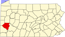
Allegheny County Pennsylvania incorporated and unincorporated areas Harwick highlighted.svg
Location in Allegheny County and state of Pennsylvania
Coordinates: 40°33′22″N79°48′19″W / 40.55611°N 79.80528°W / 40.55611; -79.80528
Country United States
State Pennsylvania
County Allegheny
Township Springdale
Area
[1]
  Total0.44 sq mi (1.14 km2)
  Land0.44 sq mi (1.14 km2)
  Water0.00 sq mi (0.00 km2)
Population
 (2020) [2]
  Total850
  Density1,923.08/sq mi (742.62/km2)
Time zone UTC-5 (Eastern (EST))
  Summer (DST) UTC-4 (EDT)
ZIP code
15049 [3]
Area code 724
FIPS code 42-33024

Harwick is a census-designated place (CDP) in Allegheny County, Pennsylvania, United States, and is located within Springdale Township. As of the 2020 census, it had a population of 850. [4]
Demographics

Historical population
CensusPop.Note
2010 899
2020 850−5.5%
U.S. Decennial Census [5]

Related Research Articles

<span class="mw-page-title-main">Demographics of the United States</span>

The United States had an official estimated resident population of 333,287,557 on July 1, 2022, according to the U.S. Census Bureau. This figure includes the 50 states and the District of Columbia but excludes the population of five unincorporated U.S. territories as well as several minor island possessions. The United States is the third most populous country in the world. The Census Bureau showed a population increase of 0.4% for the twelve-month period ending in July 2022, below the world average annual rate of 0.9%. The total fertility rate in the United States estimated for 2022 is 1.665 children per woman, which is below the replacement fertility rate of approximately 2.1.

In the United States, a metropolitan statistical area (MSA) is a geographical region with a relatively high population density at its core and close economic ties throughout the region. Such regions are not legally incorporated as a city or town would be and are not legal administrative divisions like counties or separate entities such as states. As a result, sometimes the precise definition of a given metropolitan area will vary between sources. The statistical criteria for a standard metropolitan area were defined in 1949 and redefined as a metropolitan statistical area in 1983.

<span class="mw-page-title-main">Deerfield Beach, Florida</span> City in Florida, United States

Deerfield Beach is a city in Broward County, Florida, United States, just south of the Palm Beach County line. The city is named for the numerous deer that once roamed the area. As of the 2020 census, the population was 86,859, making it the tenth-largest city in Broward County. It is a key suburb of the Miami metropolitan area, which was home to 6.14 million people in 2020.

<span class="mw-page-title-main">Miramar, Florida</span> City in Florida, United States

Miramar is a city in southern Broward County, Florida. It is a key suburb of the Miami metropolitan area, which was home to 6.14 million people in 2020. As of the 2020 census, the population was 134,721, making it the second-largest city in Broward County, the fourth-largest city in the Miami metro area, and the 11th-largest city in Florida.

<span class="mw-page-title-main">Cheswick, Pennsylvania</span> Borough in Pennsylvania, United States

Cheswick is a borough in Allegheny County, Pennsylvania, United States, along the Allegheny River. The population was 1,672 as of the 2020 census. Cheswick Borough was incorporated in 1902. It is a residential suburb of the Pittsburgh metropolitan area.

<span class="mw-page-title-main">Springdale Township, Pennsylvania</span> Township in Pennsylvania, United States

Springdale Township is a township in Allegheny County, Pennsylvania, United States. It contains the two communities of Orrville and Harwick. The population was 1,636 at the 2010 census.

<span class="mw-page-title-main">Devon, Pennsylvania</span> Census-designated place in Pennsylvania, United States

Devon is a census-designated place (CDP) located in Easttown township in Chester County, Pennsylvania, United States. The population was 1,515 at the 2010 census. The area is part of the Philadelphia Main Line suburbs.

<span class="mw-page-title-main">Sikhism by country</span> World Sikh population breakdown

Most of the 25-30 million followers of Sikhism, the world's fifth-largest religion, live in the northern Indian state of Punjab, the only Sikh-majority administrative division on Earth, but Sikh communities exist on every inhabited continent. Sizeable Sikh populations in countries across the world exist in India (20,833,116), Canada (771,790), England (520,092), the United States (~280,000), Italy (~220,000), and Australia (210,400), while countries with the largest proportions of Sikhs include Canada (2.12%), India (1.56%), Cyprus (1.1%) England (0.92%), New Zealand (0.87%), and Australia (0.83%).

Hickory is a census-designated place located in Mount Pleasant Township, Washington County in the state of Pennsylvania. As of the 2010 census the population was 740 residents.

<span class="mw-page-title-main">Americans</span> Citizens and nationals of the United States

Americans are the citizens and nationals of the United States. The United States is home to people of many racial and ethnic origins; consequently, American culture and law do not equate nationality with race or ethnicity, but with citizenship and an oath of permanent allegiance.

<span class="mw-page-title-main">Queens Gate, Pennsylvania</span> CDP in Pennsylvania, United States

Queens Gate is a census-designated place (CDP) in York County, Pennsylvania, United States. The population was 1,464 at the 2010 census. The area was part of the Tyler Run-Queens Gate CDP at the 2000 census.

<span class="mw-page-title-main">Chase, Pennsylvania</span> Census-designated place in Pennsylvania, United States

Chase is a census-designated place (CDP) in Jackson Township, Luzerne County, Pennsylvania, United States. The CDP population was 978 at the 2010 census.

<span class="mw-page-title-main">Mocanaqua, Pennsylvania</span> Census-designated place in Pennsylvania, United States

Mocanaqua is an unincorporated community and census-designated place (CDP) in Conyngham Township, Luzerne County, Pennsylvania, United States. The population was 646 at the 2010 census.

Colony Park is a census-designated place in Spring Township, Berks County, Pennsylvania, United States. It is located just off U.S. 222, approximately one mile northwest of the borough of Wyomissing. As of the 2010 census, the population was 1,076 residents.

Edenburg is a census-designated place in Windsor Township, Berks County, Pennsylvania, United States. It is located along Old Route 22, and very close to I-78, approximately two miles from Hamburg. As of the 2010 census, the population was 681 residents.

Greenfields is a census-designated place in Bern Township, Berks County, Pennsylvania, United States. It is located approximately one mile to the west of the city of Reading at the confluence of the Tulpehocken Creek and Schuylkill River. As of the 2010 census, the population was 1,170 residents.

Muhlenberg Park is a census-designated place in Muhlenberg Township, Berks County, Pennsylvania, United States. The community is located just to the west of the borough of Laureldale. As of the 2010 census, the population was 1,420 residents. Development of the community began in 1915.

Grazierville is a census-designated place in Snyder Township, Blair County, Pennsylvania, United States. It is located near I-99 and is approximately one mile to the south of the borough of Tyrone. As of the 2010 census, the population was 665 residents.

Fellsburg is a census-designated place located in Rostraver Township, Westmoreland County in the state of Pennsylvania, United States. It is home to the Fells Church, overlooking the Monongahela and Youhgiogheny Valleys. As of the 2010 census the population was 1,180 residents.

References

  1. "ArcGIS REST Services Directory". United States Census Bureau. Retrieved October 12, 2022.
  2. "Census Population API". United States Census Bureau. Retrieved October 12, 2022.
  3. "Harwick PA ZIP Code". zipdatamaps.com. 2023. Retrieved June 27, 2023.
  4. "Explore Census Data".
  5. "Census of Population and Housing". Census.gov. Retrieved June 4, 2016.