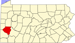
East Deer Township, Pennsylvania

Last updated

East Deer Township, Pennsylvania
Township
Allegheny County Pennsylvania incorporated and unincorporated areas East Deer township highlighted.svg
Location in Allegheny County and the U.S. state of Pennsylvania.
East Deer Township, Pennsylvania
USA Pennsylvania location map.svg
Red pog.svg
East Deer Twp
Usa edcp location map.svg
Red pog.svg
East Deer Twp
Coordinates: 40°35′25″N79°47′5″W / 40.59028°N 79.78472°W / 40.59028; -79.78472
Country United States
State Pennsylvania
County Allegheny
ZIP codes
15030, 15084

East Deer Township is a township in Allegheny County, Pennsylvania, United States. The population was 1,490 at the 2020 census. [1]

Contents

Geography

According to the United States Census Bureau, the township has a total area of 2.6 square miles (6.7 km2), of which 2.3 square miles (6.0 km2) is land and 0.3 square miles (0.78 km2), or 11.83%, is water.

Surrounding neighborhoods

East Deer Township has three land borders, including Frazer to the north, south and west, Tarentum to the northeast, and a very small border with Springdale Township to the south-southeast along the Allegheny River. Across the river in Westmoreland County, East Deer runs adjacent with Arnold.

Government and politics

Presidential elections results [2] [3] [4]
Year Republican Democratic Third parties
2020 55%39643%3160.9%7
2016 53%31146%2701%10
2012 48%28250%2962%9

Demographics

Historical population
CensusPop.Note
1970 2,081
1980 1,658−20.3%
1990 1,558−6.0%
2000 1,362−12.6%
2010 1,50010.1%
2020 1,490−0.7%
2022 (est.)1,452 [1] −2.6%
U.S. Decennial Census [5]

At the 2000 census, there were 1,362 people, 606 households, and 350 families living in the township. The population density was 590.3 inhabitants per square mile (227.9/km2). There were 682 housing units at an average density of 295.6 per square mile (114.1/km2). The racial makeup of the township was 96.84% White, 1.91% African American, 0.15% Asian, 0.07% from other races, and 1.03% from two or more races. Hispanic or Latino of any race were 0.07%. [6]

East Deer residents reported 19% being of German ancestry, 19% of Italian ancestry, 13% Irish ancestry, 11% Polish ancestry and 10% Slovak ancestry in 2000. [7]

There were 606 households, 23.4% had children under the age of 18 living with them, 41.4% were married couples living together, 12.0% had a female householder with no husband present, and 42.2% were non-families. 37.1% of households were made up of individuals, and 16.5% were one person aged 65 or older. The average household size was 2.16 and the average family size was 2.82.

The age distribution was 18.8% under the age of 18, 7.0% from 18 to 24, 32.5% from 25 to 44, 18.4% from 45 to 64, and 23.3% 65 or older. The median age was 41 years. For every 100 females there were 81.8 males. For every 100 females age 18 and over, there were 77.2 males.

The median household income was $30,078 and the median family income was $38,839. Males had a median income of $28,894 versus $24,792 for females. The per capita income for the township was $17,108. About 5.4% of families and 7.9% of the population were below the poverty line, including 6.5% of those under age 18 and 8.0% of those age 65 or over.

Related Research Articles

<span class="mw-page-title-main">Curtisville, Pennsylvania</span> Census-designated place in Pennsylvania, United States

Curtisville is a census-designated place (CDP) in West Deer Township, Pennsylvania, United States. The population was 1,097 at the 2020 census.

<span class="mw-page-title-main">Fawn Township, Allegheny County, Pennsylvania</span> Township in Pennsylvania, United States

Fawn Township is a township in Allegheny County, Pennsylvania, United States. The population was 2,193 at the 2020 census. The township derives its name either directly after Fahan, County Donegal, Ireland, by Irish settlers of which 'fawn' is the phonetic pronunciation, or indirectly from the York County township of that name with name origin. According to the township itself, Fawn Township derived its name from its parent township, Deer Township, from which it was formed March 28, 1858.

<span class="mw-page-title-main">Forward Township, Allegheny County, Pennsylvania</span> Township of Allegheny County, Pennsylvania

Forward Township is a township in Allegheny County, Pennsylvania, United States. The population was 3,068 at the 2020 census. The township is named after Walter Forward, U.S. Secretary of the Treasury from 1841 to 1843.

<span class="mw-page-title-main">Frazer Township, Allegheny County, Pennsylvania</span> Township in Pennsylvania, United States

Frazer Township is a township in Allegheny County, Pennsylvania, United States. The population was 1,164 at the 2020 census. The Pittsburgh Mills shopping mall complex is located in the township.

<span class="mw-page-title-main">Harmar Township, Allegheny County, Pennsylvania</span> Township in Pennsylvania, United States

Harmar Township is a township in Allegheny County, Pennsylvania, United States. It contains the communities of Acmetonia, Harmarville, Harmar Heights, and Chapel Downs. The population was 3,136 at the 2020 census. The township was named after Harmar Denny, a U.S. congressman and son of Ebenezer Denny.

<span class="mw-page-title-main">Indiana Township, Allegheny County, Pennsylvania</span> Township and census-designated place in Pennsylvania, United States

Indiana Township is a township in Allegheny County, Pennsylvania, and a Pittsburgh suburb located in the United States. It contains the communities of Rural Ridge, Dorseyville, and Indianola. The population was 7,255 at the 2020 census.

<span class="mw-page-title-main">Richland Township, Allegheny County, Pennsylvania</span> Township in Pennsylvania, United States

Richland Township is a township in Allegheny County, Pennsylvania, United States. The population was 11,942 at the 2020 census.

<span class="mw-page-title-main">Russellton, Pennsylvania</span> Census-designated place in Pennsylvania, United States

Russellton is a census-designated place (CDP) in Allegheny County, Pennsylvania, United States. The population was 1,330 at the 2020 census.

<span class="mw-page-title-main">South Versailles Township, Pennsylvania</span> Township in Pennsylvania, United States

South Versailles Township is a township in Allegheny County, Pennsylvania, United States. The population was 351 at the 2010 census. It contains the village of Coulter, also called Coulterville or Coulters. The U.S. Post Office in the village is called Coulters.

<span class="mw-page-title-main">Springdale Township, Pennsylvania</span> Township in Pennsylvania, United States

Springdale Township is a township in Allegheny County, Pennsylvania, United States. It contains the two communities of Orrville and Harwick. The population was 1,636 at the 2010 census.

<span class="mw-page-title-main">Tarentum, Pennsylvania</span> Borough in Pennsylvania, United States

Tarentum is a borough in Allegheny County in the U.S. state of Pennsylvania. It is 22 miles (35 km) northeast of Downtown Pittsburgh, along the Allegheny River. Tarentum was an industrial center where plate glass and bottles were manufactured; bricks, lumber, steel and iron novelties, steel billets and sheets, sack and wrapping paper were also produced.

<span class="mw-page-title-main">West Deer Township, Pennsylvania</span> Township in Pennsylvania, United States

West Deer Township is a township in Allegheny County, Pennsylvania, Pennsylvania, United States. The population was 12,262 at the 2020 census.

<span class="mw-page-title-main">Bethel Township, Armstrong County, Pennsylvania</span> Township in Pennsylvania, United States

Bethel Township is a township in Armstrong County, Pennsylvania, United States. The population was 1,096 at the 2020 census, a decrease from the figure of 1,183 tabulated in 2010.

<span class="mw-page-title-main">Buffalo Township, Butler County, Pennsylvania</span> Township in Pennsylvania, United States

Buffalo Township is a township in Butler County, Pennsylvania, United States. The population was 7,896 at the 2020 census.

<span class="mw-page-title-main">Middlesex Township, Butler County, Pennsylvania</span> Township in Pennsylvania, United States

Middlesex Township is a township in Butler County, Pennsylvania, United States. The population was 6,826 at the 2020 census.

<span class="mw-page-title-main">Richland Township, Clarion County, Pennsylvania</span> Township in Pennsylvania, United States

Richland Township is a township in Clarion County, Pennsylvania, United States. The population was 473 at the 2020 census, a decrease from the figure of 494 tabulated in 2010.

<span class="mw-page-title-main">Triumph Township, Pennsylvania</span> Township in Pennsylvania, United States

Triumph Township is a township in Warren County, Pennsylvania, United States. The population was 276 at the 2020 census, down from 316 at the 2010 census.

<span class="mw-page-title-main">Sewickley Township, Pennsylvania</span> Township in Pennsylvania, United States

Sewickley Township is a township in Westmoreland County, Pennsylvania, United States. The population was 5,590 at the 2020 census.

<span class="mw-page-title-main">Sutersville, Pennsylvania</span> Borough in Pennsylvania, United States

Sutersville is a borough in Westmoreland County, Pennsylvania, United States. The population was 605 at the 2010 census.

<span class="mw-page-title-main">Hampton Township, Allegheny County, Pennsylvania</span> Township in Pennsylvania, United States

Hampton Township is a township in Allegheny County, Pennsylvania, United States. The population was 18,470 at the 2020 census. It is a suburb of the Pittsburgh metropolitan area.

References

  1. 1 2 Bureau, US Census. "City and Town Population Totals: 2020-2022". Census.gov. US Census Bureau. Retrieved June 13, 2023.
  2. EL. "2012 Allegheny County election". Pittsburgh Tribune-Review. Retrieved October 15, 2017.
  3. EL. "2016 Pennsylvania general election results". Pittsburgh Post-Gazette. Retrieved October 15, 2017.
  4. "Election Night Reporting".
  5. "Census of Population and Housing". Census.gov. Retrieved June 4, 2016.
  6. "U.S. Census website". United States Census Bureau . Retrieved January 31, 2008.
  7. East Deer – East Deer – Ancestry & family history – ePodunk

40°35′42″N79°47′09″W / 40.59500°N 79.78583°W / 40.59500; -79.78583