Broughton, Pennsylvania

Last updated

Broughton, Pennsylvania
Curry
Coordinates: 40°19′48″N79°59′16″W / 40.33000°N 79.98778°W / 40.33000; -79.98778
CountryUnited States
State Pennsylvania
County Allegheny
Township South Park
Elevation
991 ft (302 m)
Time zone UTC−5:00 (EST)
  Summer (DST) UTC−4:00 (EDT)

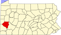
Broughton is an unincorporated community in South Park Township, Pennsylvania, United States. Originally named Curry after Joseph Curry, a frontier physician and coroner of Allegheny County in 1810, it was renamed Broughton, to avoid confusion with the nearby Curry Hollow and the Curry in Blair County. [1] It is located at the junction of Brownsville Road, Curry Road, and Broughton Road. Broughton was racially integrated in the early 20th century, due to coal miners working nearby mines in Horning. [2] It was the location of Pittsburgh Terminal Coal Company's No. 5 mine.

Related Research Articles

<span class="mw-page-title-main">Westmoreland County, Pennsylvania</span> County in Pennsylvania, United States

Westmoreland County is a county in the Commonwealth of Pennsylvania, United States. As of the 2020 census, the population was 364,663. The county seat is Greensburg.

<span class="mw-page-title-main">Bethel Park, Pennsylvania</span> Borough in Pennsylvania, United States

Bethel Park is a borough with home rule status in Allegheny County, Pennsylvania, United States. It is a suburb within the Pittsburgh metropolitan area, located approximately 7 miles (11 km) south of Pittsburgh. The population was 33,577 as of the 2020 census.

<span class="mw-page-title-main">Penn Hills, Pennsylvania</span> Home rule township in Pennsylvania, United States

Penn Hills is a township with home rule status in Allegheny County, Pennsylvania, United States. The population was 41,059 as of the 2020 census. A suburb of Pittsburgh, Penn Hills is the second-largest municipality in Allegheny County.

<span class="mw-page-title-main">South Versailles Township, Allegheny County, Pennsylvania</span> Township in Pennsylvania, United States

South Versailles Township is a township in Allegheny County, Pennsylvania, United States. The population was 351 at the 2010 census. It contains the village of Coulter, also called Coulterville or Coulters. The U.S. Post Office in the village is called Coulters.

<span class="mw-page-title-main">Gilpin Township, Armstrong County, Pennsylvania</span> Township in Pennsylvania, United States

Gilpin Township is a Second class Township in Armstrong County, Pennsylvania, United States. At the 2010 census it had a population of 2,496. As of the 2020 census, its population had decreased to 2,411, a 3.4% decrease.

<span class="mw-page-title-main">Chartiers Township, Pennsylvania</span> Township in Pennsylvania, United States

Chartiers Township is a township in Washington County, Pennsylvania, United States. The population was 8,632 at the 2020 census. Along with the borough of Houston, the township makes up the Chartiers-Houston School District. It is part of the Pittsburgh metropolitan area.

<span class="mw-page-title-main">South Park Township, Allegheny County, Pennsylvania</span> Township in Pennsylvania, United States

South Park Township is a township in the southern part of Allegheny County, Pennsylvania, United States, near Pittsburgh. The population was 13,416 at the 2010 census.

<span class="mw-page-title-main">Imperial, Pennsylvania</span> Census-designated place in Pennsylvania, United States

Imperial is a census-designated place (CDP) in Allegheny County, Pennsylvania, United States and part of the Pittsburgh metropolitan area. The population was 2,722 at the 2020 census. The CDP is located in North Fayette and Findlay Townships, and geographically close to Pittsburgh International Airport.

<span class="mw-page-title-main">Allegheny County belt system</span> Allegheny County belt system

The Allegheny County Belt System color codes various county roads to form a unique system of routes in Allegheny County, Pennsylvania, and around the city of Pittsburgh.

<span class="mw-page-title-main">Banksville (Pittsburgh)</span> Neighborhood of Pittsburgh in Allegheny County, Pennsylvania, United States

Banksville is a neighborhood in Pittsburgh, Pennsylvania. The neighborhood of Banksville is located in the West End of the city and borders the South Hills region. Real estate agencies frequently refer to the Banksville area as Greentree City due to Banksville's shared border with the borough of Green Tree. It has two zip codes of both 15220 and 15216, and has representation in Pittsburgh City Council by the council member for District 2. Theresa Kail-Smith is the current Councilperson for district two. Banksville's primary corridor, Banksville Road, is frequently used as a gateway between the South Hills of Pittsburgh and downtown Pittsburgh via the Fort Pitt Tunnels. Banksville, formerly Union Township, joined the City of Pittsburgh around 1928.

<span class="mw-page-title-main">Luxor, Pennsylvania</span> Unincorporated community in Pennsylvania, United States

Luxor is an unincorporated community and coal town in Hempfield Township, Westmoreland County, Pennsylvania, United States.

<span class="mw-page-title-main">Kettle Creek (Pennsylvania)</span> Tributary of the West Branch Susquehanna River

Kettle Creek is a tributary of the West Branch Susquehanna River running through Tioga, Potter, and Clinton counties, in Pennsylvania. It is slightly less than 43 miles (69 km) long. Although many streams in the Kettle Creek watershed are considered "Class A Wild Trout streams" by the Pennsylvania Fish and Boat Commission, the lower reaches of the stream experience acid mine drainage. The upper reaches of the creek are considered to be very high-quality.

<span class="mw-page-title-main">Keystone State Park (Pennsylvania)</span> State park in Westmoreland County, Pennsylvania, United States

Keystone State Park is a 1,200-acre (486 ha) Pennsylvania state park in Derry Township, Westmoreland County, Pennsylvania in the United States. Located off U.S. Route 22 near New Alexandria, the park opened in 1945. Its main attraction is the man-made 78-acre (32 ha) Keystone Lake. The park also has extensive picnic areas and several miles of hiking trails.

<span class="mw-page-title-main">Lehigh Gorge State Park</span>

Lehigh Gorge State Park is a 4,548 acres (1,841 ha) Pennsylvania state park in Luzerne and Carbon Counties, Pennsylvania. The park encompasses a gorge, which stretches along the Lehigh River from a U.S. Army Corps of Engineers flood control dam in Luzerne County to Jim Thorpe in Carbon County. The primary recreational activity at Lehigh Gorge State Park is white water rafting.

Harmarville is an unincorporated community located in Harmar Township, Allegheny County, Pennsylvania, United States.

<span class="mw-page-title-main">Pennsylvania Route 130</span> State highway in Pennsylvania, US

Pennsylvania Route 130 (PA 130) is a 49-mile-long (79 km) state highway located in Allegheny and Westmoreland counties in Pennsylvania. The western terminus is at PA 8 in Pittsburgh, and the eastern terminus is at PA 381 near Kregar.

<span class="mw-page-title-main">Bretton, Flintshire</span> Village in Flintshire, Wales

Bretton is a village in Flintshire, Wales. It is located to the west of the city of Chester, near the border with Cheshire, England. Along with the nearby village of Broughton, the population was 5,791 at the 2001 Census.

<span class="mw-page-title-main">Broughton, Wrexham</span> Community in Wrexham County Borough, Wales

Broughton is a community in Wrexham County Borough, Wales. It has an area of 469 hectares and had a population of 6,498 in the 2001 census, increasing to 7,454 at the 2011 Census. The area is dominated by the Moss Valley, which was known for its coal mining. Today it is operated as a country park, and there is a golf course of the same name in the vicinity.

<span class="mw-page-title-main">Coulter, Pennsylvania</span> Unincorporated community in Pennsylvania, United States

Coulter is an unincorporated community in South Versailles Township, Allegheny County, Pennsylvania, United States. The community is located along the Youghiogheny River, 14.3 miles (23.0 km) southeast of Pittsburgh.

References

  1. "The History of South Park Township" . Retrieved June 30, 2008.
  2. Smith Brown, Eliza (2007). African American Historic Sites Survey of Allegheny County. DIANE Publishing Inc. p. 178. ISBN   978-1-4223-1490-6.