Lincoln, Pennsylvania

Last updated

Lincoln, Pennsylvania
Borough of Lincoln
Wylie Run along Lovedale Road.jpg
Wylie Run and Lovedale Road
Allegheny County Pennsylvania incorporated and unincorporated areas Lincoln highlighted.svg
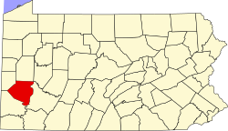
Location in Allegheny County and the state of Pennsylvania.
Coordinates: 40°17′27″N79°51′5″W / 40.29083°N 79.85139°W / 40.29083; -79.85139
Country United States
State Pennsylvania
County Allegheny
BoroughFebruary 6, 1958
Government
  TypeMayor-Council
  MayorJames Beisler
Area
[1]
  Total5.01 sq mi (12.99 km2)
  Land4.80 sq mi (12.43 km2)
  Water0.21 sq mi (0.55 km2)
Elevation
[2]
1,122 ft (342 m)
Population
 (2020) [3]
  Total932
  Density194.17/sq mi (74.97/km2)
Time zone UTC-5 (Eastern (EST))
  Summer (DST) UTC-4 (EDT)
ZIP codes
15133, 15135, 15037
FIPS code42-43408
Website www.lincolnborough.com

Lincoln is a borough in Allegheny County, Pennsylvania, United States. The population was 932 at the 2020 United States Census. [4]

Contents

Lincoln does not have its own post office. Three ZIP codes are used in the borough: 15133 for the northern portion of the borough adjacent to Liberty; 15135 for the eastern portion adjacent to the city of McKeesport; 15037 for the remainder of the borough, with mail addressed to Elizabeth.
History

The borough was named for Abraham Lincoln. [5] Lincoln was incorporated on February 6, 1958, before which it was Lincoln Township. The change in governmental structure came after a portion of the borough attempted to secede from Lincoln Township to annex with Liberty Borough. [6] Dead Man's Hollow is a 450-acre conservation area whose boundary lies within the borough. [7] [8]

Geography and surrounding neighborhoods

Lincoln is located at 40°17′27″N79°51′5″W / 40.29083°N 79.85139°W / 40.29083; -79.85139 (40.291939, −79.851303). [9] It is bounded by Glassport to the northwest, Liberty to the north, Versailles to the northeast, Elizabeth Township and the Youghiogheny River to the east and south, and Jefferson Hills, Clairton, and the Monongahela River to the west. The borough has a total area of 5.0 square miles (13 km2), of which 4.8 square miles (12 km2) is land and 0.2 square miles (0.52 km2), or 4.57%, is water.

Government and politics

As of 2019, the mayor was James Beisler. [10]

Presidential election results [11] [12] [13] [14]
Year Republican Democratic Third parties
2020 69%41629%1751%8
2016 71%37526%1372%13
2012 58%27241%1941%5
2008 52%26946%2342%11

Education

Lincoln is part of the South Allegheny School District, along with Liberty, Glassport and Port Vue.

Demographics

Historical population
CensusPop.Note
1940 1,015
1950 1,46744.5%
1960 1,68614.9%
1970 1,88511.8%
1980 1,428−24.2%
1990 1,187−16.9%
2000 1,2182.6%
2010 1,072−12.0%
2020 932−13.1%
Sources: [15] [16] [17] [18] [3]

2000 census

As of the 2000 census, there were 1,218 people, 482 households, and 359 families in the borough. The population density was 254/sqmi (98.0/km2). There were 506 housing units at an average density of 105.5/sqmi (40.7/km2). The racial makeup of the borough was 98.77% White, 0.66% African American, 0.08% Native American, 0.33% Asian, and 0.16% from two or more races. Hispanic or Latino of any race were 0.74% of the population.

There were 484 households, out of which 24.8% had children under the age of 18 living with them, 62.4% were married couples living together, 8.9% had a female householder with no husband present, and 25.8% were non-families. 22.1% of all households were made up of individuals, and 9.3% had someone living alone who was 65 years of age or older. The average household size was 2.52 and the average family size was 2.94.

The borough population contained 19.0% under the age of 18, 5.9% from 18 to 24, 27.2% from 25 to 44, 28.1% from 45 to 64, and 19.9% who were 65 years of age or older. The median age was 43 years. For every 100 females, there were 92.1 males. For every 100 females age 18 and over, there were 91.3 males.

The median income for a household in the borough was $37,917, and the median income for a family was $43,333. Males had a median income of $35,852 versus $21,131 for females. The per capita income for the borough was $18,447. About 6.9% of families and 9.1% of the population were below the poverty line, including 8.4% of those under age 18 and 14.2% of those age 65 or over.

Notable person

Related Research Articles

<span class="mw-page-title-main">Aspinwall, Pennsylvania</span> Borough in Pennsylvania, United States

Aspinwall is a borough on the Allegheny River in Allegheny County, Pennsylvania, United States. It is part of the Pittsburgh metropolitan area. The population was 2,916 at the 2020 census.

<span class="mw-page-title-main">Blawnox, Pennsylvania</span> Borough in Pennsylvania, United States

Blawnox is a borough in Allegheny County, Pennsylvania, United States. The population was 1,454 at the 2020 census.

<span class="mw-page-title-main">Brackenridge, Pennsylvania</span> Borough in Pennsylvania, United States

Brackenridge is a borough in Allegheny County, Pennsylvania, United States, located along the Allegheny River. It is part of the Greater Pittsburgh metropolitan area.

<span class="mw-page-title-main">Churchill, Pennsylvania</span> Borough in Pennsylvania, United States

Churchill is a borough in Allegheny County, Pennsylvania, United States. The population was 3,157 at the 2020 census. It is a residential suburb of the Pittsburgh metropolitan area. The town was named from the hilltop Beulah Presbyterian Church.

<span class="mw-page-title-main">Dravosburg, Pennsylvania</span> Borough in Pennsylvania, United States

Dravosburg is a borough in Allegheny County, Pennsylvania, United States, and is part of the Pittsburgh Metro Area. The population was 1,612 at the 2020 census. Dravosburg is located along the Monongahela River.

<span class="mw-page-title-main">Elizabeth, Pennsylvania</span> Borough in Pennsylvania, United States

Elizabeth is a borough in Allegheny County, Pennsylvania, United States, on the east bank of the Monongahela River, where Pennsylvania Route 51 crosses, 15 miles (24 km) upstream (south) of Pittsburgh and close to the county line. The population was 1,398 at the 2020 census. The borough of Elizabeth is entirely contained within the 15037 USPS ZIP code. The local school district is the Elizabeth Forward School District. The borough is home to neighborhoods Walker Heights and Town Hill. Elizabeth Borough is the birthplace of Town Hill Hockey established in 1978.

<span class="mw-page-title-main">Forward Township, Allegheny County, Pennsylvania</span> Township of Allegheny County, Pennsylvania

Forward Township is a township in Allegheny County, Pennsylvania, United States. The population was 3,068 at the 2020 census. The township is named after Walter Forward, U.S. Secretary of the Treasury from 1841 to 1843.

<span class="mw-page-title-main">Glassport, Pennsylvania</span> Borough in Allegheny County, Pennsylvania

Glassport is a borough in Allegheny County, Pennsylvania, United States, approximately 10 miles (16 km) south of Pittsburgh and the confluence of the Monongahela and Allegheny rivers where they form the Ohio River. Glassport lies along the east side of the Monongahela River in the "Mon Valley", where many blue-collar municipalities have suffered severe economic decline in the wake of the loss of steel-making throughout the Greater Pittsburgh area. In 1910, the population of Glassport was 5,540. By 1940, it had risen to 8,748, but has since declined to 4,475 as of the 2020 census.

<span class="mw-page-title-main">Liberty, Allegheny County, Pennsylvania</span> Borough in Pennsylvania, United States

Liberty is a borough in Allegheny County, Pennsylvania, United States. The population was 2,355 at the 2020 census.

<span class="mw-page-title-main">Mount Oliver, Pennsylvania</span> Borough in Pennsylvania, United States

Mount Oliver is a borough in Allegheny County, Pennsylvania, United States. The population was 3,394 at the 2020 census. It is a largely residential area situated atop a crest about 3 miles (5 km) west of the Monongahela River. The borough is surrounded entirely by the city of Pittsburgh, having resisted annexation attempts by the city.

<span class="mw-page-title-main">Munhall, Pennsylvania</span> Borough in Pennsylvania, United States

Munhall is a borough in Allegheny County, Pennsylvania, United States, on the west bank of the Monongahela River. The population was 10,774 at the 2020 census. It is a residential suburb of the Pittsburgh metropolitan area.

<span class="mw-page-title-main">Penn Hills, Pennsylvania</span> Home rule township in Pennsylvania, United States

Penn Hills is a township with home rule status in Allegheny County, Pennsylvania, United States. The population was 41,059 as of the 2020 census. A suburb of Pittsburgh, Penn Hills is the second-largest municipality in Allegheny County.

<span class="mw-page-title-main">Pleasant Hills, Pennsylvania</span> Borough in Pennsylvania, United States

Pleasant Hills is a borough in Allegheny County, Pennsylvania, United States. As of the 2020 census, the population was 8,504. It is a suburb of the Pittsburgh metropolitan area.

<span class="mw-page-title-main">Port Vue, Pennsylvania</span> Borough in Pennsylvania, United States

Port Vue is a borough in Allegheny County, Pennsylvania, United States. The population was 3,680 at the 2020 census.

<span class="mw-page-title-main">West Elizabeth, Pennsylvania</span> Borough in Pennsylvania, United States

West Elizabeth is a borough in Allegheny County, Pennsylvania, United States. The population was 403 at the 2020 census.

<span class="mw-page-title-main">West Homestead, Pennsylvania</span> Borough in Pennsylvania, United States

West Homestead is a borough in Allegheny County, Pennsylvania, United States, 8 miles (13 km) southeast of Pittsburgh, on the Monongahela River. Heavy industries associated with nearby steel mills existed here, such as axle works, brickworks, and manufactories of machinery, car wheels, etc. The largest concern was Mesta Machinery, which was one of the world's leading industrial manufacturers from 1898 until 1983. The population was 1,872 at the 2020 census.

<span class="mw-page-title-main">West Mifflin, Pennsylvania</span> Borough in Pennsylvania, United States

West Mifflin is a borough in Allegheny County, Pennsylvania, United States, located southeast of downtown Pittsburgh. The population was 19,589 at the 2020 census. It is named after Thomas Mifflin, 1st Governor of Pennsylvania, signer of the United States Constitution, and 1st Quartermaster General of the United States Army.

<span class="mw-page-title-main">Whitaker, Pennsylvania</span> Borough in Pennsylvania, United States

Whitaker is a borough in Allegheny County, Pennsylvania, United States, and is on the Monongahela River 3 miles (5 km) upriver from Pittsburgh. The population was 1,179 at the 2020 census.

<span class="mw-page-title-main">Wilmerding, Pennsylvania</span> Borough in Pennsylvania, United States

Wilmerding is a borough in Allegheny County, Pennsylvania, United States. The population was 1,781 at the 2020 census. It is located 12 miles (19 km) southeast of Pittsburgh. At the start of the twentieth century, it had extensive foundries and machine shops of the Westinghouse Air Brake Company. Wilmerding is adjacent to the borough of Turtle Creek, which takes its name from a small stream that flows past both places.

<span class="mw-page-title-main">Trafford, Pennsylvania</span> Borough in Pennsylvania, United States

Trafford is a borough in Allegheny and Westmoreland counties in the U.S. state of Pennsylvania. Located near Pittsburgh in western Pennsylvania, the borough lies primarily in Westmoreland County; only a small portion extends into Allegheny County. It was incorporated in 1904 from the northernmost corner of North Huntingdon Township, and was named by George Westinghouse for Trafford near Manchester, England. Westinghouse purchased the land in 1902, and the Trafford Foundry began operations on October 3, 1903. The population was 3,317 at the 2020 census. Of this, 3,113 were in Westmoreland County, and only 61 were in Allegheny County.

References

  1. "ArcGIS REST Services Directory". United States Census Bureau. Retrieved October 12, 2022.
  2. ""Find an Altitude/PA" Google Maps". Archived from the original on May 21, 2019. Retrieved May 29, 2019.
  3. 1 2 "Census Population API". United States Census Bureau. Retrieved October 12, 2022.
  4. "Explore Census Data".
  5. Ackerman, Jan (May 10, 1984). "Town names carry bit of history". Pittsburgh Post-Gazette. p. 1. Retrieved October 31, 2015.
  6. Tripod Inc.
  7. "Dead Man's Hollow - Allegheny Land Trust".
  8. Flannick, James (March 17, 2017). "New Life For Dead Man's Hollow". Pittsburgh Post Gazette. pp. LX–1, LX–2.
  9. "US Gazetteer files: 2010, 2000, and 1990". US Census Bureau. February 12, 2011. Retrieved April 23, 2011.
  10. Borough of Lincoln/Information & Resources (accessed May 29, 2019)
  11. EL. "2012 Allegheny County election". Pittsburgh Tribune-Review. Retrieved October 15, 2017.
  12. EL. "2016 Pennsylvania general election..." Pittsburgh Post-Gazette. Retrieved October 15, 2017.
  13. "Election Night Reporting".
  14. "Elections | Election Results | 2008 General Election". www.alleghenycounty.us. Retrieved July 3, 2022.
  15. "Number of Inhabitants: Pennsylvania" (PDF). 18th Census of the United States. US Census Bureau. Retrieved November 22, 2013.
  16. "Pennsylvania: Population and Housing Unit Counts" (PDF). US Census Bureau. Retrieved November 22, 2013.
  17. "U.S. Census website". US Census Bureau. Retrieved January 31, 2008.
  18. "Annual Estimates of the Resident Population". US Census Bureau. Archived from the original on October 19, 2013. Retrieved November 22, 2013.