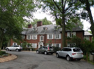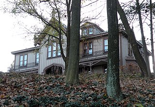
Allegheny County is located in the southwest of the U.S. state of Pennsylvania. As of 2019 the population was 1,216,045, making it the state's second-most populous county, following Philadelphia County. The county seat is Pittsburgh. Allegheny County is included in the Pittsburgh, PA Metropolitan Statistical Area, and in the Pittsburgh Designated Market Area.

Westmoreland County is a county located in the U.S. state of Pennsylvania. At the 2010 census, the population was 365,169. The county seat is Greensburg. Formed from, successively, Lancaster, Northumberland, and later Bedford Counties, Westmoreland County was founded on February 26, 1773, and was the first county in the colony of Pennsylvania whose entire territorial boundary was located west of the Allegheny Mountains. Westmoreland County originally included the present-day counties of Fayette, Washington, Greene, and parts of Beaver, Allegheny, Indiana, and Armstrong counties. It is named after Westmorland, a historic county of England.

Bridgeville is a borough in Allegheny County in the U.S. state of Pennsylvania. The population was 5,148 at the 2010 census.

Collier Township is a township in Allegheny County, Pennsylvania, United States. The population was 7,080 at the 2010 census.

Moon Township is a township along the Ohio River in Allegheny County, Pennsylvania, United States. Moon is a part of the Pittsburgh Metro Area and is located 12 miles (19 km) northwest of Pittsburgh. The population was 24,185 at the 2010 census.

Mt. Lebanon is a township with home rule status in Allegheny County, Pennsylvania, United States. The population was 33,137 at the 2010 census. It is a suburb of Pittsburgh.

Penn Hills is a township with home rule status in Allegheny County, Pennsylvania, United States. The population as of the 2010 census was 42,329. Penn Hills is the second-largest municipality in Allegheny County, after the city of Pittsburgh.

South Fayette Township is a township in Allegheny County, Pennsylvania, United States. The population was 14,416 at the 2010 census.

Ross Township is a township in Allegheny County, Pennsylvania, United States. Ross Township is a sprawling suburban community adjacent to the northern border of the city of Pittsburgh. While most areas of the Township are residential, a strong retail corridor is located along McKnight Road, along with business districts on US Route 19 and Babcock Boulevard. The population of the township was 31,105 at the 2010 census. Ross Township, along with the borough of West View, Pennsylvania, comprises the North Hills School District, and participates in the multi-municipality Northland Public Library. Ross Township is a member of the Girty's Run Joint Sewer Authority.
Community College of Allegheny County (CCAC) is a public community college in Allegheny County, Pennsylvania. With four campuses and four centers, the college offers associate degrees, certificates, and diplomas.
Pennsylvania Route 50 is a 32.7-mile-long (52.6 km) state highway located in western Pennsylvania. The western terminus of the route is at PA 844 in the Independence Township community of Independence less than a mile from the West Virginia state line. The eastern terminus is at PA 60 in Crafton Heights. Part of its routing used to be PA 28, which now terminates in the Pittsburgh neighborhood of Crafton Heights.
Pennsylvania Route 380, also known as J.F. Bonetto Memorial Highway and within the city of Pittsburgh Bigelow Boulevard, Baum Boulevard and Frankstown Road, is a 32.80 mi (52.8 km) long state highway in western portions of the U.S. state of Pennsylvania. The western terminus of the route is at Interstate 579 in downtown Pittsburgh near PPG Paints Arena. The eastern terminus is at Pennsylvania Route 286 in Bell Township, near the hamlet of Wakena.

The South Hills is the southern suburbs of Pittsburgh, Pennsylvania, and the neighborhoods in the City of Pittsburgh south of the South Side Slopes. The Pittsburgh neighborhoods include Knoxville, Mt. Oliver, Mt. Washington, Beltzhoover, Allentown, Banksville, Beechview, Brookline, Carrick, and Overbrook. Two suburban municipalities that are included in the South Hills outside of Pittsburgh are Bethel Park and Mt. Lebanon, as well as the boroughs of Castle Shannon, Dormont, and Green Tree. The South Hills also includes the townships of Baldwin, Collier, Peters, Scott, South Park, and Upper St. Clair, plus the boroughs of Baldwin, Brentwood, Bridgeville, Mt. Oliver, Heidelberg, Whitehall, Pleasant Hills, Jefferson Hills, and West Mifflin. Much of the South Hills was originally a land grant to John Ormsby.

The West Allegheny School District is a midsized, suburban public school district which is located in the western corner of Allegheny County, approximately 16 miles (26 km) from downtown Pittsburgh. The district comprises Findlay Township, North Fayette Township, and the Oakdale Borough. The district encompasses approximately 59 square miles (150 km2) and is the largest in Allegheny County in terms of geographical area. The West Allegheny School District is home of the Pittsburgh International Airport terminal. West Allegheny was formed in 1949.
Pennsylvania Route 519 runs in a north–south route through central Washington County connecting the Glyde area of North Bethlehem Township at the southern terminus with the Hickory area of Mt. Pleasant Township at the north end.
Pennsylvania State Senate District 37 includes parts of Allegheny County and Washington County. More specifically, it includes the following areas:
The Quaker Valley School District is a school district covering the Boroughs of Sewickley, Leetsdale, Edgeworth, Glen Osborne, Sewickley Hills, Sewickley Heights, Bell Acres, Haysville, Glenfield, as well as the townships of Leet and Aleppo Townships in Allegheny County, Pennsylvania. The district operates Quaker Valley High School (9th-12th), Quaker Valley Middle School (6th-8th), Edgeworth Elementary School (K-5th), and Osborne Elementary School (K-5th). The district is also responsible for the maintenance of the building that houses Sewickley Public Library.

The South Fayette Township School District is a suburban, public school district serving the Pittsburgh suburb of South Fayette Township, Pennsylvania. The district encompasses approximately 21 square miles (54 km2). In 2010, the district's population was 14,416 people. In 2009, the district residents’ per capita income was $26,082, while the median family income was $65,473. In the Commonwealth, the median family income was $49,501 and the United States median family income was $49,445, in 2010.


